Library of Congress
Uncle Tom’s Cabin and the Fugitive Slave Act
From the time of its publication, Uncle Tom's Cabin has been controversial. To better understand the debate, class members first examine a broadside decrying the Fugitive Slave Act of 1850, and then two newspaper reviews of the novel...
The Alamo
The Alamo
Remember the Alamo! Scholars investigate the Battle of San Jacinto during the Texas Revolution. Using models, maps, quotes, biographies, and the Oath of Allegiance, the Alamo comes to life as the stories of those who fought and died in...
Teaching Tolerance
Buddy Share
Here's a project that gives academics the chance to share their opinions on social justice with storytelling, creative writing, or art. Scholars choose what they want to create and are assigned buddies to support their efforts. To...
Teaching Tolerance
Community Newsletter
What does it take to develop and publish a newsletter? Young academics create a newsletter with original artwork for their school or community. They explore social justice themes and spread messages of tolerance and inclusion. Scholars...
Teaching Tolerance
Identity Self-Portraits
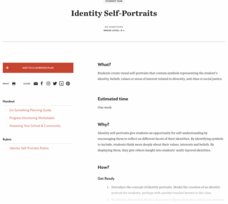
What symbols represent you best? Individuals consider how they would draw peers using symbols about their identities with an interview and art activity. After conducting interviews and portraits, the art makes a great centerpiece for...
Teaching Tolerance
Collage of Concerns
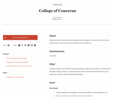
A picture can speak louder than words. An interesting lesson introduces the themes of social justice and diversity to young learners by having them create artwork. Scholars create collages from a variety of sources to showcase what...
Curated OER
Online Behavior: Privacy and Ethics
Over the course of three classes, tech-saturated youth review their cyber portraits, map their virtual lives, examine their relative anonymity, and establish a "virtual conscience" to guide choices that foster privacy protection and...
PBS
What's In a Name?
What is in a name? Eager historians trace the geographical history of places in the United States with Spanish names. Using a worksheet activity, clues, and web research developed in conjunction with the PBS "Latinos in America" series,...
Curated OER
Early America: Jeopardy Game
Fifth graders can put their knowledge of early American life, the 13 colonies, and maps to the test when they play this Jeopardy game. The game covers terminology, famous people, and geography related to Colonial American times. Note:...
Curated OER
Global History & Geography: Latin America
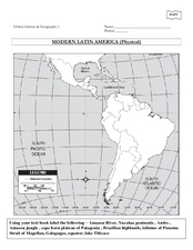
The instructions say to use a text-book to label 11 different regions in modern Latin America. If a text-book is not available a map can be found on-line and printed for student reference.
Curated OER
World War II New Guinea Campaign
Although the big picture for this lesson on the New Guidea Campaign of WWII is taking a field trip to the Douglas MacArthur Memorial, you can easily use it as a guide to an independent or group research project as well. However, if you...
Curated OER
The Roman Empire-Map Activity
In this Roman Empire worksheet, students complete a map activity in which they label and color civilizations, countries and physical features as instructed. There are no maps included.
Curated OER
Holocaust Map Studies
Students analyze maps and answer discussion questions related to WWI. In this geography lesson, students analyze historic maps to determine causes and effects of WWI in Europe. Students read testimonies of Holocaust survivors and label...
Curated OER
Cyberspace Safari
Middle schoolers go on an information gathering hunt on the Internet to study West African empires. They work in teams; meteorologists, bankers, writers, and archaeologists. They collect data on all sorts of topics related to West...
Curated OER
California's Golden History: 1848-1880
Using a variety of online resources, learners study life and society in California during the gold rush. They use a map to identify area where gold was located, explore pre-selected websites, describe mining practices, and create an...
Echoes & Reflections
The Ghettos
Young historians examine primary sources, including diaries, poems, and photographs, to consider the conditions in the ghettos and how they fit into the escalation of the Third Reich's plot against the Jewish people.
Curated OER
Pre-Columbian Cultures in the Americas
Native American studies is fun, educational, and highly motivating. Fifth graders will gain a deeper understanding of the six major pre-Columbian culture areas on the North American continent. They will choose one group and conduct...
Curated OER
Good Sportsmanship Leads to Home Run
Pupils share examples of good sportsmanship, then read a news article about a team helping an injured player score a home run. The teacher introduces the article with a discussion and vocabulary activity, then students read the news...
Curated OER
Introduction to the United States Map
Students identify a map of the United States. In this United States map lesson, students study a map of the United States and find various locations on the map. Students then locate and list the state that touches their state.
Curated OER
Second Graders on the Map
Second graders explore the various types of maps. They examine the differences between street maps and aerial photographs. Students identify various features on each map. They use cardinal directions and the compass rose. They write...
Curated OER
Map Your Area
Young scholars map the geographic boundaries of a recycling program's service areas and include the location of buyers important to the program. They use this map as an aid in managing a school recycling program or project.
Curated OER
Geography Tutor: Maps and Map Projections Questions
In this geography skills lesson, students watch a video titled "The Geography Tutor," and then respond to 14 short answer questions about maps and map projections.
Curated OER
Mapping It Out
This PowerPoint provides information about maps. Students discover the functions of legends, compasses, indexes, and scales on maps. Two resources links are provided, however one of them is broken.
Curated OER
United States Map - Lesson 9
Students explore the concept of cardinal directions. In this geography lesson plan, students identify the compass rose on a large U. S. map and then discuss the cardinal directions.


