Annenberg Foundation
Teaching Geography: Workshop 4—North Africa/Southwest Asia
Can Jerusalem be equitably organized? Can Israel and Palestine be successfully partitioned? Part one of a two-part workshop looks at the geo-political history of Jerusalem while Part two investigates Egypt's dependence of the Nile River...
NET Foundation for Television
1850-1874 Homestead Act Signed: Who were the Settlers?
Life in the great, wide-open spaces of the West! Scholars analyze the reasons behind the vast movement to the Great Plains after the passing of the Kansas-Nebraska Act and the Homestead Act. Using photographic, document, map, video, and...
Curated OER
Geography/Current Events Project
Using the Balkan region as an example, fourth graders review the five themes of geography as a class. They identify the physical and human characteristics of a region before labeling the countries and landforms on a map. They then...
Curated OER
Follow the Light
Here is another in the interesting series of lessons that use the special State Quarters as a learning tool. During this lesson, pupils learn about lighthouses, maps, the cardinal directions on a compass, and U.S. geography. There are...
Curated OER
A Practical Experiment In Colonization
Role-play and simulation exercises are fantastic ways to help learners understand the reality behind many social and historical events. Pretending they are colonists, upper graders choose a location, create a history, establish laws, and...
Curated OER
Women in Texas Politics: Winning the Vote, Three Pioneers, and Serving the People
Fourth graders study women's involvement in Texas politics. In this US history lesson, 4th graders discuss woman suffrage, examine three Texas female pioneer legislators by reading biographies, and explore women's issues by generating a...
Orange County Water Atlas
Location, Location, Location…
Young geographers discover not only how to read and recognize coordinates on a map, but also gain a deeper understanding of latitude and longitude and how climate changes can vary significantly across latitudes.
Society for Science & the Public
Easter Islanders Made Tools, Not War
When studying artifacts, especially tools, how do archaeologists determine what the devices were used for? In what ways might researchers' previous experiences influence their perception of an artifact? An article about researchers'...
Channel Islands Film
Cache: Lesson Plan 1 - Grades 9-12
Archaeologists have discovered a cache of Native American relics. They want to preserve these relics by removing them from the rapidly eroding site to a lab where they can be studied. Native American traditions demand that the items be...
Curated OER
French and Family
Where is France? Interest young learners in exploring France, French language, and French culture. They identify similarities and differences between French and American families, speak the French words for family members, analyze maps,...
Curated OER
From Sheep to Rug
Ever wonder where wool comes from? How it is used to make a woven rug? Introduce the Native American craft of rug making to your preschool or kindergarten class with a discussion. Learners examine and discuss images of a Native American...
British Council
Letters Home
When you're writing historical fiction, the past really can become the present — especially if you're writing in the present continuous tense! Cover World War I, verb tenses, censorship, and letter writing with one informative...
University of California
The Vietnam War (1945 – 1975)
Have you ever wanted to do something so perfectly you wound up not doing it well at all? Young historians use primary and secondary documents to analyze the United States involvement in the Vietnam War. The issues surrounding the...
Curated OER
Introducing Industries
If you are looking for a way to explore Michigan's resources, physical features, and more, this lesson is for you. After discussing Michigan and the Great Lakes, learners fill out a graphic organizer identifying the state's natural...
West Virginia Department of Education
A State of Convenience: The Creation of West Virginia
Ever wondered why there is a West Virginia but not an East Virginia? The resource answers questions like this one and more as it takes an in-depth and detailed look at the history of West Virginia and how it became a state. Several...
Channel Islands Film
Arlington Springs Man: Lesson Plan 2
West of the West's documentary Arlington Springs Man and a two-page scientific article about the same topic provide the text for a reading comprehension exercise that asks individuals to craft a one page summary of information gathered...
Curated OER
Chancellorsville 360
Experience a Civil War battlefield up close. Chancellorsville 360 allows scholars to explore the battlefield in an interactive format. The site demonstrates the layout of the battlefield, strategies, and key events. Created for high...
Curated OER
Longitude and Latitude Lines
In this geography worksheet, learners examine the map and focus on the concept of latitude and longitude by finding the locations.
Curated OER
Memorable Maps
Students draw an assigned map from memory about the United States or any other region they are studying. For this maps lesson plan, students draw a map from their memory at the beginning of the year, and do the same assignment at the end...
Curated OER
Making a Mental Map
Learners discuss maps and explore the concept of the mental maps they use to navigate their everyday routines including the importance of landmarks. They draw a map of how they travel from home to school.
Curated OER
Walking on Maps
Students are introduced to the various types of maps and their functions. As a class, they play a game similar to twister to review map concepts. They answer questions about the map and use the internet to view larger maps of the world.
Curated OER
Ticky Goes to Jr. Map School
First graders sing "We All Live Together," by Greg and Steve. They look at a map and sing the "Soggy Waffle Song" to study about the compass rose. Students write N, E, S, W on the borders of paper that goes under a 100's chart. The...
Curated OER
Our Land Lesson 2: Song Mapping
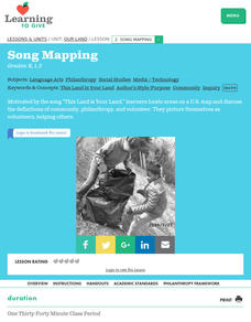
Students study the meaning of philanthropy as giving of time. talent, and treasures. They sing This Land Is Your Land while locating five of the places on a map of the United States showing that relief office are everywhere. They decide...
Curated OER
European Union Map Quest
Sixth graders identify countries of the European Union. They locate countries of Europe on a map and pair with a student to complete a blank map of Europe. They label each country and complete worksheets for the European Union. They...


