University of Pennsylvania
Decoding Propaganda: J’Accuse…! vs. J’Accuse…!
Reading snail mail is a great way to go back into history and to understand others' points of view. The resource, the second in a five-part unit, covers the Dreyfus Affair. Scholars, working in two different groups, read one letter and...
American Battlefield Trust
Civil War Battle Strategy
But for a fluke, 1862 could have gone differently during the Civil War. When Union troops found Robert E. Lee's battle plans for critical engagements in Maryland wrapped around cigars and tossed aside, history changed forever. Class...
Curated OER
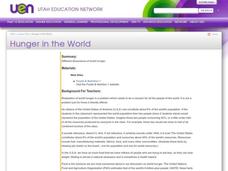
Hunger in the World
Consider various aspects of world hunger in this writing lesson. After taking a pre-test, middle and high schoolers play a map game, analyze and discuss world statistics, and write a report on an assigned country. The lesson can apply to...
Curated OER
I Hear the Locomotives: The Impact of the Transcontinental Railroad
Students examine the effects the Transcontinental Railroad had on the regions through which it passed. They analyze and discuss maps, view and describe online images, and use photos and documents to develop a cause-and-effect ladder.
Curated OER
Global Hunger and Malnutrition
Is there a difference between hunger and malnutrtion? Is this a problem only in third world countries? How does hunger and malnutrition affect the community? Why do these problems exist when the world produces enough food to feed...
North Carolina Consortium for Middle East Studies
Journey of Reconciliation, 1947
After examining the Jim Crow laws and reading primary source materials about the 1947 Journey of Reconciliation, class members create historical markers that honor riders and their journey.
Global Oneness Project
Highways and Change
What is the cost of change? Roberto Guerra's photo essay "La Carretera: Life and Change Along Peru's Interoceanic Highway" asks viewers to consider the impacts of the 1,600 mile-long highway through Peru and Brazil that connects Pacific...
Curated OER
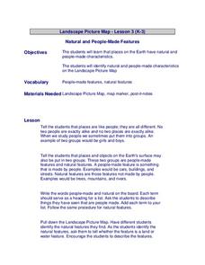
Landscape Picture Map
Learners design a landscape picture map. In this landscape picture mapping lesson, students understand when and why to use a landscape picture map. Learners discuss landscape picture maps.
Curated OER
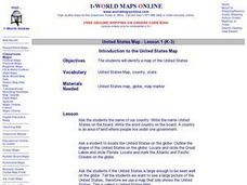
Introduction to the United States Map
Students explore the United States using a map. In this map lesson, students discover how to use a United States map and a globe to locate places.
Curated OER
The Interconnectedness of Ancient Peoples Map Study
Seventh graders begin this lesson plan by viewing various maps of the Ancient World. As a class, they take notes on the changes of different areas in Europe and Asia as their teacher lectures to them. They answer questions about the...
Curated OER
Landscape Picture Map
Students discuss differences between man made and natural features on the Earth's surface. In this natural and man made features lesson plan, learners brainstorm a list of features and categorize them on the board. Students study a...
Curated OER
Ancient Rome: Map Work
Seventh graders explore the Roman Empire. In this ancient Rome lesson plan, 7th graders participate in activities that require them to examine the history , political structure, chronology, and significant figures of the empire.
Curated OER
Learning Lesson: Analyzing a Weather Map
Students use weather maps to locate warm and cold fronts. They discover the different types of weather associated with these fronts. They also observe the weather in their local area.
Curated OER
Introduction To Topographic Map Activities
Students discuss different types of maps, their similarities and differences. Using a Topographical Maps CD-rom program students create their own map.
Curated OER
Maps! Maps! Maps!
Third graders examine and identify different types of maps. They review the types of projections and which maps are better for different information. They answer comprehension questions at the end of the lesson.
Curated OER
Tasty Mapping
Students create an edible map. In this civics and geography lesson, students research their town's features and local government. Students work in groups to design and create a physical map of their town based on research.
Curated OER
Through the Forest and Home Again: Maps Help Us Find Our Ways
Students read Little Red Riding Hood, focusing on her path home to Grandma's house. In this language arts and geography lesson, students perform a reader's theater, re-creating the walk home and possible routes that could have been...
Curated OER
What Is A Map?
Students become familiar with a map and what it is used for and become familiar with school and home surroundings. With the familiarity of their surroundings they discover that maps can be created to help them with directions and how to...
Curated OER
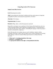
Using Maps in the LCTL Classroom
Students review terms and prepositions of location and view a map to illustrate the meanings of the prepositions students are unfamiliar with. They play "Where am I?" game utilizing correct prepositions then they work with a partner to...
Curated OER
Kid Maps: Reading and Creating Maps with Human Characteristics
Students look at maps. In this map lesson, students listen to the book My Map Book by Sara Fanelli and they see the difference between human characteristics (buildings, etc.) and natural characteristics (rivers, etc.). They...
Curated OER
Me on the Map Lesson 1
Students use maps, globes, geographic information systems and other
sources of information to analyze the nature of places at a variety of scales. They identify on a map and determine the population
of the city, county, state, country...
Curated OER
Lesson Plan on Map Skills for South Asia
Seventh graders observe and discuss an overhead transparency map of South Asia. In small groups, they label a blank map of South Asia, and listen to a lecture on the realm.
Curated OER
A Study of Alaska
Learners explore Alaska. This lesson is gearing mostly for students who live in Alaska.
Curated OER
Food on the Map
Students work together to examine the tastiest towns in the United States. After discovering the names of the equipment, they identify the seven continents. They take a survey and locate the cities and states of the foods mentioned.


