Curated OER
State Partners
Students practice locating the 50 states on the US map, and move as a "team" throughout the general space.
Curated OER
Navigation
Learners explain that globes are the best way to show positions of places, but flat maps are portable and can show great detail. They make a mercator projection of the route Lewis and Clark took on their journey.
Curated OER
Mapmaking
Learners examine the craft of cartography and how the Lewis and Clark expedition created and used maps. They analyze maps, read a handout, create a map, participate in a mini expedition and map out a route based on travel directions,...
Curated OER
Coming to America: U.S. Immigration
Students study immigration in the late 19th and early 20th century. In this immigration lesson plan, students participate in activities including creating maps, responding to non fiction text, memorizing and analyzing poetry, and...
Curated OER
A Shuttle's Eye View
Students explore the goals of the Shuttle Radar Topography Mission as a springboard to exploring the topographical features of their own state or region. They synthesize their understanding of landforms and topography by mapping their...
Curated OER
Where Am I? Navigating Around the Globe
Third graders review spatial sense learned in grades one and two. They measure distances using map scales. They use atlases, and on-line sources to find geographical information.
Curated OER
Where Is Rome?
Third graders discover Ancient Rome through maps and worksheets. For this world history lesson, 3rd graders locate Rome on a world map and identify the scope of the Roman Empire. Students label an entire map of Italy after...
Curated OER
Direction Skills
In this geography worksheet, learners read an excerpt on what directions tell someone. They respond to 6 short answer questions related to the neighborhood illustration found on the second page of the worksheet.
Curated OER
Map Creation
Second graders identify a map, symbol, key, and compass rose. Students create and print a map for teacher evaluation using the computer. Students identify the symbols on their map and orally present them to the class.
Curated OER
Mediterranean Lands: A Pilgrimage Through Time and Space
Students will use context clues and examine several maps to answer series of short answer questions over range of geographical topics, identify specific places, practice using GoogleEarth to compare satellite views to those produced two...
Curated OER
Reading distance on maps
Eighth graders complete worksheets on reading the distance on maps in miles or kilometers. In this maps lesson plan, 8th graders use a calculator and ruler.
Curated OER
Follow the Yellow Brick Road
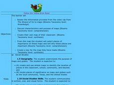
Students watch a portion of "The Wizard of Oz" and discuss how a map could be useful to Dorothy. They identify key components of maps and design a map of their classroom, including a key.
Curated OER
Exploring the Past: Mayan, Aztec, and Incan Civilizations
Fifth graders research the Mayan, Aztec, and Incan Civilizations and identify contributions they made to modern society. In this ancient civilizations lesson plan, 5th graders look at maps of where they were located.
Curated OER
A Multicultural Study: Chinese New Year
Students study the customs and beliefs of the Chinese people as they experience Chinese New Year; students become aware that they live on one planet but their festivals and holidays vary.
Curated OER
Studying the States!!!
Students explore the fifty states of America. They also learn the capitals and locations of the states. They also study the population, mottos, flags, and interesting historical facts about each state.
Curated OER
I Can Compass, Can You?
Young scholars discover how to use geographic tools. In this compass lesson, students identify cardinal directions by appropriately using compasses along with a number of various maps.
Curated OER
Lesson Design Archaeology- U.S. Map
Students examine the U.S. map and identify cultural areas. In this archaeology lesson, students locate cultural areas on the U.S. map and fill in the proper locations.
Curated OER
Mapping Africa
Students identify the location of parallel and meridian coordinates. They illustrate their understanding of the physical shape of the continent of Africa through a mapping activity, then explain the processes that have influenced the...
Curated OER
Globe Lesson 17 - Alaska and Hawaii - Grade 4-5
Students develop their globe skills. In this geography skills lesson, students explore the area added to the United States when the Alaskan territory was purchased from Russia.
Curated OER
Creating Life Maps (Elementary, Reading/Writing)
Students create a personal life timeline to better explain how a historical timeline is effective in studying history. They also write a poem about themselves.
Curated OER
Longitude & Latitude
Seventh graders role play as ship's captains to study longitude and latitude.
Curated OER
On the Street Where You Live: Online Mapping
Students access the Internet and use Google Maps to pinpoint their home address and get directions to and from school. they write the directions in paragraph format.
Curated OER
Finding Their New World
First graders place stickers on maps indicating their understanding of the cardinal directions. They locate Jamestown, England, the Atlantic, and Virginia.
Curated OER
Where in the World Am I: Latitude And Longitude
Students demonstrate their knowledge in using latitude and longitude measurements to find locations on a map, especially places in Hawaii.


