Curated OER
Southern Africa Map Quiz
In this online interactive geography quiz worksheet, students examine the map that includes 15 Southern African countries. Students match the names of the countries to the appropriate locations on the interactive map.
Curated OER
United States: Physical Features Fun
In this map worksheet, young scholars color and trace eleven listed features on a map of the United States. Students answer six additional questions about the map. A United States map is not provided. However, websites are provided to...
Curated OER
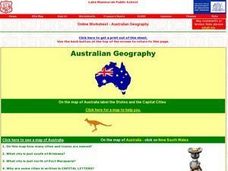
Australian Geography
In this map reading learning exercise, students label a map of Australia by adding the names of states and cities. They answer eight questions about the map.
Curated OER
Africa Capitals Map Quiz
In this online interactive geography quiz worksheet, students examine the map that includes 53 African countries. Students match the names of the countries to the appropriate locations.
Curated OER
Asia Map Quiz
In this online interactive geography quiz learning exercise, students examine the map that includes 26 Asian countries. Students match the 26 country names to the appropriate locations on the map.
Curated OER
North American Rivers Map Quiz
In this online interactive geography quiz worksheet, students examine the map that includes 13 rivers in North America. Students match the names of the rivers to the appropriate places on the map.
Curated OER
Asia Rivers Map Quiz
For this online interactive geography quiz worksheet, students examine the map that includes 18 Asian rivers. Students match the names of the rivers to the appropriate locations on the interactive map.
Curated OER
Middle Eastern Lakes, Rivers, Bays, and Seas Map Quiz
In this online interactive geography quiz worksheet, learners examine the map that includes 13 bodies of water and rivers in the Middle East. Students match the names of the bodies of water and rivers to the appropriate places on the map.
Curated OER
Middle Eastern Seas Map Quiz
In this online interactive geography quiz worksheet, students examine the map that includes 8 seas in the Middle East. Students match the names of the seas to the appropriate places on the map.
Curated OER
Caribbean Map Quiz
In this online interactive geography quiz worksheet, high schoolers examine the map that includes 20 Caribbean countries and territories. Students identify the names of the countries and territories in 3 minutes.
Curated OER
Europe Rivers Map Quiz
In this online interactive geography quiz worksheet, students examine the map that includes 14 European rivers. Students match the names of the rivers to the appropriate locations on the interactive map.
Curated OER
Europe Seas Map Quiz
In this online interactive geography quiz worksheet, students examine the map that includes 14 European seas. Students match the names of the bodies of water to the appropriate locations on the interactive map.
Curated OER
Germany States Map Quiz
In this online interactive geography quiz worksheet, learners examine the map that includes 12 German states. Students match the names of the states to the appropriate locations on the map.
Curated OER
United States Map Quiz
In this online interactive geography quiz instructional activity, students examine the map that includes all 50 states of the United States. Students match the names of the 50 states to the appropriate places on the map.
Curated OER
Concept Map
A blank concept map graphic organizer helps learners get their information, thoughts, and ideas organized. One initial concept splits into three sub-topics, which then provide a larger section for more details.
Curated OER
African Lakes, Rivers, Bays, and Seas Map Quiz
In this online interactive geography quiz worksheet, students examine the map that includes 25 African lakes, river, bays, and seas. Students match the names of the bodies of water and waterways to the appropriate locations.
Curated OER
Middle East Map Quiz
For this online interactive geography quiz worksheet, students examine the map that includes 21 Middle Eastern countries. Students identify the names of the countries in 3 minutes.
Curated OER
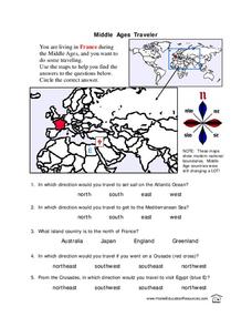
Middle Ages Traveler
In these Middle Ages worksheets, pupils use the maps to help them find the answers to the questions that help them understand the directions of north, south, east and west. Students also color another map of France according the directions.
Curated OER
Kazakhstan Outline Map
In this blank Kazakhstan outline map worksheet, learners study the political boundaries of the country. This outline map may be used for a variety of geographic activities.
Curated OER
Blank US Map
For this blank outline map worksheet, learners study the physical boundaries of the 50 states that make the United States. This outline map may be used for a variety of geographic activities.
Curated OER
Consequences of the French and Indian War
In this map skills worksheet, students examine maps that show European land claims in North America in 1753 and 1763. Students respond to 4 short answer questions regarding the information.
Geography 360°
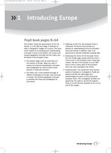
Introducing Europe
Provide your learners with a comprehensive introduction to Europe with this great set of worksheets. Map activities include matching European countries to their capitals and places on a political map, as well as exploring different...
Curriculum Corner
Holidays Around the World
Let's focus on a holiday from around the world! Young researchers choose a holiday from somewhere around the world, and conduct research to answer questions about the holiday. It can be used anytime during the year!
Curated OER
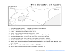
The Country of Kenya
In this map completion worksheet, students observe a map and map scale of Kenya to find and label bodies of water, cities, countries, and the equator. Students answer 11 questions.


