Curated OER
Utah State Map
In this geography of Utah worksheet, learners color and label a map of the state of Utah. Students also study a second map that shows the location of this state in the U.S.
Curated OER
Tennessee State Map
In this Tennessee state geography worksheet, learners color and label major cities and physical features on the map. Students also study a second map of the U.S. that shows the location of the state of Tennessee.
Curated OER
Virginia State Map
In this geography of Virginia worksheet, students color the map and label major cities and physical features. Students also study a second map showing the location of the state of Virginia in the United States.
Curated OER
Delaware State Map
In this geography of Delaware worksheet, students color the map and label major cities and physical features. Students also study a second map showing the location of the state of Delaware in the United States.
Curated OER
California State Map
In this geography of California worksheet, students color the map and label major cities and physical features. Students also study a second map showing the location of the state of California in the United States.
Curated OER
Georgia State Map
In this geography of Georgia worksheet, students color the map and label major cities and physical features. Students also study a second map showing the location of the state of Georgia in the United States.
Curated OER
Florida State Map
In this geography of Florida worksheet, students color the map and label major cities and physical features. Students also study a second map showing the location of the state of Florida in the United States.
Curated OER
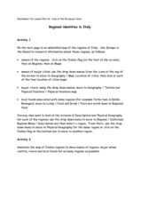
Regional identities in Italy
In this Italy map activity instructional activity, students complete 2 map activities that require them to identify major cities and landforms in the country.
Curated OER
Physical and Human Geography Review Worksheet and Study Guide
In this geography skills worksheet, students respond to 30 short answer questions pertaining to physical and human geography.
Curated OER
Thinking Critically about Geography
In this map reading worksheet, students answer 2 critical thinking questions about a map shown. Page has links to additional resources.
Curated OER
African Rivers Map Quiz
In this online interactive geography quiz learning exercise, students examine the map that includes 15 rivers in Africa. Students match the names of the rivers to the appropriate places on the map.
Curated OER
Asia Capitals Map Quiz
In this online interactive geography quiz worksheet, students examine the map that includes 31 countries in Asia. Students match the names of the capital cities to the appropriate countries on the map.
Curated OER
Africa: Geography Concept Map
In this geography skills instructional activity, students complete a graphic organizer where they list African countries and their geographic features, languages spoken, natural resources, and historical facts.
Curated OER
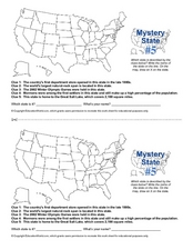
Mystery State # 5
Mystery state number five is none other than Utah! Quiz your kids on state knowledge while building deductive reasoning skills. They use each of the five clues to determine the name of the mystery state. A great warm up when studying...
Curated OER
Hernando de Soto Explores Florida
Print this resource or save it to your desk top. It contains five activities and eleven vocabulary words related to Hernando de Soto and his exploration of Florida. Each activity provides targeted skills practice to prime learners for a...
Curated OER
Asoka’s Empire Worksheet
Learning about ancient history can be enhanced by incorporating geography. The class labels six geographic features on a map of India and respond to seven short answer questions about Asoka's reign.
Curated OER
Mystery State # 28
Using clues is a great way to increase deductive and logical reasoning skills. Boost thinking skills while quizzing kids about us geography. They use five clues to determine which state is in question.
Curated OER
Outline Map of Japan
In this geography worksheet, students examine a black line outline map of Japan. There is a compass rose on the page. There are no labeled cities.
Curated OER
Map Activity: Place Name
In this map worksheet, students locate given words on a map of the United States, then answer a set of 4 related short answer questions.
Curated OER
The Crusades: Routes of Two Crusaders
Use these worksheets to kick off a great lesson on The Crusades. Eighth graders will analyze a map and four short passages to answer six reading comprehension questions.
Curated OER
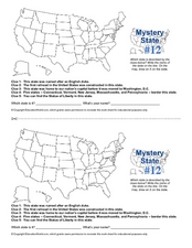
Mystery State #12
What's better than learning about US geography? Having fun while your doing it! After reviewing each of the five given clues, learners attempt to name the mystery state. A great way to reinforce geography skills and deductive reasoning...
Peter Bunzl
Cogheart and Moonlocket
Peter Bunzi takes readers to the Victorian era with two stories, Coghaert and Moonlocket. Accompany the literary time warp with a companion packet that offers a plethora of exercises. Learning...
Curriculum Corner
Australian Christmas
Where is Australia? How is an Australian Christmas from other Christmases around the world? Learners participate in a mini-research project where they discover what an Australian Christmas is like.
Aurora Trust
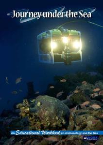
Journey Under the Sea
Discover the interesting world of maritime archaeology and explorations under the sea with this nice set of worksheets, which cover such topics as search tools and techniques of underwater archaeology, carbon dating,...


