Curated OER
Africa: A Cultural Safari
Students examine the kingdoms of West Africa during the Middle Ages. They label maps and identify Africa's physical features, simulate the trading of gold, buy and sell goods using cowrie shells, and participate in a cultural safari day.
Curated OER
Colonial North America
Showcase the religion, conflicts, daily life, and politics of Colonial North America. A very well-done presentation highlights all the major colonial groups, social norms, demographics, and political struggles of the time. Perfect for an...
Curated OER
U.S. Mint Releases New Jefferson Nickel
Students share their knowledge of Lewis and Clark, then read a news article about the redesign on the U.S. nickel to commemorate Lewis and Clark's expedition. Introduce the article with a discussion and vocabulary activity, then students...
Smithsonian Institution
Who's in Camp?
Pupils complete readings, a group activity using cards, and a writing activity to better understand people's lives during the American Revolution. The resource emphasizes people such as the militiamen, women, officers, and children,...
Curated OER
But Where Is It On This Modern Map? A problem-solving, mind-boggling experience!
Trace Columbus' voyages by locating them on 21st Century maps. Using a navigators lesson, 4th graders will examine the Age of Exploration and trace Columbus's routes accurately on laminated world maps using different maps. Note: You...
Curated OER
Mapmaker, Mapmaker, Make Me a Map!
Learners evaluate the different types of historical and geographical information that one can gather through close study of historical maps from the 16th through the 19th centuries. They create their own maps.
Curated OER
Map Keys
In this geography worksheet, students identify who a cartographer is and what they do specifically. They study an outline map of a fictitious island and then, respond to the three questions that follow. Finally, students add three more...
Curated OER
Where I Live…
Second graders explore their community. For this social studies lesson plan, 2nd graders use Internet tools to locate their community on a map and then locate where they live.
Curated OER
Mapping Colonial New England: Looking at the Landscape of New England
High schoolers understand the similarities and differences between English and Native American conceptions of the land and town settlement. They understand how the colony of Massachusetts developed and expanded. Students understand the...
Curated OER
Mapping South America
Students explore South America. In this South American lesson, students use their geography skills to create population, terrain, biomes/vegetation, and major exports maps. Students present their finished maps to their classmates and...
Curated OER
Map the Civil War
Students explore the Civil War through original maps. In this mapping lesson, students calculate distance and show it on an original map. Students examine the type of landscape and its landmarks and draw symbols on the map.
Curated OER
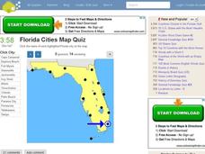
Florida Cities Map Quiz
In this online interactive geography instructional activity, learners examine a map of Florida and identify the 12 noted cities on the map using a pull down menu within 3 minutes.
Curated OER
Texas Cities Map Quiz
In this online interactive geography learning exercise, students examine a map of Texas and identify the 15 noted cities on the map using a pull down menu within 3 minutes.
Curated OER
Michigan Cities Map Quiz
In this online interactive geography worksheet, students examine a map of Michigan and identify the 14 noted cities on the map using a pull down menu within 3 minutes.
Curated OER
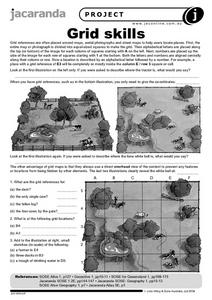
Grid Skills
In this geography activity, students use grid references on a map to locate places in the pictures given. They also identify another advantage of using a grid map, which they have an overhead view of the content to prevent any features...
Curated OER
South America Map Quiz
In this online interactive geography quiz worksheet, students examine the map that includes all of South America's countries. Students identify the 13 countries in 2 minutes.
Curated OER
Middle East Map Quiz
For this online interactive geography quiz worksheet, students examine the map that includes 26 Middle Eastern countries. Students identify the names of the countries in 4 minutes.
Curated OER
Central America Map Quiz
In this online interactive geography quiz worksheet, students examine the map that includes 22 Central American countries. Students identify the names of the countries in 3 minutes.
Curated OER
UK Cities Map Quiz
In this online interactive geography worksheet, learners examine a map of the United Kingdom and identify the 25 noted cities on the map using a pull down menu within 3 minutes.
Curated OER
Canada Map Quiz
In this online interactive geography quiz worksheet, students examine the map that includes 13 Canadian provinces and territories. Students identify the names of the provinces and territories in 2 minutes, 30 seconds.
Curated OER
German Cities Map Quiz
For this online interactive geography quiz worksheet, students examine the map that includes 12 German cities. Students identify the names of the cities in 3 minutes.
Curated OER
Washington Cities Map Quiz
In this online interactive geography worksheet, students examine a map of the state of Washington and identify the 13 noted cities on the map using a pull down menu within 3 minutes.
Curated OER
Map Your Community
Students study their community's assets and needs to create a service project that would meet the needs. For this community project lesson, students research their community and look for the strengths and weaknesses of the community. As...
Curated OER
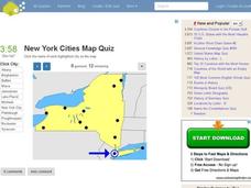
New York Cities Map Quiz
In this online interactive geography worksheet, students examine a map of New York and identify the 11 noted cities on the map using a pull down menu within 3 minutes.


