Curated OER
George Washington's Revolutionary Journeys
Middle schoolers take a closer look at historical maps. In this American Revolution lesson, students examine the provided historical maps and documents to determine the assignments that George Washington assigned to subordinates during...
Curated OER
Combining Map and Compass
Learners practice using the map and compass to find a location. In this geography lesson series, students identify basic requirements needed when traveling in the wilderness. They plan a healthy menu for a backpacking trip.
National Endowment for the Humanities
Lesson 4: The Phoenicians, the Greeks, the Romans, and Us
Learners review knowledge gained in the three-part unit on the history of the alphabet. Using maps and images, learners consolidate their understanding of ancient Greece, the Romans and the Phoenicians, and their respective impacts...
Curated OER
Me on the Map Lesson 2
Learners analyze and interpret maps, globes and geographic information systems to define and identify cities, counties, states, countries and continents to create a booklet called me on the map. They also determine and calculate the...
Curated OER
Lesson 2: Mapping Our Home
Students recognize the importance of community participation in the census. For this U. S. Census lesson plan, students use map-reading skills to find answers and learn the difference between senators and members of Congress.
Curated OER
Places on the Planet: Latitude and Longitude
Middle schoolers locate different places on globes and maps by learning about latitude and longitude lines. In this latitude and longitude lesson plan, students identify specific locations based on the degrees of latitude and longitude.
Curated OER
Mapping the Human Movement
Students research data on African-American emigration, place the data in a chart and create a human movement map. They also create another map using research on current immigration information.
Curated OER
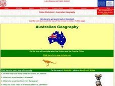
Australian Geography
In this map reading instructional activity, students label a map of Australia by adding the names of states and cities. They answer eight questions about the map.
Curated OER
Down at the Orchard
First graders examine what an apple orchard looks like and work with cardinal directions. In this apple orchard and direction lesson, 1st graders listen to Anne Rockwell's, Apples and Pumpkins, and Amy and Richard Hutchings', Picking...
Curated OER
Resources of Indiana
Fourth graders examine the resources of Indiana and how they are used to produce goods. In this resources of Indiana lesson, 4th graders explore historical periods in Indiana as they relate to its resources. Students discover that the...
Curated OER
Cardinal and Ordinal Directions
Students use a compass to locate cardinal and ordinal directions. In small groups, they describe and create a journey for their classmates using their compass. Groups create a scale map for their classmates to follow and relate this...
Curated OER
Giving Students a Little Latitude
Young scholars use a world outline map to locate places using coordinates of latitude and longitude. They answer questions about places based on their knowledge of the map and on their research and make up more questions of this sort...
Curated OER
Africa Capitals Map Quiz
In this online interactive geography quiz learning exercise, students examine the map that includes 53 African countries. Students match the names of the countries to the appropriate locations.
Curated OER
Asia Map Quiz
In this online interactive geography quiz worksheet, students examine the map that includes 26 Asian countries. Students match the 26 country names to the appropriate locations on the map.
Curated OER
North American Rivers Map Quiz
In this online interactive geography quiz worksheet, students examine the map that includes 13 rivers in North America. Students match the names of the rivers to the appropriate places on the map.
Curated OER
Asia Rivers Map Quiz
In this online interactive geography quiz worksheet, students examine the map that includes 18 Asian rivers. Students match the names of the rivers to the appropriate locations on the interactive map.
Curated OER
Middle Eastern Lakes, Rivers, Bays, and Seas Map Quiz
In this online interactive geography quiz worksheet, students examine the map that includes 13 bodies of water and rivers in the Middle East. Students match the names of the bodies of water and rivers to the...
Curated OER
Middle Eastern Seas Map Quiz
In this online interactive geography quiz worksheet, students examine the map that includes 8 seas in the Middle East. Students match the names of the seas to the appropriate places on the map.
Curated OER
Caribbean Map Quiz
For this online interactive geography quiz worksheet, high schoolers examine the map that includes 20 Caribbean countries and territories. Students identify the names of the countries and...
Curated OER
Europe Rivers Map Quiz
In this online interactive geography quiz worksheet, students examine the map that includes 14 European rivers. Students match the names of the rivers to the appropriate locations on the interactive map.
Curated OER
Europe Seas Map Quiz
In this online interactive geography quiz instructional activity, learners examine the map that includes 14 European seas. Students match the names of the bodies of water to the appropriate locations on...
Curated OER
Germany States Map Quiz
In this online interactive geography quiz instructional activity, students examine the map that includes 12 German states. Students match the names of the states to the appropriate locations on the map.
Curated OER
United States Map Quiz
In this online interactive geography quiz worksheet, students examine the map that includes all 50 states of the United States. Students match the names of the 50 states to the appropriate places on the map.
Curated OER
Concept Map
A blank concept map graphic organizer helps learners get their information, thoughts, and ideas organized. One initial concept splits into three sub-topics, which then provide a larger section for more details.


