Curated OER
Follow the Light
Here is another in the interesting series of lessons that use the special State Quarters as a learning tool. During this lesson, pupils learn about lighthouses, maps, the cardinal directions on a compass, and U.S. geography. There are...
Curated OER
A Practical Experiment In Colonization
Role-play and simulation exercises are fantastic ways to help learners understand the reality behind many social and historical events. Pretending they are colonists, upper graders choose a location, create a history, establish laws, and...
Curated OER
Women in Texas Politics: Winning the Vote, Three Pioneers, and Serving the People
Fourth graders study women's involvement in Texas politics. In this US history lesson, 4th graders discuss woman suffrage, examine three Texas female pioneer legislators by reading biographies, and explore women's issues by generating a...
Geography 360°
Introducing Europe
Provide your learners with a comprehensive introduction to Europe with this great set of worksheets. Map activities include matching European countries to their capitals and places on a political map, as well as exploring different...
Orange County Water Atlas
Location, Location, Location…
Young geographers discover not only how to read and recognize coordinates on a map, but also gain a deeper understanding of latitude and longitude and how climate changes can vary significantly across latitudes.
Society for Science & the Public
Easter Islanders Made Tools, Not War
When studying artifacts, especially tools, how do archaeologists determine what the devices were used for? In what ways might researchers' previous experiences influence their perception of an artifact? An article about researchers'...
Curated OER
Every Building Tells a Story
Examine images from past that depict buildings and towns from their own communities, and compare images with photographs taken at present locations, interview local architect and compare role of 19th Century architect to 21st Century...
Channel Islands Film
Cache: Lesson Plan 1 - Grades 9-12
Archaeologists have discovered a cache of Native American relics. They want to preserve these relics by removing them from the rapidly eroding site to a lab where they can be studied. Native American traditions demand that the items be...
Curated OER
French and Family
Where is France? Interest young learners in exploring France, French language, and French culture. They identify similarities and differences between French and American families, speak the French words for family members, analyze maps,...
Curated OER
From Sheep to Rug
Ever wonder where wool comes from? How it is used to make a woven rug? Introduce the Native American craft of rug making to your preschool or kindergarten class with a discussion. Learners examine and discuss images of a Native American...
British Council
Letters Home
When you're writing historical fiction, the past really can become the present — especially if you're writing in the present continuous tense! Cover World War I, verb tenses, censorship, and letter writing with one informative...
PreKinders
Pre-K Assessment Forms
This is a Pre-K teacher's must-have resource for pre-assessing learners at the beginning of the school year! Covering everything from alphabet recognition and sorting objects to social-emotional development and work habits, this resource...
University of California
The Vietnam War (1945 – 1975)
Have you ever wanted to do something so perfectly you wound up not doing it well at all? Young historians use primary and secondary documents to analyze the United States involvement in the Vietnam War. The issues surrounding the...
Curated OER
Introducing Industries
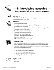
If you are looking for a way to explore Michigan's resources, physical features, and more, this lesson is for you. After discussing Michigan and the Great Lakes, learners fill out a graphic organizer identifying the state's natural...
Kids Discover
Ancient Egypt by KIDS DISCOVER
Discover Ancient Egypt! Learn about mummification and gods, visit pyramids and temples, examine cliff carvings and paintings, take quizzes and engage in activities. Colorful, interactive, and easy to use, this app is not just for kids!
Curriculum Corner
Holidays Around the World
Let's focus on a holiday from around the world! Young researchers choose a holiday from somewhere around the world, and conduct research to answer questions about the holiday. It can be used anytime during the year!
West Virginia Department of Education
A State of Convenience: The Creation of West Virginia
Ever wondered why there is a West Virginia but not an East Virginia? The resource answers questions like this one and more as it takes an in-depth and detailed look at the history of West Virginia and how it became a state. Several...
Channel Islands Film
Arlington Springs Man: Lesson Plan 2
West of the West's documentary Arlington Springs Man and a two-page scientific article about the same topic provide the text for a reading comprehension exercise that asks individuals to craft a one page summary of information gathered...
Curated OER
Chancellorsville 360
Experience a Civil War battlefield up close. Chancellorsville 360 allows scholars to explore the battlefield in an interactive format. The site demonstrates the layout of the battlefield, strategies, and key events. Created for high...
Curated OER
Global Lesson: Social Studies On-Line Global Lesson: Social Studies On-Line Continents
In this geography PowerPoint a simple world map on which each continent is represented by a solid green landform is the background for each of the nine slides. The continent names appear in a list on the first slide, followed by one...
Curated OER
The Country of Kenya
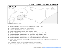
In this map completion worksheet, students observe a map and map scale of Kenya to find and label bodies of water, cities, countries, and the equator. Students answer 11 questions.
Curated OER
Map And Flag of Greece
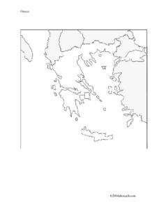
In this Greece worksheet, students color and study a Greek flag. Students also color and label a map of Greece. This could be used in writing a report.
Curated OER
Longitude and Latitude Lines
In this geography worksheet, learners examine the map and focus on the concept of latitude and longitude by finding the locations.
Curated OER
Memorable Maps
Students draw an assigned map from memory about the United States or any other region they are studying. For this maps lesson plan, students draw a map from their memory at the beginning of the year, and do the same assignment at the end...


