Curated OER
European Union Map Quest
Sixth graders identify countries of the European Union. They locate countries of Europe on a map and pair with a student to complete a blank map of Europe. They label each country and complete worksheets for the European Union. They...
Curated OER
A Road Map for the Roman Empire, Ca. 250 CE
High schoolers consider how empires are created and sustained, examine Peutinger Table as a whole and in detail as tool of empire for Rome, c. 250 CE, create ancient time-distance travel chart that synthesizes series of strip maps, and...
Curated OER
Me on the Map: Homes, Neighborhoods, and Communities
Students read a book about maps and identify the differences between a picture and a map. For this maps lesson plan, students also label maps of their home, neighborhood, and community.
Curated OER
Canada Outline Map: Labeled
In this blank outline map learning exercise, students study the political boundaries of the North American country of Canada as well as those of the provinces located there. This map is labeled.
Curated OER
Mexico Map
For this blank outline map worksheet, students study the political boundaries of the North American country of Mexico. This map may be used in a variety of classroom activities.
Curated OER
Mexico and Central America Map
In this outline map activity, students study the political boundaries of Mexico and the Central American countries. This map is labeled with the country names.
Curated OER
Canada Outline Map
In this blank outline map worksheet, students study the political boundaries of the North American country of Canada as well as those of the provinces located there.
Curated OER
Canada Outline Map
For this blank outline map worksheet, students study the political boundaries of the North American country Canada as well as those of the provinces located there. The capital cities of the provinces are listed.
Curated OER
Canada Outline Map
In this blank outline map worksheet, students study the political boundaries of the North American country of Canada as well as those of the provinces located there.
Curated OER
Canada Outline Map
In this blank outline map worksheet, students study the political boundaries of the North American country of Canada as well as those of the provinces located there.
Curated OER
Mexico Map
In this blank outline map worksheet, students study the political boundaries of the North American country of Mexico. The capital cities of each state are denoted with stars.
Curated OER
Mexico and Central America Map
In this blank outline map worksheet, students study the political boundaries of Mexico and Central America. Each of the counties is labeled and the capital cities are starred.
Curated OER
South American Outline Map
In this blank outline map instructional activity, students study the political boundaries of the continent of North America and those of the countries located there.
Curated OER
Europe Outline Map (Labled)
In this blank outline map instructional activity, learners study the political boundaries of the labeled European nations.
Curated OER
Africa Map Spatial Analysis
In this map skills worksheet, students complete a graphic organizer that requires them to examine what is represented on different types of maps of Africa.
Curated OER
North, South, East, or West
Students participate in a game to learn cardinal directions. In this map skills lesson, students move around the room using cardinal directions.
Curated OER
Continents of the Globe
Students identify the continents on the globe. In this map skills lesson, students define the term "continent" and identify the seven continents on the globe.
Curated OER
An Early American Culture
Students identify the locations of the Hopewell culture. In this map skills lesson, students use a globe to mark several locations of the Hopewell culture.
Curated OER
Compass Rose
Keep it simple and visual when practicing directions using this compass rose labeling worksheet. Learners fill in the compass themselves, using cardinal and intermediate direction abbreviations. North is done for them. Consider using...
Curated OER
Put the Mountains on the Map
Students discuss what they know about the regions where snow leopards live. They observe the worksheets to see if they can identify any of the mountain ranges and then use atlases to check and complete the country identification worksheet.
Miama-Dade County Public Schools
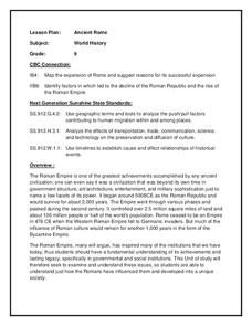
Ancient Rome
This resource outlines several general activities for a study of Ancient Rome, and includes guiding questions, a handout on the story of Romulus and Remus, and ideas for incorporating mapping and timeline activities into your review.
Curated OER
Go West With Columbus
Students play a board game where their tokens must move Columbus west. They choose cards which give commands to move in a coordinate direction. They practice moving west, north, east, south by playing the game.
Eastconn
Learning to Analyze Political Cartoons with Lincoln as a Case Study
Discover the five main elements political cartoonists use—symbolism, captioning and labels, analogy, irony, and exaggeration—to convey their point of view.


