Curated OER
U.S. Geography for Children: Michigan
In this Michigan map activities learning exercise, students observe an outline map of the state of Michigan, locate and label specific places and areas, and create a map key. Students complete 5 activities.
Curated OER
U.S. Geography for Children: The Northeast
In this map skills of the northeastern United States worksheet, students observe an outline map, locate and label the states, and designated landforms and bodies of water; and create symbols and a map key for sources of economy and other...
Curated OER
U.S. Geography for Children: State Capitals
In this United States map skills worksheet, students locate and label specified states and their capitals, and create icons and a map key to show something for each state that is famous. Students answer 5 questions.
Curated OER
U.S. Geography for Children
In this U.S. map activity worksheet, learners observe maps of the continental United States, Hawaii, and Alaska, locate and label landforms and bodies of water, and create symbols for natural resources and places of interest. Students...
Curated OER
Mapping the Human Movement
Students research data on African-American emigration, place the data in a chart and create a human movement map. They also create another map using research on current immigration information.
Curated OER
Geography Lesson 1
Students examine relationship between population centers and sports teams, explore influence of weather on attendance, and research influence of geography, traffic flow and disposable income on site selection for sports stadiums.
Curated OER
Global Lesson: Social Studies On-Line Global Lesson: Social Studies On-Line Continents
In this geography PowerPoint a simple world map on which each continent is represented by a solid green landform is the background for each of the nine slides. The continent names appear in a list on the first slide, followed by one...
Curated OER
Where in the World is Hawaii?
Students compare a globe and a two-dimensional world map and explore how they both represent the planet Earth. They locate the Hawaiian Islands on the globe or the world map and describe how the geographical position is unique.
Curated OER
Countries of the World
Students define the meaning of the word country. In this countries of the world map lesson, students identify boundaries, countries, and symbols within countries on the map. Students distinguish the words country and continent.
Curated OER
Earth at Night
Students examine the Earth at night. In this geography lesson, students identify the continents at night using various Internet Web sites. This lesson may be adapted for use with middle school and high school students.
Curated OER
You Can Find It!
Students, in groups, use longitude and latitude to locate various places on a map.
Curated OER
A Walk Around the School: Mapping Places Near and Far
After reading Pat Hutchins’ Rosie’s Walk, have your young cartographers create a map of Rosie’s walk. Then lead them on a walk around the school. When you return class members sequence the walk by making a list of how the class got from...
Curated OER
Mapping Where Animals Live
What type of reptiles live in New York State? This lesson gets the class thinking about what factors determine where particular animals live. They analyze the Hudson Valley environment, identify specific reptile and amphibian...
Scholastic
Perfect Postcards: Illinois
Connect the geography and history of Illinois using an art-centered lesson on the railroads. The railroad connected once-distant places, particularly in the Midwest. Using research, class members create postcards of fictional cross-state...
Curated OER
The Barbarian Invasions of the Roman Empire
Fifteen different locations to map and correctly label. Use the provided list to show major areas of Barbarian invasions occurring during the Roman Empire.
Curated OER
The Spread of Printing
Document the spread of printing, which occurred in the 1500s. Use the provided list of water ways, countries, and cities to label specified locations on the map.
Curated OER
Mystery State # 28
Using clues is a great way to increase deductive and logical reasoning skills. Boost thinking skills while quizzing kids about us geography. They use five clues to determine which state is in question.
Curated OER
Where Am I?
Young scholars identify volcano locations by latitude and longitude. They analyze a world map, and complete a "Volcano Event Locations Chart."
Curated OER
Boundaries and People
Students map watersheds to find their boundaries. In this watershed activity students map and then give their "watershed address." Students show the trail from stream, larger stream to oceans. Students describe the boundaries of the...
Curated OER
Mystery State # 5
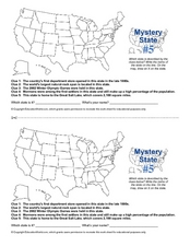
Mystery state number five is none other than Utah! Quiz your kids on state knowledge while building deductive reasoning skills. They use each of the five clues to determine the name of the mystery state. A great warm up when studying...
Curated OER
Mystery State #12
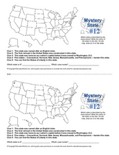
What's better than learning about US geography? Having fun while your doing it! After reviewing each of the five given clues, learners attempt to name the mystery state. A great way to reinforce geography skills and deductive reasoning...
Curated OER
Eastern Europe in 1989
Major political shifts occurred in Eastern Europe during the late 1980s. Locate, identify, and label 90 different areas on the provided map. A list of cities, countries, and water ways is provided.
Curated OER
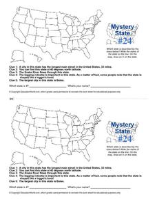
Mystery State # 24
Prepare those brains for a rousing day of learning with a fun geography activity. Your pupils use five different clues to determine the name of mystery state number 24. Where do all those potatoes come from? Idaho!
Curated OER
Paint My Counties: Map Coloring the Counties of Arizona
Fourth graders identify the counties of Arizona. In this social studies lesson, 4th graders color a county map of Arizona using the fewest number of colors possible. Students write a persuasive paragraph.


