National Endowment for the Humanities
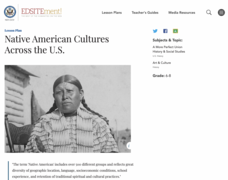
Native American Cultures Across the U.S.
Learners examine how American Indians are represented in today's society. They read stories, analyze maps, and complete a chart and create an illustration about a specific tribe.
Curated OER
Sweet Clara and the Freedom Quilt: The Real Story
Students learn how slaves communicated with each other. In this slavery and freedom instructional activity, students learn how slaves used quilts as maps, learn what different quilt patterns meant, draw a picture for their class freedom...
The New York Times
Kiev in Chaos: Teaching About the Crisis in Ukraine
Provide a historical context for the political unrest between Russia and Ukraine that began in late 2013. Learners review their prior knowledge and chronicle new understandings with a KWL chart, watch a video explaining the Ukrainian...
Curated OER
Final Regents Review: Rome
Take a trip to ancient Rome in this presentation, which includes details about Roman life, society, politics, and religion. Viewers will be enthralled with the vivid maps and pictures in these slides, which could lead to a discussion on...
American Museum of Natural History
Mythic Creatures Challenge
Mythic creatures and where to find them is the subject of an engaging interactive resource. Young anthropologists click on a bright red X on a world map to see an image of and learn the stories of 15 legendary creatures.
Curated OER
Living in the Desert
Conduct an investigation on the plants used by the Hohokam tribe. To survive in the harsh desert environment the Hohokam used many natural resources. Learners read, research, map, and graph multiple aspects of Hohokam plant use as a...
Super Teacher Worksheets
My Explorer Report
This is the perfect resource to accompany your class project on famous explorers! Learners detail basic information about their chosen explorer, his/her main events of exploration and means of transportation, and finally, illustrate the...
Curated OER
Getting to the Core of World and State Geography
Students create topography relief maps. In this geography skills lesson, students review geography core knowledge skills, design and make a state relief map, and compile a student atlas.
Curated OER
U.S. Geography- The Northeast
Students investigate the geography of the Northeast states. In this map skills lesson, students are shown a map of the Northeast states and identify the state names and borders. Students construct individual maps of the Northeast using...
Curated OER
WORLD GEOGRAPHY
Students identify and analyze map symbols and map grids by completing various worksheets and creating their own map using these skills. Students identify and analyze what latitude and longitude are on a map to play a game of Bingo....
Curated OER
Map It With Pixie
Fourth graders use the computer program 'Pixie' to create a topographic, detailed map for the state they live in. In this mapping skills lesson, 4th graders use Pixie to make a map of their state that includes topographic features, state...
Curated OER
Physical and Human Geography Review Worksheet and Study Guide
In this geography skills activity, students respond to 30 short answer questions pertaining to physical and human geography.
Curated OER
Organization of a Territory, Map Elements
Third graders compare printed and online maps and use proper geographic terminology to answer questions.
Curated OER
World Map and Globe-Equator, North Pole, and South Pole
Students identify the Equator, North Pole, and South Pole on a map. In this geography instructional activity, students use a world map and circle the North and South Pole. Students locate the Equator on a globe and use a map marker to...
Curated OER
World Map and Globe - Lesson 15 Mountains of the World
Students locate major world mountain ranges. In this geography lesson, students identify major mountain ranges on 6 on of the 7 continents on a large world physical map.
Curated OER
Discovering the Physical Geography of Washington
Students develop a mental map of the state of Washington and draw it on paper. Using the Virtual Atlas, they identify the physical features of the state and draw them on their map. They also examine the populations and diversity of the...
Curated OER
Geography Words, Page 1
In this geography words and maps worksheet, learners examine maps of North and South America. Students respond to 12 multiple choice questions regarding the maps.
Curated OER
World Map and Globe- Introduction to Symbols
Students investigate picture symbols. In this symbols lesson, students define symbols and discuss symbols that they see in everyday life. Students identify symbols on maps by using post-it notes.
Curated OER
What You Can Learn From a Map
Students discover how to interpret maps. For this geography skills lesson, students explore geographic themes as they complete worksheet activities regarding road maps, shaded relief maps, and topographic maps.
Curated OER
Florida: U.S. Geography for Kids
In this Florida geography instructional activity, students locate and label the important features of Florida and create icons for the economy and culture of Florida.
Curated OER
Tooling Around Arizona: Reading Arizona Maps
Young scholars research Arizona maps. In this map lesson plan, students discuss map titles, scales, directions, elevation, and symbols. The class will examine topography, landforms, and rivers found on an Arizona map.
Curated OER
Geography Worksheet
In this geography skills learning exercise, students respond to 14 short answer questions by using maps and atlases. The maps and atlases are not included.
Curated OER
Of Maps and Worldviews
Students explore Ptolemy's world map as an expression of the Renaissance view of the world.
Curated OER
BOLTSS Map
In this geography worksheet, students identify the six features always used on maps. They identify each of these features by the acronym BOLTSS. Students examine the Melbourne Cricket Ground shown and respond to the 4 questions that follow.


