Curated OER
Flat Earth Society
Students explore map distortion. In this geography instructional activity, students compare Mercator projection maps to globes in order to understand the strengths and weaknesses of projection maps.
Curated OER
Using Four Main Directions in the Classroom
Students identify the four cardinal directions. In this map skills geography activity, students use a magnetic compass to label the four directions in the classroom. Students use the four directions to locate objects in the classroom.
Curated OER
Natural Features
Learners identify natural features on a map. In this map skill activity, students use a landscape picture map to identify mountains, hills, islands, lakes, and rivers. Learners use post-it notes to demonstrate their location.
Curated OER
The Physical Geography of Australia, Oceania, and Antarctica
Students access information from the United States Geological Survey's Web site This Dynamic Earth to research the Ring of Fire. They answer four questions and then apply what they have learned to create a bulletin board display.
Curated OER
Colonial Vacation Planner
Students plan a family vacation to states that were among the original 13 colonies. The groups determine which state they visit, map their route, calculate the mileage, and determine how much money they spend on gasoline.
Curated OER
Europe at Exploration 1500
In this world empires and trade in 1500 worksheet, students examine a world empire map, world trade map, and Europe map. All maps display information from 1500.
Curated OER
Natural Features
Students identify natural features on a map. In this geography lesson, students identify six physical features and create pictorial definitions for each term. The terms which are listed in this lesson are mountain, hill, island, river,...
Curated OER
Taming the Mighty Dragon
Students incorporate the five themes of geography to study the Yangtze river region. They analyze the possible effects of the three rivers gorge damn project on this area and role play a float the entire length of this dangerous river...
Curated OER
Globe Skills Lesson 6 The Louisiana Purchase
Students explore the Louisiana Purchase territory. In this geography skills lesson, students use map skills in order to plot and note latitude and longitude, measure scale distance, and locate landforms that were part of the Louisiana...
Curated OER
Globe Skills Lesson 2: Paving the Way for Columbus
Students explore the expedition of Christopher Columbus. In this geography skills lesson plan, students consider the technological advances that made Columbus's expedition possible as they complete a latitude and longitude activity.
Curated OER
Globe Skills Lesson 7 The Transcontinental Railroad
Students explore the Transcontinental Railroad. In this geography skills lesson, students use map skills in order to locate legs of the Transcontinental Railroad on globes.
Curated OER
North, South, East, or West
Students participate in a game to learn cardinal directions. In this map skills lesson, students move around the room using cardinal directions.
Curated OER
Continents of the Globe
Students identify the continents on the globe. In this map skills lesson, students define the term "continent" and identify the seven continents on the globe.
Curated OER
Journeys...The Voices of Change
Students trace the immigration patterns of their ancestors. They plot information on a world map, develop a timeline of target immigration patterns, research and write a report on immigration and participate in a class play.
Curated OER
Name That Town
Young scholars explore geographic locations and locate towns on a map using map coordinates.
Curated OER
Projects For USA Units
Students study different regions of the United states through interdisciplinary activities. This lesson presents very creative, artistic ways for students to explore the variety of regions found in the United States.
Curated OER
Using the Four Main Directions in the Classroom
Students use the four main directions to locate features in the classroom. In this direction lesson, students review the 4 main directions using a world map. Students use a magnetic compass to locate the north wall in their classroom and...
Curated OER
Rockin' Round New York State
Students discuss their favorite rock groups and bands. They create rock groups that will be touring New York State. Students research cities in New York, determine dates of concerts, create touring itineraries, and develop Inspiration...
Curated OER
What Kind of Vessel Are You?
This is a strange question; but what kind of vessel would you be and why? After examining images of a large Inca jug, the class sets to writing a creative narrative that answers that very interesting question. They start by researching...
Curated OER
Topographic Connections: Earth's Surface Shapes Streams; Streams Sculpt the Earth
Young scholars identify physical characteristics of developing streams and infer changes in the landscape by creating a river model.
Curated OER
Social Studies: Neighborhoods of the Future
Students explore the present physical and human characteristics of their communities and predict their future appearance. In a two-paneled drawing, they depict their community as it is today and then imagine how it might change in the...
Smithsonian Institution
Borders with the World: Mexican-American War and U.S. Southern Borderlands
The Mexican-American War created social borders—not just physical ones. Scholars learn about the effects of the Mexican-American War on the people living in the borderlands using text excerpts, maps, and partnered activities. Academics...
Curated OER
Exploration of the Americas
Third graders demonstrate knowledge of exploration by naming and describing accomplishments of explorers. They use the internet to find corresponding information on the explorer and fill in a chart that is provided. Students also...
Curated OER
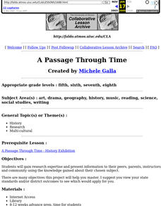
A Passage Through Time
Young learners research and present information about a chosen subject to their peers, parents, instructors, and community. This lesson has a strong research and public speaking component, and would be ideal for your higher level students.


