Curated OER
Name That Continent
Learners practice locating the seven continents, four hemispheres, and four oceans using a large world map and a review song. They also import a world map to the Kid Pix computer program then type in proper labels on the map. There are...
Curated OER
United States Map Quiz
In this online interactive geography quiz worksheet, students respond to 50 identification questions about the shapes of countries shown. Students have 5 minutes to complete the quiz.
Curated OER
Lesson Plan on Latitude and Longitude
Sixth graders identify at least ten places on the world map using given longitude and latitude points. They identify the longitude and latitude of ten places on the world map.
Curated OER
"Place the State" Game
Students participate in a computer game in which they locate and place the U.S. states on a blank outline map. In small groups, they take turns dragging and dropping the states in the proper location on a map.
Curated OER
COLONIAL FLYERS/TRAVEL BROCHURES TO THE COLONIES
Learners investigate concepts of history and geography in this lesson. They create travel brochures for travelers who are crossing the Atlantic Ocean to populate the colonies of early America. The brochure has topographical information...
Curated OER
Land Elevation
Students investigate land elevation. In this map skills instructional activity, students use a physical map to identify various elevations of the land. Students find landform features such hills and coastlines.
Curated OER
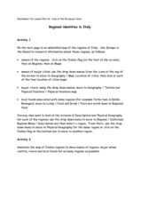
Regional identities in Italy
In this Italy map activity worksheet, students complete 2 map activities that require them to identify major cities and landforms in the country.
Curated OER
Oceania Map Quiz
In this online interactive geography quiz activity, students respond to 14 identification questions about Oceania. Students have 2 minutes to complete the quiz.
Curated OER
Australia Cities Map Quiz
In this online interactive geography quiz activity, students respond to 17 identification questions regarding Australian cities. Students have 3 minutes to finish the timed quiz.
Curated OER
Spanish Cities Map Quiz
In this online interactive geography quiz worksheet, students respond to 11 identification questions about Spanish cities. Students have 3 minutes to complete the quiz.
Curated OER
Chinese Cities Map Quiz
In this online interactive geography quiz worksheet, students respond to 10 identification questions about Chinese cities. Students have 3 minutes to complete the quiz.
Curated OER
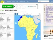
Africa Map Quiz
In this online interactive geography quiz learning exercise, students respond to 53 identification questions about the countries of Africa. Students have 6 minutes to complete the quiz.
Curated OER
Where in the World War? Mapping WWII in the Pacific
Students explore the Pacific Theatre of War. For this World War II lesson, students use reference material to access information about significant locations in the Pacific Theatre of War. Students identify the locations of the listed...
Curated OER
Where in The World Am I?
Learners explore the concept of absolution location. For this geography skills lesson, students discuss how to identify and locate latitude and longitude. Learners play a game to reinforce the skills.
Curated OER
Where Is Japan? What Direction Is It?
First graders locate countries on maps and globes and learn about the hemispheres and the cardinal directions. They listen to books read out loud and dicuss geography.
Curated OER
Where's the Sand?
Middle schoolers identify the characteristics of deserts. In this geography lesson plan, students discuss the characteristics of a desert and label a map with the names of deserts.
Curated OER
Mapping a Garden
Second graders recognize the components of a map, particularly the legend, the key, the symbols and the area. They develop their own map of a garden they be planting in their upcoming science lesson.
Curated OER
U.S. History: What Happened Here?
Students apply the global positioning system to create maps of local historical sites. By collaborating with local historical groups, they research events and relate them to broader, national history. In addition to writing essays...
Curated OER
Maize to Maquiladoras: Movement from Mexico to Arizona
Fourth graders label maps of Arizona and Mexico to show the people, goods, and ideas that have moved between the two places. In this Arizona and Mexico lesson plan, 4th graders summarize the effects of the movement on Arizona life.
Curated OER
Grades 6-8 Lesson Plan - Cities as Transportation Centers
Students examine maps of the 1800's and 1900's. In this geography skills lesson, students collaborate to read core maps and identify transportation centers and travel networks.
Curated OER
Finding Their New World
First graders place stickers on maps indicating their understanding of the cardinal directions. They locate Jamestown, England, the Atlantic, and Virginia.
Curated OER
Climb a Mountain, Raft a River on Your Own Land
Students are introduced to the characteristics of a map. As a class, they discuss the uses of public lands in their community and develop symbols for each feature. They use the symbols to create a map showing the recreational uses of...
Curated OER
Globe Skills Lesson 1 Some Early American Cultures
Students apply their knowledge of geography. In this geography skills activity, students read brief selections regarding early Americans. Students respond to the questions included in the self-guided map skills activity.
Curated OER
Take a Hike
In this geography skills worksheet, learners respond to 9 questions that require them to read topographic maps and interpret them. The topographic maps are not included.


