Curated OER
Improvisational Setting - "Where are You?"
Second graders explore setting through improvisations. In this theatre lesson, 2nd graders perform a variety of improvisations in different settings and chart how they established the setting in the different environments.
Curated OER
Teaching the Five Themes of Geography Through Picture Books
Read the story Make Way for Ducklings and introduce little ones to the five themes of geography. Reread the story, while displaying transparencies to reinforce the five themes. In groups, learners view pictures and identify the themes on...
Curated OER
A Day on a Farm
Students discuss their morning as they prepared to come to school. The teacher guides the discussion so students understand ways they relied on agriculture to accomplish tasks. Students view pictures of various farm machinery. As the...
Curated OER
Reading a Local and National Weather Map
Students examine weather maps. They examine icons and map symbols. Students explore vocabulary words related to weather. Students analyze and evaluate information provided on the weather map.
Curated OER
I Need More Information!
Students decide on an issue and then determine what questions they would like to have answered while researching the topic. They develop and improve their research skills by using a variety of available sources to investigate and write...
Curated OER
Planning My Vacation Online
Young scholars use a variety of resources to decide on a vacation destination. They locate three points of interest, a hotel, and two restaurants at their destination.Students obtain driving directions for their trip, create a trip...
Curated OER
Global Statistics
Students select appropriate data to determine the mean, median, mode and range of a set of data. They calculate the statistical data on literacy rates and life expectancy within each geographic region of the world. Students determine...
Curated OER
Reading a Local and National Weather Map
Learners practice reading a national and local weather map. Using this information, they work together to make predictions about the weather for the next few days. They discuss the use of symbols and maps as a class and discuss how...
Curated OER
Communities Around the World
Students investigate the idea of community by taking a field trip. In this civics lesson, students participate in a supervised walk around their neighborhood while identifying characteristics and objects that make their home town...
Curated OER
How Do I Learn Best?
Students discover their learning styles. In this language arts lesson, students read about the various learning styles. Students determine their learning style and discuss how they can use this knowledge.
Curated OER
Focused Learning Lesson: American History
Eleventh graders compare and contrast the type of immigrant that came to America during the 19th and 20th centuries. They write letters as if they were immigrants coming to America and what they faced and their hopes for the future.
Curated OER
Kincaid Creatures
Young scholars brainstorm a list of nocturnal and diurnal wild animals they see in their community and discuss how the animals would be different if they were living during the Ice Age. Using a handout, they discover how archeologists...
Curated OER
The Civil War--Reading on the Internet
Students grasp how to read from text and retain it. They use reading comprehension strategies specific to the Internet. They search for answers to questions related to the Civil War.
Curated OER
Rivers And Capitals
Students become familiar with the use of GIS for research and become aware of the importance of rivers to cities. They also analyze the placement of cities and learn the names of rivers in the United States.
Curated OER
Indiana Tornado Project
Students become familiar with the use of GIS for research, natural phenomena in Indiana, and analyzing collected information.
Curated OER
Pay Check Advance Loans
Students explore the implications of obtaining loans. They assess interest rates, amount to be paid back, and the implications if they do not pay back the loan on time. Students develop a comparison chart.
Curated OER
Ohio Census 1990 & 2000
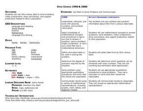
Students use Ohio census data to solve problems, make comparisons, draw conclusions, and support predictions related to Ohio's population. They interpret and work with pictures, numbers and symbolic information.
Curated OER
Energy Choices
Students add and multiply decimals to complete gas choice worksheets. They discover which gas supplier has the best gas prices. Students collect and interpret data about local natural gas suppliers and use this information...
Curated OER
Ohio Census 1990 and 2000
Students begin the lesson by examining Census data from the state of Ohio from 1990 and 2000. Using a worksheet, they solve problems using the data and a calculator. They share their responses with the class and discuss what the data...
Curated OER
PayCheck Advance Loans
Young scholars discuss the role of a paycheck advance loan company. Using data given to them, they calculate interest rates on the amount of advance they receive and identify the penalties of not repaying the loan on time. They record...
Curated OER
LLoyd's Corner
Students write a description of how a local environment has changed over time and why these changes have occurred accordingly. They describe and record changes in Lloyd's corner over time as depicted in pictures taken at four different...
Other
Metrocosm: The Shape of the Us Economy
Using cartograms, compare the GDP's of rural and urban areas in the Unites States. View the 10 largest metro areas by GDP and see how the US compares to the United Kingdom in terms of GDP.
ClassFlow
Class Flow: Communities
[Free Registration/Login Required] This flipchart defines the various types of communities and ties into the book The Little House by Virginia Burton. It features pictures from Google Earth and questions for Activotes.


