Curated OER
The Plains Indians
Students have a better understanding of another culture other than their own. This help them to see that there were other people living in this region before us.
Curated OER
U.S. Political Map
In this political map worksheet, students use the map of the United States and the 7 cities to measure the straight-line distance between the cities. Students add the total number of miles traveled and write their answers in the spaces.
Curated OER
How Far Away is Your College?
Eighth graders practice using atlases. In this geography skills lesson, 8th graders select a college they would like to attend and use an atlas to respond to questions about the geography of the place.
Curated OER
D'Nile Is Where It's At!
Students travel down the Nile River to survey ancient Egypt in this unit of nine lessons. Data about pharaohs, hieroglyphics, growing crops, pyramids, the geography, and the sacred rituals are explored in this unit.
Curated OER
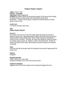
Regions, Regions, Regions!
Learners use regions to analyze the locational patterns of culture
groups at various scales. They discern the basics of region identity by discovering his/her "Home" Region through the examination of
criteria in his/her "backyard." In...
Curated OER
Cities of the World
Students identify the symbol for cities on a political map. In this world map lesson, students identify specific cities on the World Political Map. Students should identify the country in which the city is located. Students discuss the...
Curated OER
Personality and Posts
Students examine the personality type needed to become a diplomat in the US Foreign Service. They look at the results of the Myers-Briggs Personality Test that each diplomat in training must take. They study their own personality type to...
Curated OER
The United States Enters the Korean Conflict
Students locate the Korean Peninsula on a world map. They, in groups, study different sources, which explain why the U.S. entered the Korean conflict. One group uses textbooks, the other uses a government document.
Curated OER
Ethnic Foods Exchange
Students examine the following topics: geography and culture, types of foods, cooking utensils, and cooking techniques used. They present in groups, then prepare ethnic food products.
Curated OER
What if the Mormons had not come to Utah?
Fourth graders use critical thinking, evaluation, and geography skills to find alternative locations that Brigham Young could have taken the Mormons to settle.
Curated OER
Presidents North and South Timeline
Fourth graders conduct online research to create a timeline of ten US Presidents. For this historical events lesson, 4th graders find online information about the birth dates and birth states of ten US Presidents. This information is...
Curated OER
Australia: Introductory Lesson
Students explore Australia. In this global studies lesson, students listen to audio clips and watch video clips that introduce them to the the nation-continent. Students discuss what they already know about Australia and what they would...
Curated OER
War on Waste
Learners take a closer look at food waste. In this global studies lesson, students perform a waste audit at their school and institute a lunchbox challenge to reduce food waste. Learners may also complete the extension activities.
Curated OER
Following the Great Wall of China
Students explore the Great Wall of China. They participate in three activities to become familiar with the geography of China and Chinese names. Students explore the size of the wall by examining an interactive web site. They write a...
Curated OER
You've Got My Vote!
Students explore the ruling of the US Supreme Court on the ballot recounting ordered by the Florida State Supreme Court. They work in small groups to research and compare the judicial and electoral processes.
Curated OER
Oklahoma
In this geography worksheet, students read a 2 page selection detailing the location, history and early statehood of Oklahoma. They answer 10 true or false questions based on the reading.
Curated OER
United States Map- State Capitals
Students explore the state capitals. In this geography lesson, students use a political map to identify the state capitals and place post-it notes on various capitals.
Curated OER
A World in a Grain of Sand
Learners go exploring Britain's beaches. In this geography lesson, students visit selected websites to learn about specific beach habitats and the history of cleaning those beaches.
Curated OER
World War II Webquest
Tenth graders work with a partner to locate and follow the directions of a webquest of their choice. Using the internet, they research their topic in depth and write a paper on their findings. They are assessed by the criteria on the...
Indian Land Tenure Foundation
Maps and Homelands
You are never too young to learn about maps. To better understand the concept of a homeland, students work together to construct a map of their local area out of paper puzzle pieces. They'll put the maps together and then add details by...
Curated OER
Tango Bingo
Students research tango music and dancing and research where it comes from. In this tango lesson plan, students research Argentina and South America while learning about the tango and making posters of it.
Curated OER
Africa - Clothing
Third graders discuss the differences between the clothing choices within the three regions in Africa and in Hawaii.
Curated OER
This Land Is Our Land
Students research federal land holdings. They explore how those lands are used. They map these lands and design their own legends. They discuss whether or not the land is being used accordingly.
Curated OER
Valentine Village
Students build a small city by using a half-gallon milk or juice carton to "build" a miniature home. They decorate their buildings with construction paper, yarn, beads, or whatever they have and become mailmen, delivering Valentine's to...


