Curated OER
Ancient Egypt
Students use the internet to gather information on Ancient Egypt. Using this information, they create their own name cartouche using markers and construction paper. They also make pyramid cutouts and draw pictures of the Great Sphinx.
Curated OER
Water Sources in Cape Verde and West Africa
Young explorers study the scarcity and importance of a continuous supply of fresh water in Cape Verde. They research the five main ways that fresh water is obtained in these countries. Each research group prepares a presentation, and...
New York State Education Department
TASC Transition Curriculum: Workshop 11
You'll C-E-R a difference in classroom achievement after using a helpful lesson. Designed for economics, civics, government, and US history classes, participants practice using the CER model to craft arguments about primary and secondary...
Curated OER
Symbols of Our State: Arkansas
Here are a series of lessons designed to assist early elementary learners to discover the symbols of Arkansas. They learn about the state flag, insect, state seal, state bird, flower, tree, and gem. A booklet (emedded in the plan), is...
NASA
Precipitation
Here is a fabulous collection of lessons for your emerging meteorologists! In them, learners will utilize satellite data to determine distribution of rainfall, research global rainfall patterns, and utilize their knowledge to propose new...
Curated OER
States in the USA Quiz
In this online interactive geography quiz activity, students respond to 50 identification questions about the states in the United States of America. Students have 4 minutes to complete the quiz.
Curated OER
Map It With Pixie
Fourth graders use the computer program 'Pixie' to create a topographic, detailed map for the state they live in. In this mapping skills lesson, 4th graders use Pixie to make a map of their state that includes topographic features, state...
Curated OER
Enduring Cultures
Students research the art, dance or a game from the Pacific Northwest Coast Aborigines. In this Canadian Cultures lesson, students view a PowerPoint about the Inuits. Students choose a game , type of artwork or dance to research....
Curated OER
My Place In Time
Sixth graders interpret Franklin's style, his ease of writing and content, using this to inspire, motivate and guide them to do more writing. They list Franklin's civic accomplishments and political accomplishments. They name 4...
Facing History and Ourselves
Who Am I?
Sixth graders explore how people throughout time have responded to questions regarding identity. For this The House on Mango Street lesson, 6th graders create an identity chart for a fictional character and then write personal essays...
Curated OER
Fantastic Flying Journey
Third graders listen to a teacher reading of the "Fantastic Flying Journey." students research each country/continent using the Internet and creating a travel journal.
Curated OER
How To Find a Site
Fourth graders identify the three basic needs of humans. They identify on a map the best places to live and make a list of items that they can find on a map - streams, river, hills, plains, forests, etc.
Curated OER
A Tale of Two Towns
Students compare their community and region with other communities around the world. In small groups they complete a questionnaire about life in their community and correspond with e-pals, take digital pictures, conduct research on...
Curated OER
Meeting the Needs of an Aging Population
Learners examine population trends and predict how the age of the majority of Canadians will change 15 years from now in various geographic areas. They will gather statistical evidence that supports their projection. Learners will then...
Curated OER
Can You Hear Me Now?
Students explore the industry involving communication and put communication devices into activities. For this communication lesson plan, students put items into chronological order, review primary sources, compare and contrast items, and...
Curated OER
U.S. Possessions
Ninth graders research the United States acquisition of the Philippines and their fight for independence. They locate the Philippines on a map and brainstorm how its geography has benefits. They access the Internet and complete a student...
Curated OER
Cultural Anthropology Study Using the Fundamentals of Geography and GPS
Pupils, in groups, operate the GPS unit, plotting each head stone with accompanying description. Two other students to log in data that corresponds to the given points. One student to note general observations
Curated OER
Heritage: Survival and the Geography of Utah
Fourth graders are introduced to the hunting and gathering techniques used by the Native American tribes living in the region that is now Utah. They prepare a role-play of hunting and gathering appropriate to specific geographical areas.
Curated OER
Geography Review
Third graders name the continent, country, state, and community in which they live. They locate Maryland and Baltimore on a map of the United States.
Curated OER
Global Geography of Economics: the Indiana Steel Industry
Students research and identify positive and negative effects of imported steel on the Indiana steel industry.
Curated OER
Global Geography of Economics: The Indiana Steel Industry
Learners are introduced to how steel is made and investigate the importance of the steel industry. They participate in a role-play that explores the concepts of taxes, tariffs and imports vs. domestic production.
Curated OER
Great Explorers
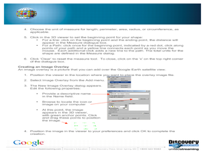
Young scholars research an explorer and present a multimedia presentation on the explorer. In this United States explorers lesson, students watch a video about Lewis and Clark. Young scholars use Google Earth to study their journey and...
Curated OER
Geography: Lesson One
Learners pretend they have been chosen to receive an elephant for a pet. Individually, they use the internet to research where elephants come from, their diet and sleeping behaviors. They identify their habitat and their characteristics...
Curated OER
State Capitals- Online Interactive
In this state capitals worksheet, students learn to match the capital cities to the 50 states. Next to each name of the state, students fill in the capital city from a list that is provided. This is an online interactive worksheet.


