Curated OER
Satellite Images- Night Time
Fourth graders study the geography and population distribution of various places on earth. They utilize actual satellite images of the night sky (lights showing heavily around area of dense population) to study and make observations...
Curated OER
My How Things Have Changed
Eighth graders discuss the impact geography had on hunter-gatherer societies, their toolmaking. They work in groups to create a Web page that links pictures of artifacts to explanations about what the artifact tell us about the lives of...
Curated OER
Living in America (The Earliest Years)
Fifth graders work in groups to study a particular group of Native Americans. They use a study guide to guide their research and use the internet and text resources to gather information. Students post their research on a class web page.
Curated OER
Social Studies: The Connecticut Hill Community
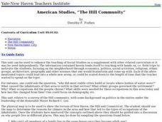
Learners discover the reasons for the settlement of the Connecticut Hill Community. Through an examination of the climate, occupations of the inhabitants, and demographics, they discuss reasons people choose locations for settlement. ...
Curated OER
Lesson 3
Students demonstrate knowledge of geography and early inhabitants of Virginia by locating and identifying water features important to early history. They also locate three American Indian language groups. Both of these activities require...
Curated OER
Vermont Map, Word Search, Scrambled Places and Crossword Puzzle
For this geography worksheet, students learn the important physical features and major cities in the state of Vermont by completing any of the 5 worksheets. There is a free form map, a "label me" map, word search, scrambled places and...
Curated OER
Bringing Illinois into the Curriculum
Students of all ages are introduced to the geography of Illinois. Depending on the grade level, they participate in different activities which allow them to discover Illinois in the past and present. They examine the animals and...
Curated OER
United Nations General Assembly
Students study China and the Chinese occupation of Tibet. They read position summaries/notes of China, Tibet and various foreign nations. Then they roleplay members of United Nations General Assembly and discuss and debate the topic.
Curated OER
Lewis and Clark
Ninth graders study the plants and animals Lewis and Clark discovered on their expedition. There is a plant illustrator, a plant recorder, an animal illustrator, and an animal recorder. They research the plants and animals and the ...
Curated OER
War of 1812
Eighth graders examine how Andrew Jackson's decisions during The Battle of New Orleans led to victory. They study the importance of The Battle of New Orleans in the Treaty of Ghent and discuss the results of the War of 1812. Finally,...
Curated OER
Canadian Provinces Quiz
In this online interactive geography quiz worksheet, students examine the map that includes 13 Canadian provinces. Students identify the names of the provinces in 3 minutes.
Curated OER
Country Flags Quiz
For this online interactive country flag quiz worksheet, students examine the 20 pictured country flags and try to name all of the countries represented in 4 minutes.
Curated OER
South America Map Quiz
In this online interactive geography quiz worksheet, students examine the map that includes all of South America's countries. Students identify the 13 countries in 2 minutes.
Curated OER
Middle East Map Quiz
In this online interactive geography quiz worksheet, students examine the map that includes 26 Middle Eastern countries. Students identify the names of the countries in 4 minutes.
Curated OER
Central America Map Quiz
In this online interactive geography quiz instructional activity, students examine the map that includes 22 Central American countries. Students identify the names of the countries in 3 minutes.
Curated OER
Canada Map Quiz
In this online interactive geography quiz worksheet, students examine the map that includes 13 Canadian provinces and territories. Students identify the names of the provinces and territories in 2 minutes, 30 seconds.
Curated OER
Famous Streets Quiz
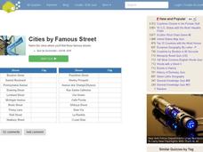
In this online interactive geography quiz learning exercise, learners examine the chart that includes the names of 18 famous streets in the world. Students have 4 minutes to identify the names of the cities where the streets are found.
Curated OER
State Nicknames Quiz
In this online interactive geography quiz worksheet, students examine the chart that includes the names of 49 states. Students identify the nicknames of the states in 6 minutes.
Curated OER
Highest Mountain Countries Quiz
In this online interactive geography quiz activity, students examine the chart that includes the elevations of 20 world mountains. Students identify the names of the mountains in 4 minutes.
Curated OER
California Cities Map Quiz
In this online interactive geography quiz worksheet, learners examine the map that includes 12 California cities. Students identify the names of the cities in 3 minutes.
Curated OER
Biggest Cities in Each State Quiz
In this online interactive geography quiz worksheet, students examine the chart that includes the names of 50 U.S. states. Students identify the names of the two largest cities in each state in 8 minutes.
Curated OER
Landlocked Countries Quiz
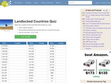
In this online interactive geography quiz worksheet, learners examine the chart that includes details about the population in 44 landlocked countries. Students identify the names of the countries in 5 minutes.
Curated OER
Famous Lakes Quiz
In this online interactive geography quiz worksheet, students examine the chart that includes details about 15 famous world lakes. Students identify the names of the lakes in 3 minutes.
Curated OER
Biggest Cities in India Quiz
In this online interactive geography quiz worksheet, students examine the chart that includes the population of 20 Indian cities. Students identify the names of the largest cities in India in 4 minutes.


