Curated OER
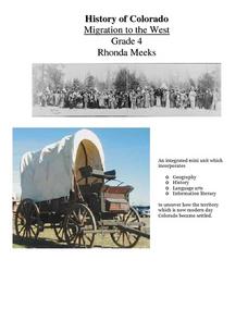
History of Colorado-Migration to the West
Fourth graders identify reasons for people moving to the Colorado Territory and examine how moving in the 1800's is different than moving today. They also practice reading maps and gathering information from maps, as well as, describe...
Curated OER
Our Fifty States
Seventh graders identify and locate all fifty states in the United States and their capitals. Individually, they research one state identifying when it became a state, its motto, song, flower and nicknames. To end the instructional...
Curated OER
The People Behind the Numbers
Tenth graders brainstorm potential definitions for "developed" and "developing" countries. They work in groups of four and research using Web sites listed to find information about their country then they create a spreadsheet which...
Curated OER
Lewis and Clark
Fourth graders research the Lewis and Clark expedition and the Corps of Discovery. They explore a variety of websites and complete a WebQuest, analyze maps, and answer comprehension questions. Students also write journal entries and...
Curated OER
Equator, North Pole, and South Pole
Pupils identify the Equator, North Pole, and South Pole on the globe. In this map skills lesson, students use a globe marker to locate specific locations on the globe. Pupils find where they live in relation to the Equator.
Curated OER
Censusmania
Students understand how the census can reveal information about people and history. They create their own census.
Curated OER
Hit The Road Jack(or Jill)
Students find the approximate area of the court order on a current map of Delaware. They draw a layout of their school and decide where a new hallway or outside pathway would be most needed.
Curated OER
Property?
Students complete a list of seven items that they own with an appropriate value attached. They understand the principle of property and write an essay on why people owned slaves.
Curated OER
Ancient Civilizations: Medieval and Early Modern Times
Seventh graders gain an understanding of the history of Mongolian culture through making inferences about Mongolian artwork
Curated OER
Latin American Relief Map
Students, in groups, research, design and construct a relief map of a section of Latin America using papier-mache. They show major landforms, elevations and notable bodies of water. They present their maps to the class.
Curated OER
Wappo Indians: Animals They Hunted
Third graders examine the hunting and foraging practices of the Wappo tribe. They discover Wappo words for food and determine which animals still live in Napa County. They research the diet, habits and homes of these animals.
Curated OER
Learning from Primary Source Documents One Day at a Time
Students differentiate between primary and secondary research sources before making a visual representation of their research into the colonist of Fort St. Louis. They write inquiry questions to guide their research.
Curated OER
Trade in the Global Village
Students use the internet to research the trade status and needs of a country of their choice. Using this information, they determine which three main products their nation needs to import and which ones they can export. They write a...
Curated OER
State Report
Students create a state report/ presentation. They research U.S. state information using the Internet and retrieve information about specific topics (Individual States in the USA) using technology resources.
Curated OER
Wickets & Woozles Exile Simulation
Students divide into two groups and become Wickets and Woozles. They are separated in the classroom and then participate in a simulation activity in which one group is in "exile." They follow the activity with a class discussion and...
Curated OER
South Dakota Towns
Fourth graders create a multimedia presentation about South Dakota towns. The presentations are made in the class. The research for each town is done using the internet and resource links could be included in the final presentation.
Curated OER
Investigating Haiti
Pupils engage in a lesson that is about the island of Haiti. They conduct research using a variety of resources. The information is used in order to help students locate the island on a map. They answer questions while participating in...
Curated OER
Adventures on the Eastern Half of Planet Earth
Seventh graders explore a country in the Eastern hemisphere. They develop a packet that could be used by someone visiting that country during the month of December. Students explore the climate, foods, geography, customs and culture of...
Curated OER
Passport to the World
Eighth graders investigate the process for obtaining a United States passport. They plan a trip to a foreign country looking at important information including the climate, geography, culture, money, and language. They complete the...
Curated OER
Korea Lesson Plan
Sixth graders research the history and development of Korea as a culture and nation. This lesson plan is unique in that the focus is upon the neighboring countries of China and Japan in order to see their contributions to Korean society.
Curated OER
Geographic Landscapes and Interstate Freeway Development
Students investigate the topography of the United States through a discovery lesson. They create a hypothetical route for a highway across the United States. Students also conduct research major landforms and define geographic terms.
Curated OER
Native Americans - People of the Plains
Students explore Plains Indians and practice computer skills by reading creation and migration stories on People of the Plains CD-ROM, and watching Plains video. Students examine village life of Plains Indians, and view different...
Curated OER
Natural Puerto Rico
Students explore the nature of Puerto Rico. They view a Power Point presentation on world population and discuss how Puerto Rico landscape differs from Wisconsin's landscape. They create a Venn diagram comparing the two and complete a...
Curated OER
Environment: Going Places
First graders learn directional words and apply this skill to map making. They record their steps on paper.


