Curated OER
Physical Features
Students draw physical land features using ClarisWorks or Kid Pix, write their definitions, create slideshow, and create class geography book.
Curated OER
Social Sstudies: Change in Space and Time
Students examine the dynamics of change and compare and contrast it with other cultures. They cite examples of how people change over time and explain why it is necessary. Students organize a skit, Webpage, or Powerpoint presentation...
Curated OER
US Cities
In this social studies activity, students find the names of major US cities. The answers are found at the bottom of the page by clicking the button.
Curated OER
Mapmaker, Mapmaker, Make Me a Map
Second and third graders practice with basic map skills. They create their own map including a legend and a compass rose. This fabulous plan has many excellent websites linked which allow learners to explore maps of all kinds; including...
Curated OER
Exploration of the Americas
Third graders demonstrate knowledge of exploration by naming and describing accomplishments of explorers. They use the internet to find corresponding information on the explorer and fill in a chart that is provided. Students also...
Concord Consortium
Center of Population
Let the resource take center stage in a lesson on population density. Scholars use provided historical data on the center of the US population to see how it shifted over time. They plot the data on a spreadsheet to look the speed of its...
Curated OER
My Summer Vacation
Students study the United States geography using Google Earth. In this U.S. geography lesson, students create travel journals about five U.S. geographical locations. Students research the human and physical characteristics for each region.
Curated OER
Social Studies: Ancient China
Seventh graders examine the contributions and influences of dynasties on Chinese history. They role-play as citizens during selected dynasties and write daily autobiographical entries. Students complete projects on the geography,...
Curated OER
World Map and Globe - Four Main Directions
Students study the four main directions on a map. In this map lesson, students locate the North and South pole, and learn the four cardinal directions. They use the compass rose on a map to help with the directions. (Map is not included...
Curated OER
African Safari
Seventh graders examine different countries in Africa to research. They choose one to concentrate their research on using the five themes of geography. They design a multimedia presentation that will make up the African safari.
Curated OER
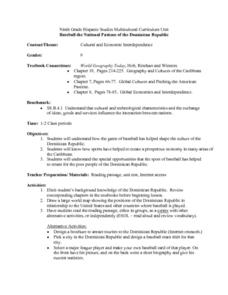
Baseball the National Pastime of the Dominican Republic
Ninth graders examine how the game of baseball has played a significant role in shaping the culture of the Dominican Republic. They analyze a world map, and read and discuss an informational handout. Students can then create a sports...
Curated OER
School Neighborhood Walking Tour
Students list specific boundaries in their school neighborhood and explain their possible purpose. They examine a neighborhood and see what connects us and what divides us. They, in groups, make maps of various neighborhoods and present...
Curated OER
World War I
Eighth graders examine the condition of the world from 1880 until the start of World War I. After watching a PowerPoint presentation, they discuss the causes and effects of the war and complete a study guide with a partner. To end the...
Curated OER
Lake Tahoe Then and Now
Students investigate the differences in Lake Tahoe from the past to the present. In this geography lesson, students read the book Washoe Seasons of Life and identify the descriptions of the land and lake. Students create a Venn diagram...
Curated OER
Landforms and Resources of the United States and Canada
In this North American geography worksheet, students read about the physical features and resources of the United States and Canada. Students take notes and answer 3 short answer comprehension questions as they read the selection.
Curated OER
Chinese Lion Dance
Students celebrate the Chinese New Year and listen to the story behind the Chinese Lion Dance. In this Chinese New Year lesson, students research the geography and culture of China. Students create puppets, dance the Lion Dance and...
Curated OER
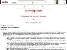
Early Explorers
Fifth graders study early explorers. In this World history lesson, 5th graders draw an outline of a map labeling each part, build geographical features out of dough, and paint each of the land and water features.
Curated OER
United States & Canada: How Are We The Same? How Are We Different?
Students compare and contrast similarities and differences between Canada and the US. In this geography lesson, students read various articles and identify similarities and differences in economies, cultures, geography, climate, and...
Curated OER
The 50 States
Fifth graders use maps and music to learn the 50 states. In this US Geography activity, 5th graders map out a region of the United States and practice singing the song, The 50 States that Rhyme.
Curated OER
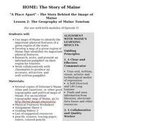
The Geography of Maine Tourism
Young scholars study topographical maps of Maine to identify the important physical features. They work in groups to create tourism pamphlet highlighting a region of the state.
Curated OER
Roman Holiday in Google Earth
Students plan an itinerary for an educational trip to Rome. In this research skills lesson, students use Google Earth to conduct research for their project in their travel teams. Students also set up blogs to share their progress through...
Curated OER
Teacher Notes
Gathering information, distinguishing between arguments, preparing an oral presentation; these skills are fostered as 10th graders explore aspects of global trade and politics. They use the Internet to gather information about NATO, The...
Curated OER
Bears and Panthers Aplenty: Early Settlers Make a Home in Arkansas
Young historians research the Southwest Trail, which ran through Arkansas back in the 19th century. Pupils are divided into four groups. Each group researches a pioneer who blazed the Southwest Trail. Then, the group presents an oral or...
National Endowment for the Humanities
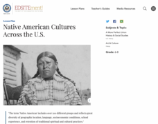
Native American Cultures Across the U.S.
Learners examine how American Indians are represented in today's society. They read stories, analyze maps, and complete a chart and create an illustration about a specific tribe.


