Curated OER
Water Features - Lesson 2 - U.S. Political Map Grade 4-5
Learners locate water features on maps. In this geography lesson, students complete worksheets that require them to identify water features on a U. S. political map.
Education World
The African American Population in US History
How has the African American population changed over the years? Learners use charts, statistical data, and maps to see how populations in African American communities have changed since the 1860s. Activity modifications are included to...
Curated OER
U.S. and Canada: How are We the Same? How are We Different?
Get high school geographers to compare and contrast Canada and the United States. They begin by drawing a freehand map of North America, then complete readings to gain insight into Canada. The text is not provided; however, another text...
Curated OER
Indian Languages
Fifth graders explore the different types of Indian languages used today in the United States.
Curated OER
Energy Crisis: Then and Now
Using political cartoons, scholars analyze the energy crisis of the 1970s and '80s, comparing and contrasting it to current tensions with oil. Display the 6 cartoons (linked) to the class, and demonstrate analysis using the worksheet...
Curated OER
They Were Born Where?
Students assess where the presidents of the United States were born and analyze the role of geography in determining the outcome of presidential elections. They create graphs visualizing the birth and home states of the presidents along...
Curated OER
Route 66 And Population Patterns
Learners investigate the geography located along Route 66. They research how the population patterns change in certain areas along the highway. Students use the information in order to form hypotheses about how and why the population...
Curated OER
Where In the World Are You?
Fourth graders fill in blank copies of the United States Map and then the World Map.
Curated OER
People in the World-Brazil
Second graders explore information about South America and choose a country to study. They explore culture, food, geography, clothing, language, and recreation of their country. Students visualize their learning by developing a slide...
Curated OER
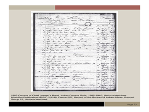
Chief Joseph and the Nez Perce
Eleventh graders explore the life of Chief Joseph and Nez Perce. In this US History lesson, 11th graders analyze paintings and photos detailing the flight of Nez Perce. Students create a narrative newspaper article based on their...
Curated OER
A New World and the Emergence of a New Race
Students study specific terms and concepts about the discovery of America. They improve their history knowledge about some Latin American regions and their map and geography skills of the New World. They describe what is meant by...
Curated OER
Homer's Odyssey:The Original Incredible Journey
Young scholars study Greek culture, particularly as it relates to Homer's Odyssey. They examine how human activities shape the earth's surface and identify forces that influence a culture's beliefs and traditions. They determine that...
Curated OER
RACED Comprehension Sheet
In this race worksheet, pupils respond to 10 short answer questions regarding geography concepts that feature the letters of the word "raced" as mnemonic hooks.
Curated OER
Explorer Comprehension Worksheet
In this exploration worksheet, students draw the routes of the listed explorers on the blank world map. Students should also provide a color-coded map key.
Curated OER
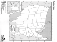
United States Map Lesson
Students explore basic map skills. In this United States geography lesson, students define "country" and "state," locate their state on a United States map, and identify and trace state boundaries defining their state and surrounding...
Curated OER
United States Map - Lesson 9
Students explore the concept of cardinal directions. In this geography lesson plan, students identify the compass rose on a large U. S. map and then discuss the cardinal directions.
Curated OER
United States Map - Lesson 11
Students explore lakes of the United States. In this geography lesson, students identify noteworthy lakes on a map of the United States.
Curated OER
Three Mapping Activities
Students label three maps of China after being introduced to background information about the country. In this geography lesson, students color two maps and label various points of interest in China. Finally, students draw their own...
Curated OER
Kosovo: Where is It and What's All the Fuss About?
Students investigate the US military involvement in Kosovo and answer teacher generated questions.
Curated OER
Coming to America
Fifth graders listen to the song America by Neil Diamond, view pictures of Ellis Island, and role play as processing officers who evaluate, classify and recommend which immigrants can stay in America.
Curated OER
Early Explorers
Fifth graders investigate the routes taken by the early explorers. In this explorers lesson, 5th graders use interactive notebooks, discussion and maps to discover the routes taken. Students get into pairs and label maps, and create...
Teachers' Curriculum Instituted
The Roman Record
Using Google Earth, Google Docs, and other Google Tools, collaborative groups of seventh graders research and then create and share online newspapers reporting on the early development, geographical features, political issues, and family...
Curated OER
Ancient Greece
Sixth graders examine the research that archaeologists have done on a Late Bronze Age shipwreck in order to work out the extent of trade in the Eastern Mediterranean during this period, with emphasis on the involvement of the Mycenaeans...
Curated OER
A Map Mystery
Second graders solve a map mystery. In this technology lesson plan, 2nd graders develop an awareness of maps and the symbols associated with maps as they the "Neighborhood Map Machine."


