Curated OER
Countries of South America
Students focus on the geography of the countries of South America. Using a map, they identify the European countries who claimed the South American countries and research the influences they had on South America. To end the lesson,...
University of Texas
Let's Go to Argentina/¡Vámonos a Argentina!
Give your young Spanish language learners a lesson in culture! Focus on learning Spanish though exploring Argentinian culture. Pupils interact with maps, fill out travel journals, discuss time and food, learn and practice new vocabulary...
Curated OER
South American Capitals Quiz
In this online interactive geography quiz worksheet, students respond to 12 identification questions about the capital cities of South America. Students have 4 minutes to complete the quiz.
California Polytechnic State University
Australian Geography Unit
At the heart of this resource is a beautifully detailed PowerPoint presentation (provided in PDF form) on the overall physical geography of Australia, basic facts about the country, Aboriginal history, and Australia culture and lifestyle.
Curated OER
Americas: Physical Map
In this Americas physical map worksheet, students make note of the major landforms and bodies of water located on the North American and South American continents.
Curated OER
Data Comparison And Interpretation: North Korea, South Korea, And the United States
Ninth graders brainstorm "what they know about North Korea and South Korea." They determine the approximate distance from the United States to North and South Korea and create a graph comparing the birth rates, death rates, infant...
Curated OER
Cacao Tree Geography
Learners use a map to learn about where chocolate comes from. In this lesson on the cacao tree, students locate various regions where the cacao tree grows. They will discuss why the cacao tree grows more favorably in particular climates...
Curated OER
And the Rains Came Down: A South American Rainforest
Students examine the characteristics of a South American tropical rainforest. They analyze maps, develop graphs, listen to the book, The Great Kapok Tree, and create a rainforest mural.
Curated OER
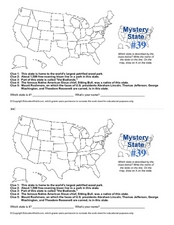
Mystery State # 39
Which state will be the answer to the five clues today? After considering each clue, learners will name the mystery state. If your class can determine which state was home to Chief Sitting Bull, they'll be able to answer South Dakota.
Curated OER
Christopher Columbus: The Man, the Myth, the Legend
Learn more about maps by examining Christopher Columbus's voyage to the New World. Kindergartners will learn about basic map skills and how to identify the compass rose, oceans, and land masses. They will also discover the purpose of...
Curated OER
Welcome to the Americas
Students research and map the North and South American continents. In this geography lesson on the Americas, students can locate North, Central and South American countries and states. Students choose a location to research and prepare a...
Curated OER
Trekking to Timbuktu: The Geography of Mali -Teacher Version
Learners investigate the geography of Mali. They locate Mali on a satellite map, explore various websites, describe the landscape and climate, label a map, and write an essay about the Niger Riger.
Curated OER
Geography of South America
Students explore South America. In this geography skills lesson, students watch a video about the geographical features of the continent. Students complete worksheets on the topic.
Curated OER
World Map and Globe - Lesson 15 (K-3)
Students discover mountain ranges and their locations in the world. In this physical map lesson, students locate and identify major mountain ranges of the world on a large physical map.
Curated OER
Latin American Relief Map
Students, in groups, research, design and construct a relief map of a section of Latin America using papier-mache. They show major landforms, elevations and notable bodies of water. They present their maps to the class.
Curated OER
World Map and Globe - Lesson 15 Mountains of the World
Students locate major world mountain ranges. In this geography lesson, students identify major mountain ranges on 6 on of the 7 continents on a large world physical map.
Curated OER
African Americans in South Carolina: Gullah
In this African Americans worksheet, students research websites about them in South Carolina and answer short answer questions. Students complete 13 questions.
Core Knowledge Foundation
Volume 1 - A History of the United States: Precolonial to the 1800s
Volume One of the 299-page Core Knowledge History of the United States covers events from the Precolonial Period to the 1800s.
Curated OER
Country: Brazil
Pupils use the internet to explore the culture, history, language and animals of Brazil. They read first hand accounts of students growing up in the South American country.
Curated OER
Making a Report to President Washington
Young scholars gain an understanding of some of the challenges the U.S. faced at its birth. They are asked to compose a report on the state of the nation in 1790 (addressed to President George Washington), which includes a narrative,...
Curated OER
South America
In this map of South America activity, students study the map of South America and then write the names of the 15 countries and territories on the provided lines.
Curated OER
The United States in 1790
In this geography skills worksheet, students study the provided map of the United States in 1790 and then complete the provided quiz over the 17 states and territories.
Curated OER
World Map and Globe
Students locate and identify continents and countries. In this world map lesson, students locate and identify one country on each continent.
Curated OER
Mapping Baseball
Learners research how climate, distance, population shifts and immigration have influenced American baseball. They also consider how players from other countries have made their mark on American baseball.


