Other
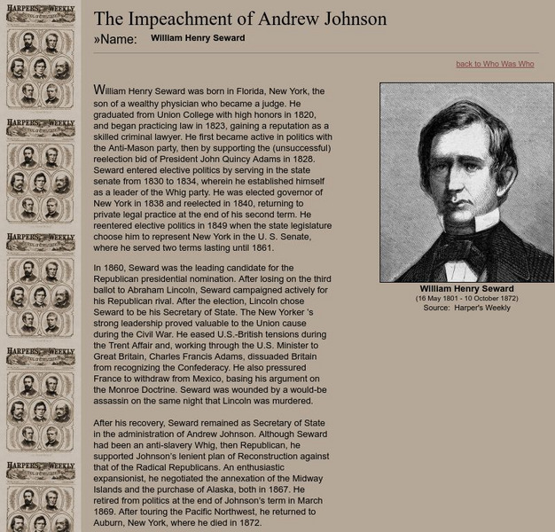
Impeachment of Andrew Johnson: William H. Seward
Short biography of the man who served as secretary of state under President Lincoln and Johnson.
Curated OER
Educational Technology Clearinghouse: Maps Etc: United States, 1917
A map of the United States and territories showing the expansion from the formation of the original states to the purchase of the Danish West Indies (Virgin Islands) in 1917. The map is color-coded to show the original states, the states...
Ducksters
Ducksters: Animals for Kids: Bald Eagle
Kids learn about the bald eagle, endangered bird that is the symbol of the United States.
US National Archives
Our Documents: A National Initiative on American History, Civics, and Service
Our Documents is home to one hundred milestone documents that influenced that course of American history and American democracy. Includes full-page scans of each document, transcriptions, background information on their significance, and...
OpenStax
Open Stax: American Foreign Policy 1890 1914: Turner, Mahan, and Roots of Empire
Examines the development of American foreign policy in the latter part of the 1800s, and what Frederick Jackson Turner and Alfred Thayer Mahan did to further American imperialistic interests.
University of Oregon
Mapping History: American History
Interactive and animated maps and timelines of historical events and time periods in American history from pre-European times until post-World War II.
University of Groningen
American History: Essays: Manifest Destiny: The New Manifest Destiny
While many thought that the doctrine of Manifest Destiny had spent itself when Americans reached the Pacific Ocean, it could also be seen to extend beyond the shores of the United States. For example, Hawaii and Alaska were acquired later.
Smithsonian Institution
National Museum of Natural History: American Mammals: American Marten
American Martens are widely distributed in northern forests across Canada and into Alaska. Only 200 years ago, they were also abundant in the southeastern United States. Learn more about the Martes americana, more commonly known as an...
Curated OER
Etc: The Alaskan Boundary Dispute, 1825 1903
A map of the northern Pacific coastland of North America showing the territorial dispute of the Alaska boundary from the Anglo-Russian Treaty of St. Petersburg in 1825 that established the British claims, the purchase of the area by the...
Curated OER
Educational Technology Clearinghouse: Maps Etc: Hay Herbert Treaty, 1903
A map of the southern border of Alaska and Canada showing the area of boundary dispute and the boundary established by the Hay-Herbert Treaty between Britain and the United States in 1903. The map shows the coastline and fjords of the...
Curated OER
Etc: Acquisition of Territory, 1783 1884
A map from 1885 of the United States showing the territorial growth from the original States and the Northwest Territory in 1783 to the Russian cession of Alaska in 1867. The map is color-coded to show the progression from the original...
Curated OER
Educational Technology Clearinghouse: Maps Etc: North America, 1783
A map of North America, Central America, and northern South America at the end of the American Revolutionary War (1783). The map is color-coded to show the territory of the United States at the time, British possessions in Canada,...
Curated OER
Educational Technology Clearinghouse: Maps Etc: North America, 1858
A map from 1858 of North America showing the boundaries at the time for Russian America (Alaska), Greenland, British America or New Britain, Canada East and Canada West, the United States, Mexico, Central America, and the West Indies...
Curated OER
Etc: Maps Etc: Population Distribution of North America, 1921
A base map from 1921 of North America, Central America, and the Caribbean showing the general population distribution in Alaska, Greenland, Dominion of Canada, United States, Mexico, and Central America at the time. People are most...
Curated OER
Etc: Development of Amer Interests in the Pacific, 1791 1903
A map of the United States and Pacific Ocean showing the development of American interests in the Pacific from the early exploration of Oregon Country in 1791 to the formal annexation of the Midway Islands and the Panama Strip in 1903....
Curated OER
Wikipedia: National Historic Landmarks in New York: William Seward House
Home of William Henry Seward, statesman whose long career was capped by the purchase of Alaska as Secretary of State, for most of his life.
ClassFlow
Class Flow: Pacific Coast Region
[Free Registration/Login Required] This flipchart is one in a series of flipcharts about the different regions of the US. Facts and links to websites included on the Pacific Region.


