Curated OER
Alaska Purchase
In this reading comprehension and geography worksheet, students read a selection about the Alaska Purchase, its origins as a state, and its attributes. They answer 7 fill in the blank questions using information from the selection.
Curated OER
States and their flags
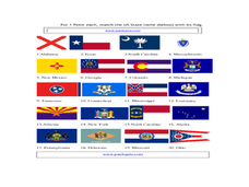
For this state flag worksheet, students match the state name below with their flag. Students match 20 state names with their flags.
Curated OER
States and Capitals of the United States
Students label states and capitals on a United States map and complete research on one of the states. In this states lesson plan, students fill in the states on blank maps.
Curated OER
State to State Scavenger Hunt
In this states worksheet, students utilize the Internet to access one specific website to locate the answers to five fill in the blank statements about the states found on a United States map.
Curated OER
State Symbols
In this social studies learning exercise, learners examine and analyze each of the state's abbreviations, capitals, birds, flowers, animals and the dates when they became a state.
Curated OER
U.S. State Capitals Multiple Choice Definitions Worksheet
In this state capitals worksheet, students choose the correct state capitals for each state. Students complete 15 multiple choice questions.
Curated OER
The Powers of National and State Government
Learners define term federalism, identify the powers granted to state and national government, and identify powers shared by the state and national governments.
Curated OER
Mapping the United States
In this map of the United States worksheet, students label mountains, surrounding countries, oceans, and more. Students complete 12 tasks.
Curated OER
Basic U.S. Geography
Provide your 11th graders with a basic understanding of U.S. Geography. They label the state, regions, and boundaries found in the contiguous U.S. as well as Hawaii and Alaska. Then, they complete two Internet related activities.
DocsTeach
What Else Was Happening During the Civil War Era?
Examine a time of political division and upheaval— not unlike our own—using firsthand accounts. While study of the Civil War often takes center stage in the classroom, the 1850s and 1860s were a period of profound change in other areas...
Curated OER
Alaska
In this Alaska state activity, students research and respond to various questions related to the state of Alaska. They identify and name the state's capital and statehood. Then, students identify and name the motto, bird, flower, and...
Curated OER
The Brief American Pageant: America on the World Stage
America's presence in Alaska and the Caribbean are the focus of this short presentation. Two detailed maps help to illustrate America's growing influence in the regions past its continental borders, which could supplement a more thorough...
Curated OER
A Geopoem About Alaska
Sixth graders conduct Internet research on the physical and human characteristics of Alaska. They compose and write geopoems about the state of Alaska, using a template.
Curated OER
American States and Their Nicknames
In this states worksheet, students match the American states with the nicknames they are commonly referred to as. Students match 15 states to their nicknames.
Curated OER
Alaska
Students describe and explain variations in Alaska's physical environment including climate, landforms, natural resources and natural hazards and compare how people in different communities adapt to or modify the physical environment.
Curated OER
Mush! Tracking Travelers on the Trail
Students get to know Alaska and the Iditarod route that is run by dogs as they track the mushers' progress on a map that they create specifically for the race. They learn about latitude, longitude, plotting on a map, checkpoints, and...
Curated OER
Biggest Cities in Each State Quiz
In this online interactive geography quiz worksheet, students examine the chart that includes the names of 50 U.S. states. Students identify the names of the two largest cities in each state in 8...
Curated OER
United States Map- Continent, Country, State
Students identify their continent, country, and state on a globe. In this geography instructional activity, students use a globe to identify the seven continents, the United States, and the state which they live in. Students define key...
National Institute of Food and Agriculture
Water Supply
Participate in three activities that look at the earth's limited water supply and the changes water goes through as it enters each phase of the water cycle. The resource is complete with three activities that demonstrate the changing...
Curated OER
It's a Gas! Or is it?
Examine the effects of temperature and pressure on solubility and the states of matter of ocean water. Learners make inferences about the unique chemistry of ocean water at different depths. They engage in an activity related to...
Curated OER
States Quizzes
In this state postal code learning exercise, students respond to 45 fill in the blank questions that require them to use the listed state postal codes as answers.
Curated OER
Geography: US States and Capitals Pictures/Words #1
In this printing practice worksheet, students practice their handwriting skills by tracing the sentences that state the capital cities for Alabama, Alaska, Arkansas, and California.
Curated OER
Alaska
Fourth graders explore how humans adapt to variations in physical environment, compare how people in different communities adapt to or modify the physical environment and identify and compare the human characteristics of selected regions.
Curated OER
Earthquake of 1964
Young scholars examine the damage from the earthquake across a large geographic area of Alaska. They discover additional damage occurred from the tsunami, fires, and flooding after the initial earthquake. They collect images and...


