Curated OER
What Do You Know About Colorado?
In this online interactive Colorado worksheet, students respond to 10 multiple choice questions that require them to exhibit what they know about the state. Students may submit their answers to be scored.
Curated OER
Colorado: Reading Comprehension
In this Colorado reading comprehension instructional activity, students read a 2-page selection regarding the state and then respond to 10 true or false questions.
Curated OER
Colorado Outline Map
In this Colorado outline map instructional activity, students examine political boundaries of the state and the placement its capital city as well as its major cities. This map is not labeled.
Curated OER
What Can We Discover About Colorado?
Students locate Colorado and its neighbors on a map (either in a book or on the Internet). They create a graphic that illustrates what they know and want to know about the state (KWL); finally, they draw and label Louisiana maps.
Curated OER
Mystery State #16
In this mystery state worksheet, students answer five clues in an attempt to identify the state in question. Then, students locate it on a map.
Curated OER
American States and Their Capitals
In this United States capitals worksheet, students match the 15 states on the left side of the sheet to their respective capitals on the right side of the sheet.
Curated OER
USA States, Capitals Print Worksheet
In this United States worksheet, students read a list of all of the states and their capitals. Students write the abbreviations for each state. Students are given 50 states and 50 capitals.
Curated OER
States in the USA Quiz
In this online interactive geography quiz worksheet, students respond to 50 identification questions about the states in the United States of America. Students have 4 minutes to complete the quiz.
Curated OER
Mystery State #11
In this United States mystery worksheet, students determine which state is described by the 5 clues listed on the sheet and then mark it on the outline map of the United States.
CK-12 Foundation
Regular and Irregular Polygons: Polygon States
Colorado would probably object if Wyoming enlarged its borders. Scholars use an interactive map to change the borders of U.S. states to see how angles change. They then answer questions about regular and irregular polygons.
Curated OER
U.S.A. State Capitols
In this state capitol worksheet, students fill in the state capitol of given states. A reference web site is given for additional activities.
Curated OER
Library Guide to the States
Students use a library research activity to research the fifty United States. In this library research lesson, students complete a unit of lessons where they research and study the fifty states in the United States. Students research the...
Curated OER
Influential Groups In Colorado's History
Fourth graders watch a teacher made PowerPoint presentation that introduces the study of Colorado's history. They view images and listen to music that is indicative of the mountain men, miners, pioneers, the Spanish, and Native Americans...
Curated OER
Colorado Greats Trading Cards
Students research to find information about famous people from Colorado. They copy and save pictures from the Internet, then make a trading card containing important biographical data.
Curated OER
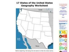
17 states
In this states worksheet, students label states in the United States that are on the west side of the country. Students label 17 states.
Curated OER
State Symbols
In this social studies worksheet, students examine and analyze each of the state's abbreviations, capitals, birds, flowers, animals and the dates when they became a state.
Curated OER
U.S. State Capitals Multiple Choice Definitions Worksheet
For this state capitals worksheet, students choose the correct state capitals for each state. Students complete 15 multiple choice questions.
Curated OER
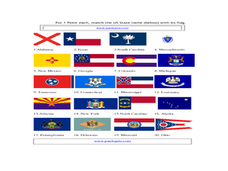
States and their flags
In this state flag activity, students match the state name below with their flag. Students match 20 state names with their flags.
Curated OER
The Powers of National and State Government
Students define term federalism, identify the powers granted to state and national government, and identify powers shared by the state and national governments.
Curated OER
Mapping the United States
In this map of the United States worksheet, students label mountains, surrounding countries, oceans, and more. Students complete 12 tasks.
Curated OER
Evidence of Climate Change
Sixth graders examine climate change in the state of Colorado. In this climate lesson, 6th graders watch 2 video clips regarding the topic and research the subtopics- snow pack, precipitation, temperature, forest fires, river flow,...
Curated OER
Redwood National Park Coloring Sheet
Give your youngsters a piece of history with this coloring page. Redwood National Park was established less than 50 years ago, in 1968. For your olde learners, discuss why parks are created and encourage them to research various state...
Curated OER
Mapmaker, Make Me a Map!
Here is a well-designed, very thorough lesson plan on mapping for very young children. Within the six-page plan, you will find everything you need to implement the instructional activity. They will identify various landforms found in...
Curated OER
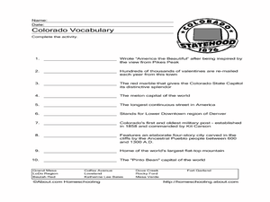
Colorado
In this Colorado worksheet, students respond to 7 questions that are related to the state of Colorado. First, they identify and name the state's capital and when it became a state. Then, students identify and name the state's motto,...


