Curated OER
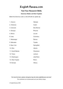
American States and Their Capital- Test Your Research Skills Worksheet
In this geography skills worksheet, students match the American state listed on the left with its capital city listed on the right by drawing a line from one to the other.
Curated OER
Controlling the Flow of the Colorado River: A Study of Dams
Students research and map the Colorado River and its dams and predict the effects of a dam on an area. They suggest reasons a dam would be built and compare the Colorado River system with other major river systems within the US and...
Curated OER
States Quizzes
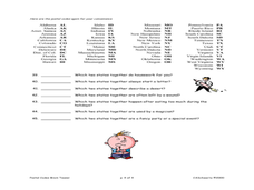
In this state postal code worksheet, students respond to 45 fill in the blank questions that require them to use the listed state postal codes as answers.
Curated OER
Major United States Rivers
In this history worksheet, learners review and circle twelve major United States rivers in a word search puzzle. Students also write a short paragraph on the back of the worksheet telling about a river in their state.
Curated OER
State Nicknames - A Right Angle Puzzle
In this right angle puzzle, students identify the names of states by their nickname. They write the names of the states on a puzzle. This three-page worksheet contains 50 clues. Instructions are on the first page,...
Curated OER
States in America and Their Capitals
In this capitals of states in America worksheet, students answer multiple choice questions about the capitals of states. Students complete 10 questions total.
Curated OER
Puzzles and Brain Teasers
In this geography worksheet, students match the state with its capital city. Students match the capitals for all 50 states. The states are divided up by 10 on each page.
Curated OER
Spanish Influence in the U.S.
Eighth graders research the role of the first Spanish conquistadors who explored the now United States. Using the internet, they gather information on different explorers and write a paper about why he is important in American history. ...
Curated OER
Fourth Grade Social Studies
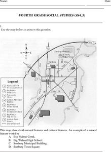
In this social studies worksheet, 4th graders answer multiple choice questions on state maps, city maps, road maps, political maps, and more. Students complete 25 multiple choice questions.
Curated OER
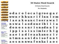
50 States Word Search
In this fifty states worksheet, students identify and locate all fifty states of the United States of America. There are 50 states located in the word search.
National Institute of Food and Agriculture
Water Supply
Participate in three activities that look at the earth's limited water supply and the changes water goes through as it enters each phase of the water cycle. The resource is complete with three activities that demonstrate the changing...
Curated OER
Express Your Opinion
Students explore local, state, and national levels of government and discuss which level of government they should contact to get information, express their opinions, or get help on specific issues.
Curated OER
The Four Corners Region of the United States Cultures, Ruins and Landmarks
Learners who live in the inner city are introduced to the four corners region of the United States. In groups, they examine how the region differs compared to where they live and their culture. They develop maps of the area and locate...
Curated OER
Train Of States
Fourth graders create a class book with information about each of the United States. After students draw a state name out of a hat, they use various resources to fill in a facts chart about their state. Students draw the state flag and...
Curated OER
Paint the States - 50 & D.C.
Students select and research a state as an individual project and present their findings to the class. Then, they write a one page paper and create a collage or painting of their state on a mural. Finally, students create and illustrate...
Curated OER
New Mexico
In this New Mexico worksheet, students read a two page text about the history of the state of New Mexico. Students answer ten true and false questions.
Curated OER
A Mountain of Myths
Students examine myths and the reverse of the Colorado quarter. They define myth, view and discuss a transparency of the Colorado Quarter Reverse, and create a myth to explain the formation of a landform in Colorado.
Curated OER
Traveling Through North America
Students identify places and landmarks in North America, specifically Canada and the United States, by using and constructing maps. Six lessons on one page; includes test.
Curated OER
United States Map Quiz
In this online interactive geography quiz worksheet, students respond to 50 identification questions about the shapes of countries shown. Students have 5 minutes to complete the quiz.
Curated OER
Making A Colorado Brochure
Young scholars create a Colorado brochure. Given a variety of brochures, students explore the aspects of an attractive brochure. In groups, young scholars explore tourist attractions, important people, major cities, and statistics of...
Curated OER
Geography of the United States
Students examine the population growth of the United States. In this Geography lesson, students construct a map of the fifty states. Students create a graph of the population of the USA.
Curated OER
Colorful Colorado
Students investigate the components of white light as viewed through a prism. The multiple colors of the spectrum produced are related to wavelengths and experienced through the creation of a color wheel.
Curated OER
Understanding And Measuring Matter
First graders observe ice melting and water evaporating. They experiment with sugar and water and read the poem "Matter Really Matters." They define vocabulary words and sing a matter song.
ProCon
Should Recreational Marijuana Be Legal?
Almost 600,000 Americans are arrested each year for marijuana possession. Pupils decide if marijuana should be legalized for recreational use after reading state-by-state laws and the top pro and con arguments. The resource also includes...


