Curated OER
Crazy Quilt Texture Board
Artists explore textures they can create when working with acrylic modeling paste. In this simple-to-implement art lesson, learners divide a rigid surface into six squares, and use a variety of tools to create different textures within...
NOAA
Ground-truthing Satellite Imagery with Drifting Buoy Data
Ground-truthing ... is it even a word? The last installment of a five-part series analyzes how scientists collect sea surface temperature data. Scholars use government websites to compare temperature data collected directly from buoys...
Curated OER
Forest Fires
Students play the role of a Ranger with the Department of Forestry. In this forest fires lesson plan, students examine data on biomes and images to determine high risk areas for forest fires to develop.
Curated OER
The Solstices
Compare surface temperatures when the solstice occurs in the different hemispheres. Young scientists draw conclusions from their investigation of data collected using spreadsheets and a globe.
Curated OER
Solar Cell Energy Availability From Around the Country
Students determine areas that are the most likely to produce solar energy by using NASA data. For this solar energy lesson students analyze plots and determine solar panel use.
University of Wisconsin
Rain Garden Species Selection
The activity really comes to life within its intended unit on starting a rain garden. Working in groups, participants research native plants and coordinate them with the conditions in the designated garden area. Give the class access to...
Curated OER
What Do Maps Show?: Lesson 4 How to Read a Topographic Map
Students examine the use of topographic maps as two dimensional representations that show elevations and slopes with contour lines. They read maps of the Salt Lake City, Utah area and complete the associated worksheets that show map...
Curated OER
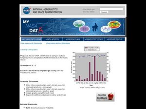
Creating Climographs
Students use satellite data to compare precipitation and surface temperatures on different islands. In this satellite lesson students create graphs and explain the differences between weather and climate.
Curated OER
Latitude
Your young geologists generate a graph given a table of values from the context of latitude and percent of the earth's surface north of that latitude. The questions in the activity then focus the learners to a deeper understanding of the...
Curated OER
Incoming Solar Radiation
Demonstrate how the spherical shape of the Earth contributes to unequal heating of its surface and results in varying climates at different latitudes. This would be an illuminating addition to your meteorology lessons, especially when...
Curated OER
The Pythagorean Puzzle
An engaging hands-on activity is presented. Learners of all ages are addressed in thie unique plan. K-5 learners identify, name, and define a rectangle, square, triangle, and the concept of area. Older learners prove the Pythagorean...
California Academy of Science
A Day inthe Life of a San Francisco Native Animal
Although the lesson is specifically about the San Francisco Bay area, it's good enough to be adapted to any local region. Children research what the landscape in San Francisco was like prior to settlement, they consider the types of...
Curated OER
Glaciers and Ice Wedging
Fourth graders observe and identify a variety of weathering and geological activities in the area in which they live. This focuses primarily on what happened during the Ice Age, and how, even today, glaciers are shaping and re-shaping...
Teach Engineering
Manned Mission to Mars
To go or to not to go — the question for a mission to Mars. This resource provides details for a possible manned mission to Mars. Details include a launch schedule, what life would be like on the surface, and how the astronauts would...
National Gallery of Canada
Self-Portrait, Mirrors and Metamorphosis!
Using M.C. Escher's Hand with Reflecting Sphere as inspiration, learners create their own set of self-portraits using various reflective surfaces. The lesson plan begins with a discussion about portraiture and ends with a presentation of...
NOAA
Ocean Zones
How can organisms light up in water? Bioluminescence is light produced in a chemical reaction that can occur in an organism's body. First, learners determine what happens to light/color as you move into the deep ocean. In groups, they...
National Nanotechnology Infrastructure Network
Small Scale Sculpting: Etch Lab
Make works of art using a vintage yet effective etching strategy. The surface of a semiconductor chip has specific patterns formed through a process called etching. Through a lab investigation, young scholars recreate that process...
Curated OER
Kosovo: A Thousand Year Old Border Conflict
Students present proposals and negotiate with other representatives to bring lasting peace to the area through a simulated "Summit Conference."
Curated OER
Ozark Karst: A Fragile Landform
Young geologists become familiar with the Karst Topography in the Ozark Mountains. They study how human activity has affected the cave ecosystem. They conduct a simulation in which a large development is proposed in the area, and they...
Curated OER
Introduction to Flight: A Math, Science and Technology Integrated Project
Seventh graders review graphing procedures and practice locating points using x,y coordinates. Students calculate the areas of the top and bottom surfaces of the airfoil. They construct a test model of the airfoil.
Polar Bears International
Top of the World
Learn about polar bears and the Arctic circle with a lesson about the countries and conditions of the region. After examining how the area differs from Antarctica, kids explore climates, animals, and geographical position...
Teach Engineering
Take Off with Paper Airplanes
Let's go fly a kite ... oops, a paper airplane! The 13th segment in an aviation unit of 22 relates the parts of an airplane to paper airplanes. Pupils learn the functions of the control surfaces of a plane to really make their knowledge...
Curated OER
Building Soil Nature's Way: Exploring decomposition and soil health
Students explore decomposition and soil health by creating their own garden. In this agriculture lesson, students build a "lasagna garden" with organic matter found in the area and plant perennials native to their region....
AMCO
Whimsical Figures
Clay is a wonderful and expressive medium for learners of any age. Kids get creative as they make whimsical figures out of clay. A hyperlinked materials list, images of each step in the process, and helpful tips makes this a great art...
Other popular searches
- Surface Area and Volume
- Surface Area and Net
- Cylinder Surface Area
- Surface Area of Prisms
- Surface Area Volume
- Surface Area of Cylinders
- Finding Surface Area
- Surface Area Cone
- Surface Area Volume Cylinder
- Surface Area Lesson
- Cylinder Surface Area Nets
- Lateral Surface Area


