Curated OER
Solar Cell Energy Availability From Around the Country
Students determine areas that are the most likely to produce solar energy by using NASA data. For this solar energy lesson students analyze plots and determine solar panel use.
Curated OER
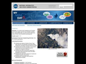
Forest Fires
Students play the role of a Ranger with the Department of Forestry. In this forest fires lesson plan, students examine data on biomes and images to determine high risk areas for forest fires to develop.
Curated OER
The Reason for the Seasons
Students compare graphs of their data that was generated on a NASA website. In this seasons lesson students complete a lab activity.
Waterloo Mathematics
Number Sense and Numeration: Ratio and Rate
Seventh-graders solve 20 various types of problems related to ratio and rate. They write ratios in simplest form for each given statement, to compare the area of two figures, and write two ratios equivalent to each ratio. Pupils express...
Curated OER
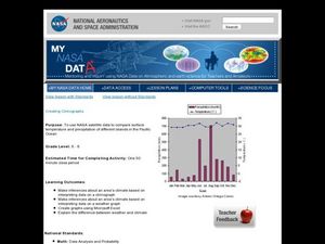
Creating Climographs
Students use satellite data to compare precipitation and surface temperatures on different islands. In this satellite lesson students create graphs and explain the differences between weather and climate.
California Academy of Science
A Day inthe Life of a San Francisco Native Animal
Although the lesson is specifically about the San Francisco Bay area, it's good enough to be adapted to any local region. Children research what the landscape in San Francisco was like prior to settlement, they consider the types of...
Curated OER
Glaciers and Ice Wedging
Fourth graders observe and identify a variety of weathering and geological activities in the area in which they live. This focuses primarily on what happened during the Ice Age, and how, even today, glaciers are shaping and re-shaping...
Curated OER
Ozark Karst: A Fragile Landform
Young geologists become familiar with the Karst Topography in the Ozark Mountains. They study how human activity has affected the cave ecosystem. They conduct a simulation in which a large development is proposed in the area, and they...
Curated OER
Kosovo: A Thousand Year Old Border Conflict
Students present proposals and negotiate with other representatives to bring lasting peace to the area through a simulated "Summit Conference."
AMCO
Whimsical Figures
Clay is a wonderful and expressive medium for learners of any age. Kids get creative as they make whimsical figures out of clay. A hyperlinked materials list, images of each step in the process, and helpful tips makes this a great art...
Teach Engineering
Nanotechnology and Cancer Treatments
Information on the biomedical use of nanotechnology, specifically in the detection and treatment of cancer, is the focus of a lesson that seems like it is out of a science fiction novel. Pupils learn about electrophoresis, which is used...
Teach Engineering
Take Off with Paper Airplanes
Let's go fly a kite ... oops, a paper airplane! The 13th segment in an aviation unit of 22 relates the parts of an airplane to paper airplanes. Pupils learn the functions of the control surfaces of a plane to really make their knowledge...
Curated OER
Scientific Method Experiment: Factors Affecting How Ice Melts
Students demonstrate the scientific method by conducting an ice cube melting experiment. They make predictions and observations, and conclude what factors make ice melt more slowly or quickly than normal.
Curated OER
Peace Corps Challenge Game: Soil Runoff
Young scholars examine the causes and effects of soil runoff. In this environment lesson, students look at ways in which soil runoff is controlled. Young scholars then play a game and discuss how the Peace Corps deals with soil...
Curated OER
Earth's Water: A drop in your cup
Students complete activities where they observe the amount of freshwater in the world as a fraction of the actual amount of water using different mixtures. In this freshwater lesson plan, students brainstorm on how to preserve...
National Nanotechnology Infrastructure Network
Can We Absorb Nanoparticle Pollutants?
Just because we can't see it doesn't mean it isn't there! A growing concern for environmental scientists is toxic nanoparticles in our air and water. Young scholars conduct an experiment to demonstrate how these particles can cross our...
Curated OER
Math Challenges
Students engage their critical thinking skills to solve challenging math problems. In these problem solving lessons, student work with tessellations, weights/measurement, reasoning, surface area, geometric shapes, and algebraic procedures.
Shodor Education Foundation
Volume of Prisms
Explore the concept of volume of prisms using an applet to perform the calculations. The link to the interactive applet is embedded into the lesson plan as well as a link to associated data sheets. Get your math class to the computer lab...
Curated OER
Stress, Strain and Hooke's Law
Students study Hooke's Law and stress-strain relationships. In this spring lesson students create a strain graph in Microsoft Excel.
Curated OER
Chain Across the Hudson Lesson Plan A - Locating the Chain
Students read a letter from George Washington requesting them to identify on a map a location that would stop the advance of British warships. They choose a location and justify their choice.
Curated OER
The Global Precipitation Measurement Mission (GPM) Lesson
Introduce your class to one of the ways that technology is benefiting humanity. The Global Precipitation Measurement Mission involves the data collected by nine satellites from different countries with a united focus on studying world...
Curated OER
Map Lesson Plan
Fourth graders locate and label major sites related to the Revolutionary War in the Hudson River Valley. They examine topographical features of each site and list a few of these features and list two advantages of each military site.
Curated OER
Measuring with Mathematics
Eighth graders discover how the change in the dimensions of a shape cause a change in the overall area of the shape, but the perimeter stay the same. They, in groups, go out to the playground and construct large areas using stakes and rope.
Curated OER
Triangle Explorer
Students calculate the area of triangles using a variety of materials including computer applets.


