Curated OER
Canada's Geographic Position
Ninth graders investigate the characteristics of the geographic position of Quebec and Canada in the World. They study Canada's land and water boundaries, surface area and time zones.
Curated OER
Volcano Live
Pupils discover the inevitable threat of volcanoes as they identify the ring of fire. In this natural disasters lesson, students examine the tectonic plate theory and discuss how magma works it's way to the surface of the Earth. Pupils...
University of Nottingham
Drawing to Scale: A Garden
See how design and geometry go hand in hand. The activity asks learners to use geometry to design a backyard garden given dimensions of each feature. Scholars work with ratios and scale to develop an accurate scale drawing that includes...
American Farm Bureau Foundation for Agriculture
Welcome to My American Farm!
Take a step into the virtual farm world and explore the impact farming has on our everyday eating habits. Future farmers discover the meaning of agriculture and the hard work that goes into providing food for us to enjoy. A computer game...
Curated OER
Measurement: 2D and 3D
Students solve volume problems. In this geometry lesson, the class watches a video about clean water (link provided) and individuals compare the volume of different prisms, including an actual drinking glass. Extension activities include...
American Statistical Association
Exploring Geometric Probabilities with Buffon’s Coin Problem
Scholars create and perform experiments attempting to answer Buffon's Coin problem. They discover the relationships between geometry and probability, empirical and theoretical probabilities, and area of a circle and square.
Chicago Botanic Garden
Impacts of Climate Change
Scholars become experts on the eight major impacts of climate change through a jigsaw and grand conversation. They then research and present what they learned about effects specific to their region.
Perkins School for the Blind
Beanbag Toss
Why is learning how to catch and toss so important? If one has visual impairments, learning this basic skill will help him increase orientation and mobility, coordination, and cognitive development,. Mastery of this skill will also mean...
Curated OER
Does Contact Area Matter?
Students work together to design and implement an experiment on friction. They test to see if contact area affects the amount of friction. They discover how engineers use friction to make certain products better.
Curated OER
Area of Solids
Students find the area of rectangular solids and cylinders by cutting them into flat pieces and adding the areas.
Curated OER
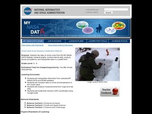
Great Lakes Snow Analysis Collaborative Network
Students interpret data on snow cover and analyze trend patterns. For this snow lesson students compare data and locate their school's GPS coordinates.
Curated OER
Earthquake Formation
Students explore earthquakes. In this natural disaster and engineer career education instructional activity, students identify features of the earth's surface that increase the likelihood of an earthquake. Students use visual aids to...
Teach Engineering
Get Me Off This Planet
What do Newton's Laws have to do with getting from Earth to Mars?The activities in this resource show how Newton's Laws work with rockets to get them into space. Background information includes facts about orbits and how orbits are used...
Curated OER
Wow! You're Eating Geography
Middle schoolers examine patterns of food producing areas, and identify foods that are grown locally, in the U.S., and around the world. They map and graph the major food crops of their local area, the U.S., and other countries, and...
University of Arkansas
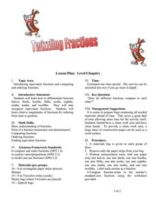
Twizzling Fractions
Using food as a manipulative is one of the best ways to incorporate hands-on learning in the classroom. This hands-on approach allows young mathematicians to compare, order, and identify fractions with the use of Twizzlers® and fraction...
Curated OER
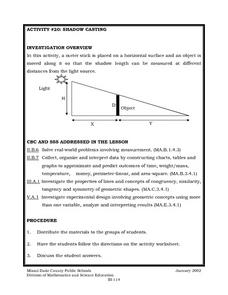
Shadow Casting
Eighth graders use a meter stick that is placed on a horizontal surface and an object is moved along it so that the shadow length can be measured at different distances from the light source. They solve real-world problems involving...
Nature
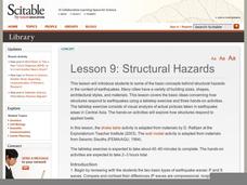
Structural Hazards
The scientific explanation of seismic waves is detailed in the introduction. A fictional scenario is also provided for your class to discuss. Pictures and handouts that are meant to be included, however, they are not accessible....
Curated OER
Tree Identification/Tree Art
Seventh graders identify and examine a deciduous and coniferous tree. Using the descriptions, they discover the types of tress in their local area. As a class, they practice identifying trees on a walk in a park collecting leaves. They...
Curated OER
How Clean is the Water?
Students read about and discuss water and how it is used as a resource and how engineers use technology to preserve it. In this water lesson plan, students look at a picture of water treatment and tell what is wrong with the picture.
Curated OER
The Earth is a Changin'
Students view examples of different types of erosion. In this erosion activity, students discuss the different types of erosion and how erosion changes Earth. Students explore erosion and the effect it has on engineering.
Curated OER
How Does Your Soil Stack Up?
Students examine the soil in their local area and create a soil profile. They record observations in the field and the classroom. They create their own display of the soil profile as well.
Curated OER
Design a Better Classroom Workplace
Students design a new classroom workplace. For this architecture lesson, students use area formulas to identify the problem with the existing desks in their classroom. Students design their own solution volume formulas to solve the...
Curated OER
Opening A Cube
Fifth graders investigate mathematical concepts related to the construction of a three dimensional cube. They construct the cube from two dimensional patterns and compute the surface area. Students also define the faces, edges, and...
Curated OER
Surface Water Supplies And The Texas Settlements
Pupils engage in a lesson that is concerned with the allocation and finding of water resources. The location of different settlement areas is considered as one looks how the water is distributed. They map some of the early Spanish and...


