Curated OER
The Oregon Trail
In this Oregon Trail worksheet, students practice their map skills while they explore the states of Oregon, Missouri, Idaho, Nebraska, and Wyoming. Students us a map of the US to plot six points on the map that show the Oregon Trail.
Curated OER
Locating Places
For this locating places worksheet, students locate locations by referring to the absolute locations and finding out the coordinates for each location. Students complete 16 problems.
Curated OER
Trapezoids
In this trapezoids worksheet, 10th graders solve 10 different types of problems related to measuring trapezoids. First, they identify the isosceles trapezoid on the sheet with the bases MA and TH. Then, students use the given information...
Curated OER
Word Search With Vocabulary Words
For this word search worksheet, students recognize words in a puzzle. Students complete the word search by finding the fifteen words in the puzzle.
Curated OER
Using Journals in Writing Classes
Ninth graders develop brainstorming and stream of consciousness writing techniques. Using their journals daily, 9th graders develop their ability to write consistently in their journal without concern for grammar, usage and punctuation.
Curated OER
Magellan
Students identify the route of Magellan's voyage. In this map skills lesson, students use a globe to identify various coordinates where Magellan traveled.
Curated OER
The Gold Rush
Young scholars identify the routes involved in the Gold Rush on a map. In this map skills instructional activity, students use a United States map to locate the routes used to travel to California during the Gold Rush. Young scholars...
Curated OER
Perimeter: Practice
In this perimeter activity, students find the perimeter or the missing length for each rectangle. Students then complete the chart by writing the formula and finding the perimeter. Students finish with two test prep questions.
Curated OER
Parallels and Meridians
For this parallels and meridians worksheet, students read about parallels and meridians and answer questions about lines of latitude and longitude. Students complete 8 problems.
Curated OER
An Early American Culture
Pupils identify the locations of the Hopewell culture. In this map skills lesson, students use a globe to mark several locations of the Hopewell culture.
Curated OER
Post Roads
Learners locate the major cities in the colonies during the Revolutionary War. In this map skills lesson, students use a globe to locate cities such as Charleston and Boston using latitude and longitude coordinates.
Curated OER
Solving Equations with Variables on Both Sides
In this solving equations worksheet, students solve 15 equations with variables on both sides of the equal sign. Students are encouraged to check all solutions.
Curated OER
The Global Grid System-World Map Activity
Students demonstrate how to use the global grid system. In this map skills lesson, students use a world map to locate various locations. Students identify locations based on the global grid system. Students complete a worksheet as an...
Curated OER
The Underground Railroad
Learners explore the Underground Railroad routes. In this map skills and Civil War lesson, students use map and globe reading vocabulary and skills to track the routes the slaves followed from the Bahamas to the United States and from...
Curated OER
The Rise of Segregation
Eleventh graders describe the foundation for legal segregation in the South and identify three key African American leaders' responses to discrimination. They also find and copy the definition of sharecropper and answer a variety of...
Curated OER
The Treaty of Versailles: The League of Nations Student Worksheet
In this world history worksheet, students read a 1-page selection as well as Internet articles about the Treaty of Versailles and the League of Nations and then respond to 8 short answer questions.
Curated OER
Estimate Quotients
Fifth graders have to use division to solve problems in everyday situations. This activity on estimation and division has students practice these skills using real-life examples. The activity is part of the Houghton Mifflin math series...
Curated OER
Odd One Out
In this categorizing worksheet, students read 10 questions regarding a wide range of topics and identify the answers in each that are not correct.
Curated OER
Globe Lesson- Early Spanish Settlements
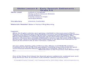
Students use a globe. In this geography and early settlements lesson, students learn about the settlement of missions and haciendas in New Mexico. Students locate Mexico City and San Francisco on the globe and determine the distance...
Curated OER
Cattle Trails
Young scholars identify and locate cattle trails on a globe. In this map skill lesson, students use a marker to locate Texas and Montana and use the map scale to calculate the distance of the cattle trail.
Curated OER
Pearl Harbor
Young scholars identify the location of Pearl Harbor and Hawaiian Islands on a map. In this map skills lesson, students use latitude and longitude coordinates to locate various places of importance of the Pearl Harbor attack.
Curated OER
The French Revolution
In this French Revolution learning exercise, students respond to 13 short answer questions regarding the patterns of revolutions as well as questions based on a population chart.
Curated OER
The Ugly Duckling's Journey to Away - Reduce, Reuse, and Recycle
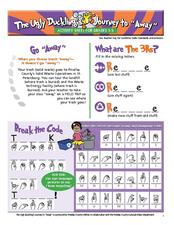
In this recycling activity set, students read about where trash goes in Pinellas county. They fill in blanks in the words reduce, recycle, and reuse. They identify items that can be recycled, make words from the letters in the word...
Curated OER
Chapter 28 – The 1980s
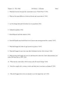
In this U.S. history worksheet, learners read assigned textbook pages describing 1980's America and respond to 49 short answer questions.


