Other
Norman Conquest of Anglo Saxons
A colorful site depicting the Norman Conquest. Background information, description, results and effects of Battle of Hastings included. Also includes timelines, diagrams and worksheets corresponding to the site. Easy to read and navigate.
Other
Reading Museum Service: Online Resources: Bayeux Tapestry
Activities and lesson ideas that revolve around the significance of the events depicted in the Bayeux Tapestry.
Other
United States Naval Academy: Kings and Kingdoms of England and France
This comprehensive resource covers all the highlights of history (wars, kings, famine) in England and France between 973-1350. Organized by dates, this site includes links to primary source documents, maps, and artwork from this time...
Curated OER
Eastern Part of Coast of Sussex to Illustrate Battle of Senlac, Oct 14, 1066
A map of coastal Sussex, England, at the time of the Norman Invasion (1066). This map shows Senlac Hill, battle site of the Battle of Hastings (14 October, 1066) between the Normans under William of Normandy (William the Conqueror) and...
BBC
Bbc: Hands on History: Normans
Download activities covering castles, medieval feasting, creating your own Bayeaux tapestry, and the Battle of Hastings to re-create life in Norman Britain.
Curated OER
Etc: Maps Etc: Battle of Edge Hill, October 23, 1642
A map of the Battle of Edge Hill on 23 October, 1642, in Warwickshire, England during the First English Civil War (1642-1646). The battle, between the Royalist army under Charles I of England and the Parliamentarian army under the Earl...
Texas State Library and Archives Commission
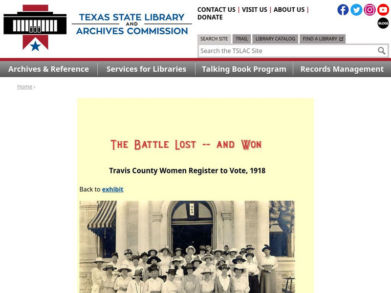
Texas State Library and Archives Commission: The Battle Lost and Won: Travis County Women Register to Vote
Following the passage of the primary suffrage measure in Texas in 1918, women made haste to register to vote, because they only had 17 days to do so before the vote. Here is a group photo of Texas women doing so.
Other
Secrets of the Norman Invasion
Author purports that the Normans landed in a site different from Pevensey and presents interesting evidence to support his claim. There are also links to the Bayeux Tapestry with explanations.
BBC
Bbc: History Trails: Conquest: William the Conqueror: A Revolutionary
Seven-part biography of William examines the new order brought to England by the Normans.
BBC
Bbc: Hands on History: The Normans: Tapestry Activities [Pdf]
Activities for students and families provide opportunities to learn why the Normans invaded the UK, take a look at the Bayeux Tapestry, and design a crest. Tapestries were used to tell the story of the Norman invasion of England; stitch...
National Archives (UK)
National Archives Learning Curve: Snapshot: Domesday Book
A history lesson examines the question, "What Can We Learn About the 11th Century" based on the Domesday Book. Background information and teacher notes included.
Curated OER
Image of Knights at Battle of Hastings
A leading British historian examines the famous invasion in 1066 and explains how a group of 20,000 Normans managed to take over an island of two million people.
Curated OER
Neighborhood of York to Illustrate Battle of Stamford Bridge, September 25, 1066
A map of Yorkshire, England, in the neighborhood of York, showing the location of the Battle of Stamford Bridge (25 September, 1066). The battle was fought between and allied army of Norwegians and Northumbrian rebels under King...
Curated OER
Educational Technology Clearinghouse: Clip Art Etc: William I of England
William I of England (1027 - 9 September 1087), better known as William the Conqueror, was Duke of Normandy from 1035 and King of England from 1066 to his death. To claim the English crown, William invaded England in 1066, leading an...
Curated OER
Image of Norman Horseman
Seven-part biography of William examines the new order brought to England by the Normans.
Curated OER
Bbc: Learning Zone Broadband Class Clips: Bayeux Tapestry
Panel from the Bayeux Tapestry
University of California
Ucla: Manas: The British East India Company
UCLA provides a thorough history of The (British) East India Company and its role as the governing body in India from 1757 to 1857. Includes links to relevant topics and people, providing a nontraditional look at imperialism and its...
Curated OER
Educational Technology Clearinghouse: Maps Etc: East Kent, 1908
A detailed travel map of southeastern England from 1908, showing portions of Kent County. The map shows first class and secondary roads, railways, cities, towns, ferry routes across the Strait of Dover with distance in miles, rivers,...


![Bbc: Hands on History: The Normans: Tapestry Activities [Pdf] Activity Bbc: Hands on History: The Normans: Tapestry Activities [Pdf] Activity](http://content.lessonplanet.com/resources/thumbnails/409981/large/bwluav9tywdpy2symdiwmduymc0xmjczoc04dnpkenouanbn.jpg?1589982831)

