K12 Reader
Eastern Woodland Natives
Supplement your social studies instruction with a reading passage about the Eastern Woodlands. After reading the passage, learners respond to five related questions.
Curated OER
North Carolina Salt Dough Map Social Studies Project
In this lesson, North Carolina Salt Dough Map, 4th graders create a salt dough map of North Carolina, Students use dough to form the shape of the state of North Carolina. Students label the three regions of North Carolina and all of...
Curated OER
What Do Maps Show?
This teaching packet is for grades five through eight, and it is organized around geographic themes: location, place, relationships, movement, and regions. There are four full lessons that are complete with posters, weblinks, and...
Curated OER
The Geography of the United States
Full of bright maps and interesting information, this presentation details U.S. Geography. Slides include basic facts about size, regions, topography, and demographics, as well as fascinating trivia about the United States, including...
Curated OER
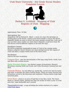
Regions of Utah - Mapping
Fourth graders draw a rudimentary map of the state of Utah, dividing it into the three regions: the Great Basin, the Colorado Plateau, and the Rocky Mountain Region.
Curated OER
How Big is a Crowd?
Sixth graders compare the relative sizes of the five Great Lakes and their human populations. They describe some of the problems that arise when many people depend on a limited resoure. Students discuss how the Great Lakes and the...
Curated OER
The 1927 Flood
Upper elementary and middle schoolers examine the Great Flood of 1927 in the state of Arkansas. They each prepare an oral report about this flood and the huge impact it had on the economics of that time. Additionally, learners research...
Curated OER
Indians of North America
Students, after investigating Indians of North America, give examples of early cultures and settlements that existed in North America prior to contact with Europeans. They identify and compare historic Indian groups of the East,...
Scholastic
The Rise of Railroads: California
Railways are an integral part of the history of California. Using a timeline format, class members connect major historical events to the rise of the railroads and their impact on the state. Activities include a mix of independent and...
Curated OER
Dead Sea Investigation: Middle East and African Connections
Students demonstrate comprehension of the physical characteristics of the Dead Sea region and its connection to the Red Sea and the African Great Rift Valley. They are given students the opportunity to understand the role of plate...
Curated OER
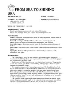
FROM SEA TO SHINING SEA
Identify agricultural products grown in each region of the country.
Discuss how geography affects what is grown or raised in a particular area.1. Hand out a copy of the two activity sheets "Food From Sea to Shining Sea" to each student....
Curated OER
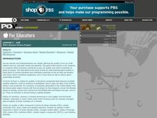
P.O.V.'s Borders Picture Project: Lesson 1 - Air
Take photos of human activities that impact air quality. Collaborative groups present one of the photographs, identifying how the activity contributes to air quality and what can be done to minimize the impact. As one in a series of...
Scholastic
Perfect Postcards: Illinois
Connect the geography and history of Illinois using an art-centered lesson on the railroads. The railroad connected once-distant places, particularly in the Midwest. Using research, class members create postcards of fictional cross-state...
National Energy Education Development Project
Introduction to Wind Energy
The U.S. produced enough wind energy in 2015 to power all of the homes in Alaska, California, Delaware, the District of Columbia, Hawaii, Idaho, Maine, Montana, Nebraska, New Hampshire, North Dakota, Rhode Island, South Dakota, and...
Curated OER
National Marine Sanctuaries Fish
Information is provided on Gray's Reef, Florida Keys, and Flower Garden Banks marine sanctuaries. Young marine biologists then visit the FishBase and REEF databases to collect fish species information for each location. They then...
Michigan Sea Grant
Wetlands
Wetlands may not sound particularly ornate, but they are as important as any habitat! With a hands-on activity, young scientists build a wetland model and observe its many functions in action. They discover the importance of wetlands to...
Syracuse University
Erie Canal
While canals are not the way to travel today, in the first half of the nineteenth century, they were sometimes the best way to move goods and people. Scholars examine primary sources, including maps and pictures, to investigate the role...
Curated OER
Fur Trading
Students take on a role such as a farming community, hunting community or a trading post. They decide which products they focus on and then trade with the other groups.
Curated OER
Discover a Pond Food Web
Students study the biodiversity of animal life in a pond. They investigate the interdependence between pond organisms by completing a pond dipping activity and completing a checklist.
K12 Reader
United States Geography
Encourage reading for information with a text about United States geography. Kids read a short passage about the landforms in the United States, including mountain ranges and natural resources, and answer five reading comprehension...
Biology Junction
Mollusks
Mollusks created every shell on Earth. Young scientists learn more about the phyllum mollusca in an informative presentation. It covers their characteristics, body plans, and relationships in the ecosystem. Then, it details each class of...
Curated OER
Air: Air Quality Picture Project
High schoolers recognize which activities contribute to poor air quality and which contribute to good air quality. They discover how air quality is measured, and come up with ways that humans can have a positive affect on air quality.
Curated OER
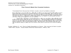
Lesson 6: Examining Events from Different Perspectives Friend or Foe?
Fifth graders sequence events of European exploration and colonization by creating timelines. They define the differences between primary and secondary sources. They discuss claims to Texas land in the 17th Century.
Curated OER
Pop Around the World
Learners study the origin of popcorn. They locate countries where it is grown on a world map. They color the world map and glue kernels of popcorn onto the countries from which popcorn originated. They write the names of common items...


