Curated OER
Earth Materials - Geology and Plate Tectonics
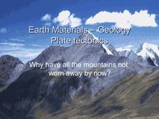
Not going into depth on any one topic, this Earth science presentation skims the crust. It touches on the materials that construct the crust and then moves into plate tectonics. This is a useful and colorful note-taking guide for your...
It's About Time
Where are the Volcanoes?
Middle school geologists map the volcanoes closest to themselves, learn about map distortion, and infer possible future volcano locations. A focus on latitude, longitude, and volcanoes beneath the ocean helps connect the lesson.
Curated OER
AP: Chapter 25: Phylogeny and Systematics
As a review or note taking guide, this resource wraps up a unit on the tree of life. Biology bigwigs define phylogeny and answer questions about the subsequent classification of organisms. The learning exercise takes a straightforward...
Museum of Tolerance
Immigration Journeys
Through the journey of four stories of immigration, scholars complete graphic organizers and apply knowledge to create a visual representation of their findings on a large poster. Third and fourth readers write a letter to their family...
Museum of Tolerance
Where Do Our Families Come From?
After a grand conversation about immigration to the United States, scholars interview a family member to learn about their journey to America. They then take their new-found knowledge and apply their findings to tracking their family...
BrainPOP
Latitude and Longitude Differentiated Lesson Plan
Scholars warm-up their map skills with a discussion using location words to describe familiar places. An engaging video informs class members about latitude and longitude. Three leveled activities extend the learning experience for...
Space Awareness
Continental Climate and Oceanic Climate
There's nothing better than a cool breeze blowing in from the ocean. Scholars explore how water affects change in temperature using a hands-on experiment on climate. They use measurement tools to compare the continental and oceanic...
Curated OER
Plate Tectonic Cycle
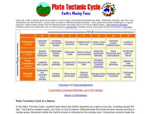
Students explore the Earth's movements by completing worksheets. In this plate tectonics lesson plan, students define such natural disasters as volcanoes, earthquakes, tsunamis and mudslides and discuss their connections to plate...
Curated OER
African Safari
Sixth graders gain an appreciation for the different cultures that inhabit the Earth by focusing on the people of Africa
Curated OER
Land of the Rising Sun
Students survey aspects of traditional and modern Japanese customs and beliefs in the seven lessons of this unit. Both the culture and the geography of the country are studied in this unit.
Curated OER
Rapping Regions in America
Students determine what designates a place as a region. They apply their criteria for a region to the US map. They work in groups to write a rap about their region that describes its organization, type and structure.
Curated OER
SEEDS WE EAT
Students identify seeds humans eat and do not eat. Students make seed collections, using common kitchen foods. Students display seeds from the foods they serve and discuss them with their guests. Students complete activities which...
Curated OER
Regions of South America
Students explore facts about South America in the four lessons of this unit. Booklets are created from the materials produced as the class delves into the topic.
Curated OER
Island Formation
Students create models of how islands are formed by hot spots and then write a summary of their observations and of how they think their model relates to volcanic hot spots and island formation.
Curated OER
The History of Ancient Egypt
In this World History worksheet, students use the clues to identify what historians now understand about ancient Egypt and its people. They complete each of 14 clues with a word or phrase related to what they already know.
Curated OER
Finding Magnetic Fields of Earth
Fifth graders, in groups, create paper bag "globes", complete with magnetic poles. They use compasses to determine and label various locations (N. and S. Poles, Prime Meridian, Equator, etc.) and finish it by drawing in the continents...
Curated OER
The Struggles Between "Something Old" and "Something New"
Students explore traditional life in Africa and assess how modern society may be impacting the values of the continent's traditional peoples. Students work in small groups to research various aspects of the infrastructures of African...
Curated OER
What Makes a Tropical Rainforest Special?
Students examine the characteristics of the tropical rainforest. Using a map, they locate the rainforests found around the world, continents and the equator. Using the internet, they research the various layers of the rainforest and...
Curated OER
Where in the World Is ...?
Students move themselves around a "world" map on the classroom floor, using lines of latitude and longitude to locate specific spots. They determine the locations of 11 countries where Peace Corps Volunteers are serving and identify in...
Curated OER
Ecosystems Connect
Students investigate ecosystems near their school and across the world. They examine both living (biotic) and non-living (abiotic) elements of each. They recognize ecosystems from various continents around the globe. The use of computers...
Curated OER
Hatsiatsia Music
In this music instructional activity, students learn about the rhythms of Hatsiatsia music. Students read about different instruments and facts about Ghana and see a map of the African continent.
Curated OER
And a Star to Steer Her By: A Field Trip Guide for the Planetarium Show
In this field trip study guide for the planetarium show activity, students construct a model of the Earth and describe the relative positions of the continents using latitude and longitude. Students construct a star chart to find...
Curated OER
Asia Outline Map
In this Asia outline map activity, students explore the continent as they label the 47 countries. The countries are numbered and lines for the answers are provided on the sheet.
Curated OER
Canada: Our Neighbor and Friend
Learners investigate the geography and culture of Canada by practicing the French language. In this world geography lesson, students create a continent map of North America while analyzing the unique geography of Canada. Learners...


