Curated OER
The Globe Game
Students locate continents, oceans, and major mountain ranges on the globe. In this globe instructional activity, students play a toss the globe game. They name the continent, ocean, or major mountain range that is located closest to...
Curated OER
Where in the world is...
Learners identify locations around the world. In this mapping lesson, students place tag board pieces with names of locations on a wall map of the world. Initially, learners identify states, then cities, then continents, eventually...
Curated OER
Leapin' Landmarks: Locating 10 Man-made Landmarks Around the World
Third graders label continents, oceans, and major mountain ranges on maps and use the maps to write an informational report about landmarks. For this landmarks lesson plan, 3rd graders write about 1 major landmark.
Curated OER
The World (With an emphasis on the United States)
Fourth graders recognize the different continents. They are introduced to longitude and latitude and how to find locations using these measurements. This series ends with an emphasis on the fifty states of the United States and their...
Curated OER
Geography
First graders recall names and placement of 7 continents. They recall cardinal directions. They identify and locate 3 oceans.
Curated OER
Directional Terms
Students identify and demonstrate various locational terms, and examine how a globe is a model of Earth. They repeat words and movements for various finger plays to demonstrate locational terms, play directional words games, and sing a...
Curated OER
Worksheet 3. Names of Places
In this geography learning exercise, students write the geography words in the correct columns. The columns are "Continents", "Countries", and "Cities". There are 12 words on this page to organize.
Curated OER
World Map
In this world map learning exercise, students practice their geography skills as they label the 7 continents and 5 oceans. A word bank in included.
Curated OER
Global Connections Geography Review
In this beginning world geography PowerPoint, students answer basic questions about continents and oceans, as well as land and water that surround or can be found in the United States. Correct responses earn a mark on the interactive...
Curated OER
The Earth's BIG Features
Your students will enjoy the vivid pictures and interesting facts about world geography, in this presentation. Depicted are several major geographical features found around the world and a description of each.
Curated OER
Continents and Oceans
In this geography activity, learners read a paragraph and learn about the seven continents and five oceans of the world. Students study a map of the world and answer 12 short answer questions. This is an online interactive activity.
Curated OER
Hemispheres & Continents
Students learn in cooperative learning groups to determine how the equator and the Prime Meridian divide the earth into hemispheres and use Venn diagrams. Students will locate and label the hemispheres, continents, and oceans.
Curated OER
Comparison of Snow Cover on Different Continents
Students use the Live Access Server (LAS) to form maps and a numerical text file of snow cover for each continent on a particular date. They analyze the data for each map and corresponding text file to determine an estimate of snow cover...
Curated OER
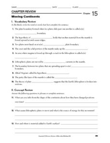
Moving Continents
In this moving continents worksheet, students review the different types of plate boundaries, what causes earthquakes, and where volcanoes are formed. This worksheet has 10 fill in the blank and 9 short answer questions.
Curated OER
North America, Then and Now
Learners identify ocean, lake, gulf, and continent on maps of North America from 1845 and the present, and identify Pacific and Atlantic Oceans, the Great Lakes, and the Gulf of Mexico on maps of North America from 1845 and the present.
Curated OER
Community Cartography
Learners use an inflatable globe which they wrap in plastic wrap. They use a permanent marker and outline the continents, and label major oceans and trace the equator. Students bring heir globes and use their projection for a discussion...
Curated OER
Major American Water Routes
Sixth graders locate and identify the major bodies of water and waterways in the United States. Through a simulation activity, they describe how early explorers would have described their surroundings. Working in groups, they create...
Curated OER
Extreme Elevations
For this geography worksheet, 5th graders work in groups in order to locate and graph mountains found on all the continents of planet earth.
Curated OER
Map of Asia
In this map worksheet, 3rd graders will study a map of Asia. Students will use this map to label and/or familiarize themselves with various aspects of the continent.
Curated OER
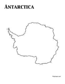
Map of Antarctica
In this map worksheet, 3rd graders will study a map of Antarctica. Students will use this map to label and/or familiarize themselves with various aspects of the continent.
Curated OER
Continent Song
In this continent song worksheet, students learn the lyrics to a continent song that names all seven of the continents on the globe.
Curated OER
Geography of Australia: The Shaping of a Continent
Whether you are embarking on a unit on ecosystems, or on the characteristics of the Australian terrain, this picture-packed presentation would be a great one to use. Not only does the presentation contain useful information, it also has...
Curated OER
Islam Expands: In spite of internal conflicts, the Muslims create a huge empire that includes land on three continents.
Beginning with a vocabulary review and ending with the Muslim Trade Network, this well-put-together presentation covers the events that lead to the spread of Islam. Also covered are internal conflicts which would provide a good...
Curated OER
Celebrate Kwanzaa in the United States
Students explore and study the celebration of Kwanzaa in which African-Americans remember their heritage and remind people of the importance of sharing with family and friends. They participate in a chant about the seven continents and...


