Curated OER
Changing Planet: Sea Levels Rising
Begin by showing a six-minute video, Changing Planet: Rising Sea Level as an anticipatory set. Pupils draw a topographic map of a potato continent. Finally, they will visit NOAA's sea levels online map and NASA's carbon dioxide...
Curated OER
Early African Kingdoms & Empires
Give your class a thorough view of African history with this series of photographs, maps, and engaging questions. Coupled with a lecture about human migration and religious and European influences on the continent, this presentation will...
California Academy of Science
Tropical Belt
Where in the world is the equator? Explore a world map with your class, coloring in oceans, continents, and rainforests while locating the three major lines of latitude: the equator, Tropic of Cancer, and Tropic of Capricorn. Discuss how...
Boston University
Scramble for Africa
In this fantastic simulation, your young historians take on the roles of imperialistic European countries in the nineteenth century and then "scramble" to carve up the continent of Africa! This is a very hands-on activity that will help...
NASA
Outline Maps
Don't miss this gold mine of blank maps for your next geography lesson! Regions include traditional continents such as Asia, Europe, and Africa, as well as other major world areas such as the Pacific Rim and the Middle East.
Australian Government
The Great Artesian Basin
Covering 23% of the continent and holding 64,900 cubic kilometers of water, the Great Artesian Basin is the primary source of water for much of inland Australia. Using detailed student worksheets, experiments, and case studies, young...
Geographer Online
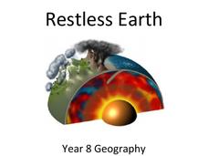
Restless Earth
In less than 25 years, the continent of Australia moved 4.9 feet thanks to plate tectonics. The presentation introduces the idea of the layers of the earth as well as plate tectonics. It goes into why the plates move and where we believe...
Reed Novel Studies
Mr. Popper's Penguins: Novel Study
Antarctica is actually a desert. Using the novel study that explores Mr. Popper's Penguins, pupils find four of their own interesting facts about the amazing continent. They also practice putting words in alphabetical order and answer...
Howard Hughes Medical Institute
EarthViewer Climate Guide Activity
What did Earth look like 4.5 billion years ago, and what was the climate like then? Scholars explore a view of Earth throughout history. They observe continents moving, temperatures fluctuating, and huge changes in ecosystems. A learning...
National Endowment for the Humanities
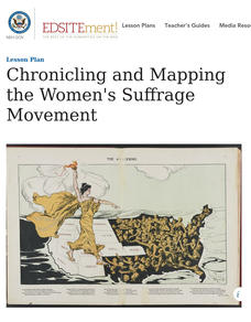
Chronicling and Mapping the Women's Suffrage Movement
While women's suffrage is often believed to be the result of a single constitutional amendment, the effort of women to secure the vote spanned decades and continents. Using primary sources in online archives, class members explore the...
Curated OER
Garb and Grub Across the Globe
First graders discuss what part of the world their ancestors came from. They locate the locations on a map and discuss the differences and similarities of each continent and their people. They become familiar with the traditional...
Curated OER
A Book Is A Window To the World
Second graders listen to pieces of literature that take place in different regions of the world. Using a map, they identify and locate the continents and oceans mentioned in the story. They describe the physical and human characteristics...
Curated OER
Geography With Dr. Seuss
Students read the book, The King's Stilts by Dr. Seuss and discuss the geographical information given in the book. Then they discuss and locate on a map the physical features that make up the continent of Africa. They create an original...
Curated OER
Dinosaurs
Second graders classify and analyze living things by structure and function and make predictions based on observations rather than random guesses. They make predictions about where dinosaurs lived and correctly place their databases onto...
Curated OER
Earth at Night
Students examine the Earth at night. In this geography lesson, students identify the continents at night using various Internet Web sites. This lesson may be adapted for use with middle school and high school students.
Curated OER
Countries of the World
Students define the meaning of the word country. In this countries of the world map lesson plan, students identify boundaries, countries, and symbols within countries on the map. Students distinguish the words country and continent.
Curated OER
The Geography of Africa
Hop a flight to Africa in this presentation, which includes brilliant and appealing photographs of the continent as well as maps and graphs about its geography, topography, and climate. Those who are researching Africa for a project or...
Curated OER
Prehistoric Mesosaurus
Middle schoolers draw conclusions why Mesosaurus has only been found in Africa and Brazil and how its fossil remains serve as important evidence that shows where two continents were once joined together.
Curated OER
Geography and Culture
Students explore African geography, study the overall continent of Africa and its individual countries, discuss demographics, and participate in research and class activities.
Curated OER
Creating Mind maps
Middle schoolers discuss their impressions of Africa. They work in groups to create a mind map. Students are explained what a mind map is. They discuss what they think are the defining features of the continent of Africa. Middle...
Curated OER
Comparison of Juan Bautista de Anza and George Washington
Fifth graders discover that Anza and Washington lived at the same time but on opposite sides of the American Continent. They identify differences and similarities in their lives. They present the data in an illustrated time line
Curated OER
Magical Maps
Second graders discuss the importance of using maps and how they are used. After they listen to a folktale, they develop their own story line maps and write their own folktale to accompany a map. They also identify and locate the seven...
Curated OER
Comparing Temperatures and Latitudes
Eighth graders collect weather data from a variety of cities at the same latitudes, but on different continents. They organize data using spreadsheet program, generate graphs, and incorporate into a word processing document. Students...
Curated OER
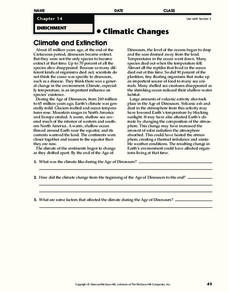
Climatic Changes
In this weather worksheet, students read an excerpt describing the climate and extinction. Then they explain what the climate was like during the Age of Dinosaurs. Students also determine some factors that affected the climate during...


