Jamestown-Yorktown Foundation
History Is Fun: Angela [Pdf]
The story of Angela, a young woman West Central Africa who was kidnapped in 1619, and ended up in Virginia as a slave to a planter named William Peirce.
Curated OER
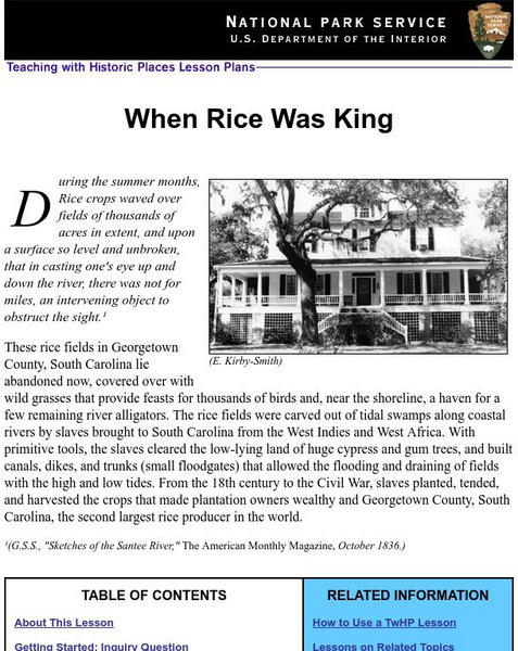
National Park Service: Teaching With Historic Places: When Rice Was King
Lesson plan teaching the rice culture of Georgetown County, South Carolina in the 1700's.
PBS
Africans in America: "Defense of Slavery in Virginia"
From PBS's "Africans in America," Reverend Peter Fontaine's defense of slavery to his brother in 1757. Click to read the text of the actual document.
Other
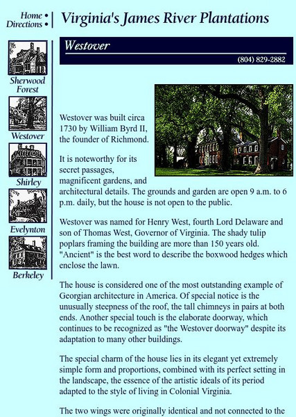
James River Plantations: Westover Plantation
William Byrd built Westover, his plantation home. Here you can view photographs of it and learn of some details of interest.
University of Georgia
University of Georgia: A Map of North and South Carolina and Georgia(1765)
An English map from 1765 entitled "A New Map of North and South Carolina and Georgia."
Other
The History of Tobacco Part Ii
Extensive timeline (1492-1997) of tobacco cultivation--in three parts. Click links at bottom of pages to view Parts I, III, and IV.
Curated OER
Etc: Maps Etc: Greene's Campaign in the South, 1781
A map of the southern Colonies showing the area of General Nathaneal Greene's campaign (1781) against the British under Charles Cornwallis in the closing years of the American Revolution. The map shows the important sites of Cowpens,...
Curated OER
Educational Technology Clearinghouse: Maps Etc: Pre Colonial Africa, 1858
Map of Africa in 1858, prior to the extensive European colonization of the continent established at the Berlin Conference of 1885. This map shows the European possessions of the Cape Colony, Natal, and Orange River Free State, and the...
Curated OER
Educational Technology Clearinghouse: Maps Etc: Northwestern Africa, 1906
Map of Northwestern Africa in 1906 showing the Barbary States of Morocco, Algeria, Tunis, and a portion of Tripoli, the western country of Rio de Oro, and the Upper Guinea States of Gambia, Portuguese Guinea, Sierra Leon, Liberia,...
Curated OER
Etc: Maps Etc: Sketch Map of Mid Century Africa, Circa 1850
A map of Africa around the middle of the nineteenth century showing European interests on the continent prior to the Berlin Conference of 1885, which established their territorial claims. The majority of the continent was unexplored at...
Curated OER
Etc: Maps Etc: Africa Before the Berlin Conference, 1882
A map of Africa as it was known in 1882 before the Berlin Conference of 1885, when the most powerful countries in Europe at the time convened to make their territorial claims on Africa and establish their colonial borders at the start of...
Curated OER
Educational Technology Clearinghouse: Maps Etc: Pequod (Pequot) War, 1636 1638
A map of southern Connecticut and Rhode Island showing the area of the Pequot War (1636-1638) between the allied Massachusetts and Plymouth colonies against the Pequot tribe. The map shows the territories of the Mohegans, Narragansetts,...
Curated OER
Etc: Maps Etc: Dutch and Neighboring Settlements, 1600s
A map of New Netherlands in the 1600's showing New Amsterdam and Dutch Fort (Albany) established in 1623, the English Settlements on the Connecticut River (Hartford) and the New Haven Colony, and the southern Dutch and Swedish...
Curated OER
Etc: Attempts at Huguenot Settlements in Florida, 1562 1565
A map of the southern Atlantic coastline showing the early attempts by the French Huguenots under Jean Ribault to establish settlements in the Spanish territory of Florida. The map shows the sites of Charles Fort (Charlesfort) South...
Curated OER
Etc: Operations in South During the Amer Rev War, 1780 1781
A map showing the southern operations (1780-1781) during the American Revolutionary War. The map shows terrain, rivers, and major battle sites from the northern Virginia line south to St. Augustine, which was at the time a Loyalist...
Curated OER
Etc: Maps Etc: French Posts and Forts in Louisiana and New France, 1754
A map of North America showing the French posts and forts at the beginning of the French and Indian War (1754) between the French and the British. The map is color-coded to show the territorial claims of the British, French, and Spanish...


![History Is Fun: Angela [Pdf] Article History Is Fun: Angela [Pdf] Article](https://d15y2dacu3jp90.cloudfront.net/images/attachment_defaults/resource/large/FPO-knovation.png)


