Curated OER
African Adventures
Students access the Internet to gather information. They record their observations of African habitats. They create either an electronic slideshow or mural to present a science experiment.
Curated OER
Fostering Geospatial Thinking: Space to Earth: Earth to Space (SEES)
Young scholars locate and access data to help them with their science inquiry. For this geographical positioning lesson students evaluate and compare data sets.
Curated OER
A Lion's Lair
Learners evaluate the likelihood that a particular animal lived in a particular habitat. They research and illustrate lion habitats to determine whether lions were likely to have lived in ancient Greece.
Curated OER
Lâlâkea Stream: Diversion and Restoration
Students research the history of the Lalakea stream diversion and restoration. They examine the restoration project from multiple viewpoints and consider how it affects the stream-related environments.
Curated OER
Clean Kansas Water
Students gain an understanding of ways we can be responsible custodians of our water supply. Students explore the governor's clean water initiative involving the Lower Kansas/Republican river basin and the pollutants present there.
Curated OER
Do Human Practices Affect Water Quality?
Students determine if human practices have any noticeable effects on the quality of stream life as measured by the presence of certain macroinvertebrates. They collect, preserve and identify macroinvertibrate samples and quantify the data.
Curated OER
Linkages Between Surface Temperature And Tropospheric Ozone
Students collect and interpret data to make predictions about the levels of ozone in the atmosphere. Using the internet to collect data students use their collected data to create a line graph for analysis. Students make mathematical...
Curated OER
The Civil War in Henry County
Students consider how the Civil War impacted their community. In this Civil War lesson, students use primary and secondary sources to research the Civil War in Henry County, Georgia. Students use their findings to create multimedia...
Curated OER
Natural Hazards
Students evaluate the hazards of naturally occurring events. After watching a video concerning safety hazards, students work in groups to discuss the safety issues involved in taking a trip to a mountainous region. Recommendations are...
Curated OER
On the Road Again": Moving People, Products, and Ideas
In this lesson students learn how to identify modes of transportation and communication for moving people, products, and ideas from place to place. Students also study the advantages and disadvantages of different modes of...
Curated OER
Creating and Analyzing Graphs of Tropospheric Ozone
Students create and analyze graphs using archived atmospheric data to compare the ozone levels of selected regions around the world.
Curated OER
Using My Nasa Data To Determine Volcanic Activity
Young scholars use NASA satellite data of optical depth as a tool to determine volcanic activity on Reunion Island during 2000-2001. They access the data and utilize Excel to create a graph that has optical depth as a function of time...
Curated OER
Linkages Between Surface Temperature And Tropospheric Ozone
Pupils organize and analyze data regarding changes in tropospheric ozone and then hypothesize about the consequences of these changes.
Other
Geoscience Australia: Map Reading Guide: How to Use Topographic Maps [Pdf]
A topographic map can be challenging to read. This guide explains how to decipher one and how to use a magnetic compass to orient yourself to the landscape. It also explains how to use GPS coordinates.
US Geological Survey
U.s. Geological Survey: 27 Ideas for Teaching With Topographic Maps
A collection of twenty-seven activities that can be done with topographic maps, for elementary up to university level students. Includes many accompanying resources.
Other
California State University: Topographic Map Symbols
Click on any of the geographical terms on this website to see examples that illustrate the symbols commonly used on maps. Includes boundaries, building symbols, caves, mines, elevation symbols, coastal features, and more.
US Geological Survey
Usgs: Finding Your Way With Map and Compass
This resource has a topographic map that tells you where things are and how to get to them. Use this site to help you use a map and compass to determine your location.
Science Education Resource Center at Carleton College
Serc: Geo Map App Learning Activities: Rules of Contouring
Using GeoMap software, learners learn how to read topographic maps, and the rules for using contour lines on a map. Detailed teacher and student handouts are provided. (GeoMap software can be downloaded at: http://www.geomapapp.org/.)
Other
Ordnance Survey: Map Zone: Relief and Contour Lines
Discover how to read and show height on maps using relief and contour lines.
Harvard University
Harvard University: Maps and Mapping
This site is provided for by Harvard University. Students follow a map on a scavenger hunt, create a map of their classroom and their town, learn how to read topographic maps, and discover latitude and longitude in these inquiry activities.
TeachEngineering
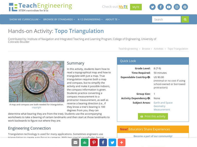
Teach Engineering: Topo Triangulation
In this activity, students will learn how to read a topographical map and how to triangulate with just a map. True triangulation requires both a map and compass, but to simplify the activity and make it possible indoors, the compass...
CK-12 Foundation
Ck 12: Earth Science: Maps
[Free Registration/Login may be required to access all resource tools.] How to use topographic, bathymetric, and geologic maps.
TeachEngineering
Teach Engineering: Topo Map Mania!
Maps are designed to allow people to travel to a new location without a guide to show the way. They tell us information about areas to which we may or may not have ever been. There are many types of maps available for both recreational...
National Association of Geoscience Teachers
Nagt: Urban Planning 101: Map Appreciation
In this lesson students will begin by looking at a series of maps and they will brainstorm ways the natural world may interact with humans and vice-versa. Students will then come up with a list of features of a city or town, make...








![Geoscience Australia: Map Reading Guide: How to Use Topographic Maps [Pdf] Handout Geoscience Australia: Map Reading Guide: How to Use Topographic Maps [Pdf] Handout](https://d15y2dacu3jp90.cloudfront.net/images/attachment_defaults/resource/large/FPO-knovation.png)


