Curated OER
Flooding
Students take a closer look at flooding. In this floods instructional activity, students investigate the causes of flooding and the impact of flooding as they examine a flooding animation.
Curated OER
African Adventures
Learners access the Internet to gather information. They record their observations of African habitats. They create either an electronic slideshow or mural to present a science experiment.
Curated OER
High Mountain Retreat
Students explore and analyze atmospheric conditions for a high mountain retreat. They examine the relationship between altitude, atmospheric pressure, temperature and humidity at a particular location. In addition, they write reports...
Curated OER
Physical Habitat of a Stream
Young scholars measure in metric units and use a stopwatch, calculator. They collect data with minimal instructions after the initial pre-activity briefing, then record data in the data sheets provided.
Curated OER
A Lion's Lair
Students evaluate the likelihood that a particular animal lived in a particular habitat. They research and illustrate lion habitats to determine whether lions were likely to have lived in ancient Greece.
Curated OER
Lâlâkea Stream: Diversion and Restoration
Students research the history of the Lalakea stream diversion and restoration. They examine the restoration project from multiple viewpoints and consider how it affects the stream-related environments.
Curated OER
SHOW 303: The Channel Island Fox
Learners explore how archaeologists and other scientists use different clues to piece together a picture of the past. Students perform activities that allow them to conduct three types of scientific research. They discuss their...
Curated OER
Introduction to Drawing Isopleths
Learners draw isopleths based on how many pieces of "confetti snow" land in their cup.
Curated OER
Research Report on Earth Science Topics
Sixth graders are given a variety of Earth Science topics which be covered during the year. They select one of their choices to research and work in class and at home to meet the guidelines for their report.
Curated OER
Introduction to the Planets
Students become familiar with the members of the solar system and planetary order. They identify differences and characteristics of individual planets. Finally students visualize the great size of the solar system and make the image more...
Curated OER
Banana Republics - United Fruit Co.
Students define multinational companies and describe their roles as key economic developers in developing countries, determine whether trade-off between surrendering control of a country's economy to foreign companies and economic...
Curated OER
Creating and Analyzing Graphs of Tropospheric Ozone
Students create and analyze graphs using archived atmospheric data to compare the ozone levels of selected regions around the world.
Curated OER
Earthquake Introduction
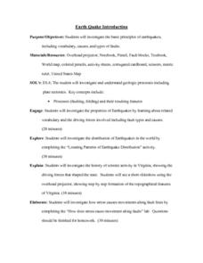
Students investigate basic principles and properties of earthquakes, including vocabulary, causes, and types of faults. They examine history of seismic activity in their home state, and complete "Locating Patterns of Distribution" lab.
Other
Geoscience Australia: Map Reading Guide: How to Use Topographic Maps [Pdf]
A topographic map can be challenging to read. This guide explains how to decipher one and how to use a magnetic compass to orient yourself to the landscape. It also explains how to use GPS coordinates.
Other
Ordnance Survey: Map Zone: Relief and Contour Lines
Discover how to read and show height on maps using relief and contour lines.
PBS
Pbs Learning Media: Earth's Systems: Map It
Explore different types of maps and how different things are represented on maps in this media gallery from WGBH. Maps are used to help locate different places and different things. Map symbols are representations of larger things in the...
Other
Centre for Topographic Information: Map Scale
This resource uses illustrations to demonstrate scale. Check out the links to the The National Topographic System of Canada and the Aerial Survey Data Base.
CK-12 Foundation
Ck 12: Earth Science: Maps Study Guide
Get an overview of different types of Earth Science maps.
Ducksters
Ducksters: Earth Science for Kids: Topography
Kids learn about the Earth science subject of topography including features such as landforms, elevation, latitude, longitude, and topographical maps.
Alabama Learning Exchange
Alex: Land Surveying Project
This project resulted from of the collaboration of a computer aided drafting teacher, Chris Bond, and a math teacher, Lee Cable, (Hewitt-Trussville High School) to provide higher math expectations in CT and real life application in...
Purdue University
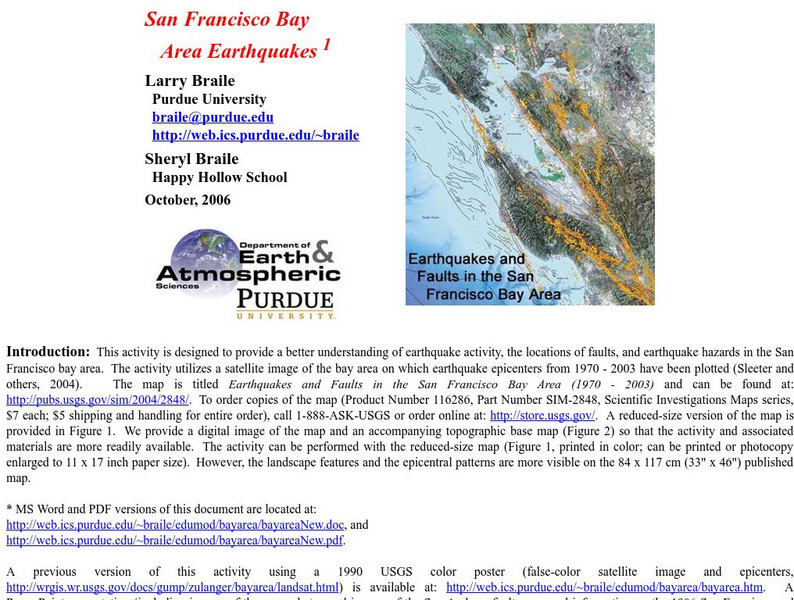
Purdue University: San Francisco Bay Area Earthquakes
Students use geologic fault maps of the San Francisco Bay Area to find relationships between tectonic plate fault lines and landscape features, topographic features, and epicenters of past earthquakes.
US Environmental Protection Agency
Epa: Enviro Mapper Store Front
Lets kids create their own maps, down to the square mile, anywhere in America, choosing various features from water discharges to hazardous waste to roads.
Geographyiq
Geography Iq
Detailed geographical information on any country is available at this site. Within the World Map section, you can get facts and figures about each country's geography, demographics, government, political system, flags, historical and...







![Geoscience Australia: Map Reading Guide: How to Use Topographic Maps [Pdf] Handout Geoscience Australia: Map Reading Guide: How to Use Topographic Maps [Pdf] Handout](https://d15y2dacu3jp90.cloudfront.net/images/attachment_defaults/resource/large/FPO-knovation.png)


