Curated OER
Introduction of the Lunar Relief Map Project
Students investigate the geographic features of the surface of the moon. In this lunar relief map lesson, students watch and discuss the Apollo II Moon landing and make preliminary plans for their lunar maps.
Curated OER
Gallery Walk Questions on Weathering and Mass Wasting
A set of questions on weathering and erosion are found in this resource. Some of them can be used as discussion topics or lecture guides. There are also suggested activities such as the examination of topographic quadrangles and the...
Curated OER
The Delicate Balance - Iowa's Natural Resources
Discover the natural resources in Iowa by studying it's history. In this environmental lesson, your students will observe a topographical map of Iowa and identify where its most valuable resources are. They complete an Iowa name...
Curated OER
Understanding a Geological Map
Students identify different types of maps and observe a geological map. In this geology lesson students create a replica map of a geological area that includes a key.
Curated OER
Geologic Mapping I
Students create a geologic map and cross-section of an area of horizontal sedimentary rocks, exposed in several locations. Map must include a complete key or legend with rock descriptions of the various formations.
Curated OER
Getting from Place to Place
Students examine modes of transportation. In this transportation lesson, students listen to their instructor present a lecture on modes of transportation over the past 300 years. Students respond to questions about...
Curated OER
Orienteering
Students proceed through a simple course following a map but not using a compass. They must find 18 controls working in pairs that leave at 2 minute intervals. Students must record letter and after finding all 18 controls they will...
Curated OER
Cookie Mapping
Students study the components of a bedrock geology map through a hands-on activity involving a cookie and graph paper.
Curated OER
Map It!
Fourth graders collect and explore different maps and their uses before using the program Pixie to create maps of geographic features, political features, and economic information for the state in which they live.
Curated OER
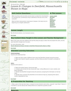
Lesson 8: Changes in Deerfield, Massachusetts Shown in Maps
Eighth graders study maps of the same area from different time periods which show the ways in which the land stayed the same, and the ways this New England village changed over the years.
Curated OER
Mapmaking: Colorado Quarter Reverse
Students examine the Colorado quarter reverse and draw symbols of the state's land and water features on maps. Using copies of the Colorado reverse, they color the coin design. They list reasons for the state's motto of "Colorful Colorado"
Curated OER
Stranded along the Coast
Students plot stranding sites onto a map using latitude and longitude as well as compass directions with respect to coastal features. They identify several species of marine animals that might become stranded; distinguish their...
Curated OER
TE Activity: The Trouble with Topos
Students study the uses of topographical maps including the many forms that they take. They discover that the map features show its intended use such as city maps, wilderness maps, and state maps. They complete a worksheet in which they...
Curated OER
Continents and Oceans on the Move
Students create an awareness of the vast percentage of water covering the earth. They relate similarities/differences between topographical maps and other maps of various time periods. Students examine how to use a topographical map.
Curated OER
Geography of the Harbor
Students study estuaries and their boundaries. In this investigative instructional activity students locate an estuary on a map and use nautical and topographical maps.
Curated OER
Waldseemuller's Map: World 1507
Seventh graders analyze various maps. In this Geography lesson, 7th graders create a large map as a whole class. Students write a letter to Mr. Waldseemuller.
Curated OER
Topographic Connections: Earth's Surface Shapes Streams; Streams Sculpt the Earth
Young scholars identify physical characteristics of developing streams and infer changes in the landscape by creating a river model.
Curated OER
Gallery Walk Questions on Rivers
A Gallery Walk is a technique that allows small groups to visit different stations, where they examine and discuss materials about an overarching topic. Questions about rivers and fluvial processes are available in this resource;...
Curated OER
Playdoh Mountains
In this mountain building worksheet, students use playdoh to create mountain features. They cut apart the mountain and then use the pieces to create a topo graphic map of their mountain.
Curated OER
Running Water/Rivers-Life Cycle
Pupils explore the parts of a river system and use topographical maps to determine the stage of the river.
Curated OER
Watershed Delineation
Students use topographic maps to delineate a watershed.In this ecology lesson, students draw the boundaries of a watershed onto a map using contour lines as a guide. Their resulting maps are used to evaluate their understanding.
Curated OER
Bushy Run: A Decisive Battle of Pontiac's Rebellion
Students study the battle at Bushy Run. In this Pontiac's Rebellion lesson, students examine an 1765 map of the Bushy Run battle as well as letters and a modern topographic map of the area in order to simulate the event and research how...
Curated OER
Siting Wind Power
Students analyze a variety of curves that describe the power extracted from the wind by a variety of commercially produced wind turbines. They utilize site specific topographic maps and political boundary data to evaluate and make...
Curated OER
A Thoreau Look at Our Environment
Sixth graders write journal entries o school site at least once during each season, including sketched and written observations of present environment. They can use sample topographical maps and student's own maps. Students can use...


