Curated OER
A Thoreau Look at Our Environment
Sixth graders write journal entries o school site at least once during each season, including sketched and written observations of present environment. They can use sample topographical maps and student's own maps. Students can use...
Curated OER
MAP UNIT
First graders investigate how maps are used to identify different locations. They will also appreciate how there are different types of maps for their purposes. Finally students study how maps contain symbols that represent real places.
Curated OER
U.S. Geography- The Northeast
Students investigate the geography of the Northeast states. In this map skills lesson, students are shown a map of the Northeast states and identify the state names and borders. Students construct individual maps of the Northeast using...
Curated OER
COLONIAL FLYERS/TRAVEL BROCHURES TO THE COLONIES
Students investigate concepts of history and geography in this lesson. They create travel brochures for travelers who are crossing the Atlantic Ocean to populate the colonies of early America. The brochure has topographical information...
Curated OER
Mapping Seamounts in the Gulf of Alaska
Students describe major topographic features on the Patton Seamount, and interpret two-dimensional topographic data. They create three-dimensional models of landforms from two-dimensional topographic data.
Curated OER
Regions of Utah - Mapping
Fourth graders draw a rudimentary map of the state of Utah, dividing it into the three regions: the Great Basin, the Colorado Plateau, and the Rocky Mountain Region.
Curated OER
Mud Maps
Young scholars discuss the location of stores, buildings, and homes in their community. Afterwards, they create a 'mud map' demonstrating the route from one point to another. In pairs, students read travel directions from a brochure,...
Curated OER
Outdoor Education; Maps, Elevation
Ninth graders use online topographical maps to fill in a chart regarding elevation and contour lines.
Curated OER
Stranded along the Coast
Students plot stranding sites onto a map using latitude and longitude as well as compass directions with respect to coastal features. They identify several species of marine animals that might become stranded; distinguish their...
Curated OER
Nebraska's Geology, Soils, Groundwater Regions, and Topographic Regions
Learners examine the distribution of geology, soils, groundwater, topography, and geography in Nebraska. They identify various regions and characteristics on a map, and develop a plan to manage the soil and groundwater resources of the...
Curated OER
Making a Region Map of a State
Fourth graders create salt maps of a state and indicate its regions. They include topographical elements including mountains, valleys, lowlands and major water bodies and a compass rose.
Curated OER
Mapmaking: Colorado Quarter Reverse
Students examine the Colorado quarter reverse and draw symbols of the state's land and water features on maps. Using copies of the Colorado reverse, they color the coin design. They list reasons for the state's motto of "Colorful Colorado"
Curated OER
Virtual Geologic Field Trip to Griffith Park
Students explore the geological processes and research methodology involved in the evolution and development of Griffith Park. They justify the selection of a geologic hypothesis based on observations.
Curated OER
The Marsh Land as a Changing Environment
Sixth graders continue their examination of the state of Connecticut. After taking a field trip, they identify the types of birds, plants, invertebrates and vertebrates who make their home in the salt marshes. In groups, they identify...
Curated OER
Common Themes
Tenth graders test usefulness of a model Earth by comparing its predictions to observations in the real world. In this landforms lesson students construct an island from a contour map using model clay then analyze the landscape...
Curated OER
Beyond the Tap
Students explain the basic properties of a watershed including how water flows from higher to lower elevations and how watersheds are interconnected. They comprehend how the placement of buildings, roads, and parking lots can be...
Curated OER
Volcano Contour Models Activity
Students experiment with water levels and plastic topographic volcano models to determine the contour lines that would be used to create a topograpohic map of a volcano. They use the traced lines to actually develop the map.
Midnight Martian
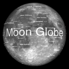
Moon Globe
Not just a simple globe of the moon, this interactive version allows you to choose lighting according to the location of the sun, views from different positions on Earth, and more! Satellite images and topographic data have been combined...
Curated OER
Land Use Over Time
Pupils view aerial photos and topographic maps of their local area. They compare and contrast major land use patterns over time by comparing these images to maps that are at least 50 years old. They analyze them using the four land use...
Curated OER
Ecological Pyramids
Students apply the ecological pyramids of numbers and biomass with an activity using topographic maps. In this trophic level lesson, students work in groups using a topographic map to determine the number of organisms that can live in an...
Curated OER
Science: Draining the Land - the Mississippi River
Students use topographic maps to identify parts of rivers. In addition, they discover gradient and predict changes in the channels caused by variations in water flow. Other activities include sketching a river model with a new channel...
Curated OER
Nature and Place Names in Arkansas
Middle schoolers examine the way that many place names in Arkansas came to be. By looking at Arkansas highway maps, they find names that come from the characteristics of each of the state's six geographical divisions. This interesting...
Curated OER
Elevation at its Peak
Students pretend they are hiking up a mountain. They practice making calculations on angles and elevation. They use topographic maps to estimate distances and trigonometric ratio methods.
Curated OER
The Landscape
Students recognize and recreate the political boundaries and physical features of the nation of Slovakia. They create topographic maps of Slovakia. The maps should include labeled line drawings of bordering countries. Slovakia should be...
Other popular searches
- Reading Topographic Maps
- Science Topographic Maps
- Making Topographic Maps
- Geography, Topographic Maps
- Topographic Maps Labs
- Topographic Maps Computer
- Topographic Maps Isolines
- Topographic Maps Salines
- Topographic Maps + Salines
- Topographic Maps + Isolines
- Geography Topographic Maps
- Topographic Maps Profiles


