Curated OER
Greece: The Landscape
Students work in small groups to create a topographic map of Greece. They must include labeled line drawings of bordering countries and bodies of water. Students use salt and flour clay to make Greece three dimensional, showing the many...
It's About Time
Taking a Ride on a Lithospheric Plate
Assist your pupils and broaden their horizons with several activities that determine the exact positioning of various communities over the globe. Pupils use data from the Global Positioning System to determine the position and rate of...
Curated OER
When You Were My Age, What Was This Place Like?
Students discover how land use in their community has changed. In this community and ecology lesson, students scan old newspapers to find articles about the development of community land. Students discuss and predict how land use has...
Curated OER
Topography: Know the topography of your neighborhood
Students read and identify features on a topography map. In this topography lesson plan, students learn how to read a topography map, and then go out and take pictures of their own and discuss the topography pictures they took.
Curated OER
World Climate Growing Zones
Students create a map showing where crops would be grown around the world. In this crops lesson plan, students show how the world climate would produce different parts of the world at different times. Students fill out worksheets.
Curated OER
Landforms And The Oregon Trail
Fourth graders investigate the historical context for the founding of The Oregon Trail. They conduct research to put together the events that led to the geographical route that was taken. The lesson also strengthens geography skills with...
Curated OER
Orienteering
Students proceed through a simple course following a map but not using a compass. They must find 18 controls working in pairs that leave at 2 minute intervals. Students must record letter and after finding all 18 controls they will...
Curated OER
The Battle of Brandywine
Students explore the Battle of Brandywine, how to analyze maps, and construct a model of a battlefield.
Curated OER
Oil: The Problem or Solution to the World's Economic Future
Middle schoolers map the major oil producing and consuming countries and regions. They identify current and future topographic and political problems that could affect the production and transportation of oil.
Science Matters
Slip Sliding Along
The San Andreas Fault is the largest earthquake-producing fault in California. In the seventh instructional activity in the 20 part series, pupils create maps of California, focusing on the San Andreas Fault system. The comparison...
National Endowment for the Humanities
Lesson 1: On the Road with Marco Polo: A Boy in 13th Century Venice
Learners investigate Marco Polo's life as a young boy in 13th century Venice. They analyze maps, explore various websites, complete a chart and answer discussion questions, and create a travel brochure about visiting 13th century Venice.
Curated OER
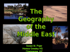
The Geography of the Middle East
Topographic, political, and satellite maps establish the world of the Middle East for your class- a land about which they have heard quite a lot, but might not really understand. This presentation would be a good introduction into a unit...
NOAA
Sediments
Calcareous ooze ... what an interesting name! The 15th installment of a 23-part NOAA Enrichment in Marine sciences and Oceanography (NEMO) program focuses on sediments found on the ocean floor. After viewing the slideshow lecture,...
Curated OER
Eagle Creek Park (A Hike)
Young scholars plot a hiking course using aerial photos and a topographic overlay and find the latitude and longitude of absolute locations. They measure the total distance of a hiked area and figure the area of the ground walked using...
Curated OER
Plotting the Ocean Floor
Fourth graders plot points on a graph, connect the dots to make the ocean floor profile and label the topographical features. They utilize a worksheet and a website imbedded in this plan to plot the ocean floor.
Curated OER
U.S. Geography: The Northeast
Students investigate U.S. Geography by creating a map in class. In this natural resource lesson, students create a map of the United States and research the Northeast based on their resources and recyclable materials. Students...
Curated OER
Lewis and Clark and the Native Americans
Students practice using maps and identifying landmarks on the Lewis and Clark expedition. They research Lewis and Clark's relationship with the Native Americans and report their findings to the class. They identify the impact of the...
Curated OER
Radio Program #2: Ethnic Mix
Learners examine patterns of migration into the area. They complete various map activities and interviews. Students partake in family histories as well. On a map of Europe, identify the countries of immigrant origin mentioned in the...
Curated OER
The Silk Roads Big Map
Young scholars generate oversized rendition of the Silk Roads from Europe to East Asia, apply elements such as political and topographic features, the Silk Roads, products of the regions, and the routes of key travelers.
Curated OER
Landscape Diversity in the Yukon Territory
Students review and analyze a satellite image of the Yukon territory.
Curated OER
PA Watersheds, Many Ways to the Sea
High schoolers examine the water cycle and the factors that interact with watersheds. In this watersheds lesson students describe the purification process, trace the flow of infiltrate water through aquifers, and research the...
Curated OER
Getting from Place to Place
Students examine modes of transportation. In this transportation lesson, students listen to their instructor present a lecture on modes of transportation over the past 300 years. Students respond to questions about...
Curated OER
Chain Across the Hudson Lesson Plan A - Locating the Chain
Students read a letter from George Washington requesting them to identify on a map a location that would stop the advance of British warships. They choose a location and justify their choice.
Curated OER
Chinese Landscapes
Learners explain some of the topographical features of China's landscape. They view a Chinese landscape and discuss their view of the harmony between man and nature, then create their own karst mountain scene.
Other popular searches
- Reading Topographic Maps
- Science Topographic Maps
- Making Topographic Maps
- Geography, Topographic Maps
- Topographic Maps Labs
- Topographic Maps Computer
- Topographic Maps Isolines
- Topographic Maps Salines
- Topographic Maps + Salines
- Topographic Maps + Isolines
- Geography Topographic Maps
- Topographic Maps Profiles


