Curated OER
Park Brochures
Sixth graders investigate natural environments by researching national parks. In this brochure making lesson, 6th graders explore a specific national park and research it's information by utilizing the web. Students create travel...
Curated OER
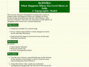
What Happens When Sea Level Rises or Falls
Students examine the impact of sea level on land formations. In this geography and map lesson, students construct a contour map model illustrating how much of the clay "coastline" is covered as water is added. Metric measurement is...
Midnight Martian
Mars Globe HD
Explore the surface of Mars without leaving the comforts of your home or classroom! Learn about volcanoes, missions to the red planet, view the topography, and more.
Curated OER
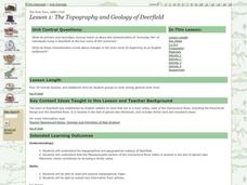
The Topography and Geology of Deerfield
Eleventh graders explain the topographical and geographical makeup of Deerfield. They explain the Massachusetts section of the Connecticut River Valley is located in the bed of glacial Lake Hitchcock, which contributes to its being a...
Curated OER
The Challenges Ahead
Students examine the physical obstacles that the Lewis and Clark expedition encountered on its journey. They report what challenges these physical obstacles might have posed. They review a modern-day map and explain if the obstacles...
Curated OER
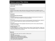
Exploring Ancient Greece
Sixth graders use play dough to create a relief map of Greece and through personal investigation and class discussion, draw conclusions about the impact of the geography of Greece on daily life and culture in Ancient Greece.
Curated OER
Uncharted Territory
Students examine what were preconceived perceptions of the areas Lewis and Clark explored. They compare and contrast past and modern maps of North America. They accurately place route and site information on the map.
Curated OER
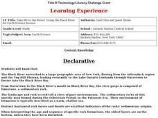
Take Me to the River! Using the Black River for Earth Science Review
Ninth graders use maps to identify landscape regions and drainage patterns producing the Black River. They create PowerPoint presentations pertaining to the Black River watershed, its geologic history and highlighting safe rafting...
Curated OER
Landforms
Students begin their examination of landforms. Using a map, they locate and identify the major landforms on Earth. They discuss how landforms affect the lifestyle of the community and determine which goods and services the community...
Curated OER
I Know Where You Are!
High schoolers study what a GPS is and use it to challenge themselves and find positions on a map. In this investigative instructional activity students find various points on a map using a GPS system and answer questions on a...
Curated OER
Using Soil properties and Vegetation Differences to Hypothesize the Land Use History and Topographic Differences between Two Locations
Ninth graders take soil samples and perform tests on these samples.
Curated OER
BOUND TO BE NEW HAMPSHIRE
Students identify neighborhood, town, and state boundaries. They distinguish between natural and man-made boundaries. They identify major state geological features and explain how NH boundaries have changed over time.
Curated OER
Explore Your World--Geography Takes You Places
Students examine how the world around them is constantly changing. In groups, they travel between centers in their classroom to role play the role of explorers in Washington D.C. They share their experiences with their classmates and...
Curated OER
Car Wash
Learners determine the most appropriate site for a car wash, based on each site's soil characteristics (chemical, physical) and topographic features. They perform an experiment to determine the changes to three different soil types when...
Curated OER
Water, Rivers & Topography
High schoolers explore the topography of Idaho and the importance of surface water and drainage. using digital maps, they inspect the courses of major rivers, Yellowstone Hot Spots, and the natural landscaping of Pocatello. Students...
Curated OER
The Future of Social Studies Education
Students work in groups of four and complete a roster of their names and personal information and to complete a release form that allows their pictures to be placed online. They then engage in classroom activities while being...
Curated OER
Comparison of Snow Cover on Different Continents
Learners use the Live Access Server (LAS) to form maps and a numerical text file of snow cover for each continent on a particular date. They analyze the data for each map and corresponding text file to determine an estimate of snow cover...
Curated OER
State My Name
Students study the names of all fifty states, their capitols, location on a map, and an economic resource of each state. They complete a matching game activity.
Curated OER
Lahar Travel Time
Ninth graders analyze published geologic hazard maps of California and comprehend how to use the map's information to identify evidence of geologic events of the past and present and predict geologic changes in the future. They select...
Curated OER
Navigation Across the Seas
Students examine nautical navigation and discover the differences between nautical charts and other types of maps or charts. Students practice setting a course, taking a bearing, and dead reckoning. This gives students an example of...
Curated OER
U.S. Place Names Show Our Diversity
Middle schoolers study place names for different area in the US and determine why they were named in such a way. They examine maps to look at the religious names, "new" beginning names, and copy cat names. They complete a word search to...
Curated OER
Exploring Our Watershed System
Students examine how watershed systems are made up, and visit the Susquehanna watershed system and map out the system. They evaluate the order of watercourses in their area.
Curated OER
Hidin' Out
Fourth graders draw three major Underground Railroad routes crossing Indiana on an outline map and include habitats and towns. They produce an oral history involving at least three natural habitats and one human habitat.
Curated OER
Burt County, NE, Soil Survey
Students identify the soil types and textures, and locate the waterways in or near the towns of Lyons and Decatur, Nebraska. They analyze soil profile maps, and answer conclusion questions.
Other popular searches
- Reading Topographic Maps
- Science Topographic Maps
- Making Topographic Maps
- Geography, Topographic Maps
- Topographic Maps Labs
- Topographic Maps Computer
- Topographic Maps Isolines
- Topographic Maps Salines
- Topographic Maps + Salines
- Topographic Maps + Isolines
- Geography Topographic Maps
- Topographic Maps Profiles


