Curated OER
Analysis of Atmospheric Conditions for a High Mountain Retreat
Students examine the relationship between altitude, atmospheric pressure, temperature and humidity at a particular location. They practice science and math in real world applications. They write reports detailing their scientific...
Curated OER
African Adventures
Learners access the Internet to gather information. They record their observations of African habitats. They create either an electronic slideshow or mural to present a science experiment.
Curated OER
High Mountain Retreat
Students explore and analyze atmospheric conditions for a high mountain retreat. They examine the relationship between altitude, atmospheric pressure, temperature and humidity at a particular location. In addition, they write reports...
Curated OER
Fostering Geospatial Thinking: Space to Earth: Earth to Space (SEES)
High schoolers locate and access data to help them with their science inquiry. In this geographical positioning lesson students evaluate and compare data sets.
Curated OER
Riemann Sums
In this calculus worksheet, students solve prolbem in which they estimate double integrals by using Riemann sums. The three page worksheet contains four questions. Answers are not included.
Curated OER
Clean Kansas Water
Students gain an understanding of ways we can be responsible custodians of our water supply. Students explore the governor's clean water initiative involving the Lower Kansas/Republican river basin and the pollutants present there.
Curated OER
Lâlâkea Stream: Diversion and Restoration
Students research the history of the Lalakea stream diversion and restoration. They examine the restoration project from multiple viewpoints and consider how it affects the stream-related environments.
Curated OER
Introduction to the Barnegat Bay Estuary
Students research estuaries. In this estuaries lesson, students discuss the differences in a bay and an ocean. Students watch a PowerPoint of the properties of the estuaries and geography of Barnegat Bay. Students complete a worksheet...
Curated OER
Do Human Practices Affect Water Quality?
Students determine if human practices have any noticeable effects on the quality of stream life as measured by the presence of certain macroinvertebrates. They collect, preserve and identify macroinvertibrate samples and quantify the data.
Curated OER
Introduction to Drawing Isopleths
Learners draw isopleths based on how many pieces of "confetti snow" land in their cup.
Curated OER
Where Is That Place?
Students choose a school in their state to compare their weather to. They also describe the differences between country, state, and a city. They can make flashcards to help them remember the important terms and concepts.
Curated OER
SHOW 303: The Channel Island Fox
Learners explore how archaeologists and other scientists use different clues to piece together a picture of the past. Students perform activities that allow them to conduct three types of scientific research. They discuss their...
Curated OER
Geology of Yosemite
Students are shown slides of Yosemite and explore how the valley was formed by performing an experiment. Instructions on how to set up the lab are included. They can be assessed orally or by writing a report on the outcome of the lab.
Curated OER
Spreading the Word
Fourth graders research and discuss the importance of Gail Borden and his printing press to the history of Texas. They write a newspaper article from Gail Borden's viewpoint.
Curated OER
Research Report on Earth Science Topics
Sixth graders are given a variety of Earth Science topics which be covered during the year. They select one of their choices to research and work in class and at home to meet the guidelines for their report.
Curated OER
Community Improvement
Pupils examine a local body of water to determinet the health of its ecosystem and monitor it during the year. If needed they write a report on any conditions that need improvement including photographs and relevant data.
Curated OER
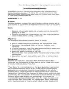
Three Dimensional Geology
Learners use rocks and fossils to interpret the geology of an area. They use prior knowledge and make recommendations about where to build a subdivision based on the rocks.
Curated OER
Mountains in the Sea Exploration No Escape
Students study data to hypothesis about the influence of a water circulation cell on the retention of benthic invertebrate larvae in the area of a seamount. They investigate the positives and negatives of larvae retention in this series...
Curated OER
Don't oZone Out
Students study the ozone and measure its concentration in different areas. Students use Ecobadge strips and other equipement for measurement. Then they share their results on an on-line forum. Also, students study environmental problems.
Curated OER
The Water Cycle and Watershed
Middle schoolers summarize the steps in the water cycle. In this earth science lesson, students create a skit, song or poem showing the various components of the cycle. They identify the different watersheds in their area.
Curated OER
Introduction to the Planets
Students become familiar with the members of the solar system and planetary order. They identify differences and characteristics of individual planets. Finally students visualize the great size of the solar system and make the image more...
Curated OER
Plant Life of the Rainforest
Students study pictures of tropical rainforests and discuss its stratified character. Students then work with a partner to make a scale drawing of the rainforest strata.
Curated OER
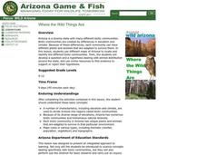
Where the Wild Things Are
Young scholars examine the characteristics that divide Arizona into different regions. In this resources lesson students complete a worksheet on the biotic communities Arizona has.
Curated OER
Banana Republics - United Fruit Co.
Students define multinational companies and describe their roles as key economic developers in developing countries, determine whether trade-off between surrendering control of a country's economy to foreign companies and economic...
Other popular searches
- Reading Topographic Maps
- Science Topographic Maps
- Making Topographic Maps
- Geography, Topographic Maps
- Topographic Maps Labs
- Topographic Maps Computer
- Topographic Maps Isolines
- Topographic Maps Salines
- Topographic Maps + Salines
- Topographic Maps + Isolines
- Geography Topographic Maps
- Topographic Maps Profiles


