Curated OER
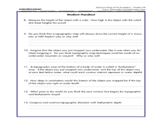
A Watered-Down Topographic Map
Eighth graders explore the ocean floor. In this topography activity, 8th graders compare topographical maps to bathymetric charts. They will create a topographic map and note landmarks and other land features.
Curated OER
Fossil Fuels (Part II), The Geology of Oil: Topographic Mapping, Crustal Deformation, Rock Porosity, and Environmental Pollution
Students review an interpretation of geologic history and relate it to the formation of oil deposits. They explore and explain factors controlling the porosity and permeability of sediments and sedimentary rocks. Pupils also interpret...
Curated OER
Orienteering - Lesson 1 - Maps & Map Scales
Lesson 1 of 10 lessons in this orienteering unit is about maps and map scales. After all, orienteering is all about maps, compasses, and finding ones' way around. It is imperative to be able to read maps and understand the relevance of...
National Endowment for the Humanities
On This Day With Lewis and Clark
Walk in the footsteps of Lewis and Clark as they discover the wonders, beauty, and dangers of the American frontier. After gaining background knowledge about Thomas Jefferson and the Louisiana Purchase, young explorers use primary...
Curated OER
Maps Reinforcement
In this map instructional activity, students complete 6 multiple choice questions and 5 short answer questions about 3 different map figures.
Curated OER
Exploring Arizona's Biotic Communities Lesson 1: Mapping Biotic Communities
As part of a unit on Arizona's biotic communities, young ecology learners create a map. They describe how humans and animals adapt in their habitat. They take notes and create graphic organizers from articles they read. Beautiful maps,...
Curated OER
Regents High School Examination: Physical Setting Earth Science 2009
Junior geologists address 50 multiple choice questions and 35 short answer questions about the earth system. Plenty of visuals are included for interpretation: diagrams, graphs, maps, photographs, laboratory setups, weather symbols, and...
Curated OER
Contour Map Worksheet #3
Earth scientists answer five multiple choice questions about the topographical map atop the worksheet. Use this as a quick assessment of understanding after having taught how to read contour lines and topographic maps.
Curated OER
Malta: The Landscape
Students work in small groups to create a topographic map of Malta. They must include labeled line drawings of bordering countries and bodies of water. Students use salt and flour clay to make Malta three dimensional, showing the nearest...
Curated OER
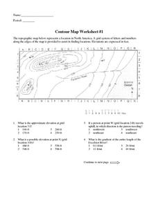
Contour Map Worksheet #1
Being able to read a topographic map is a standard in middle school earth science units and imperative for outdoor enthusiasts. As you introduce learners to this skill, you can assign this as an assessment or reinforcement. Pupils view a...
Curated OER
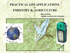
Practical GPS Applications in Forestry & Agriculture
An explanation of the Global Positioning System (GPS) and the Geographic Information System (GIS) is given in this presentation. Uses and applications are considered. How it works and sources of error are also touched upon. A large...
Curated OER
Salad Tray 3D Topographic Model
Students explore the characteristics of topographical maps. They examine the relationship of contour lines and vertical elevation. Students create a three-dimensional model of a landscape represented by a topographic contour map.
Curated OER
What You Can Learn From a Map
Students investigate the use of road maps, shadeded relief maps, and topographic maps.
Curated OER
How Much Water is in That River?
Young scholars practice measurement using the Hudson River. They calculate the discharge measurement at a location on the Hudson River using ingenuity and a topographic map.
Curated OER
A Contouring We Go
Students examine the built environment and infrastructures of their community by constructing contour equipment, using the equipment, and comparing their results to current topographical maps of the same area
Teach Engineering
What is GIS?
Is GIS the real manifestation of Harry Potter's Marauders Map? Introduce your class to the history of geographic information systems (GIS), the technology that allows for easy use of spatial information, with a resource that teaches...
Curated OER
Planning A Railroad Online Lesson
Students plan a route across Donner Summit using topographical maps in order to understand the challenges involved in constructing the railroad in the Sierra Nevada Mountains. In this history lesson plan, students first discover how to...
Curated OER
Watershed Investigations
Students explore the components of a watershed and the factors that affect it. They read a topographical map and use geometry to determine the area of a watershed. Students estimate the volume of a body of water and perform runoff...
Curated OER
Project Map: Scale Worksheet
In this map reading learning exercise, students determine the distance from a plotted treasure on a topographic map. They must adjust for magnetic declination.
Curated OER
Map It!
Fourth graders demonstrate map making skills by using the computer to create maps of the geographic features, regions, and economy for their state.
Curated OER
Map Lesson Plan
Fourth graders locate and label major sites related to the Revolutionary War in the Hudson River Valley. They examine topographical features of each site and list a few of these features and list two advantages of each military site.
Curated OER
Building A Topographic Model
Students visualize, in three dimensions, features represented by contour lines on a topographic map. They see that the different elevations shown on a two dimensional topographic map can be used to build a 3-D model.
Curated OER
Production of the Lunar Relief Map Project
Students replicate the lunar surface. In this mapping skills lesson, students study the topography of the moon. Students then use craft materials to create topographic maps of the lunar surface where the Eagle landed.
Curated OER
Play Doh Map of Your State
Students create a state map using Playdoh. For this hands-on state geography lesson, students work in groups to form a three-dimensional map of their state using Playdoh made at home following a (given) recipe. Students use four...
Other popular searches
- Reading Topographic Maps
- Science Topographic Maps
- Making Topographic Maps
- Geography, Topographic Maps
- Topographic Maps Labs
- Topographic Maps Computer
- Topographic Maps Isolines
- Topographic Maps Salines
- Topographic Maps + Salines
- Topographic Maps + Isolines
- Geography Topographic Maps
- Topographic Maps Profiles


