Curated OER
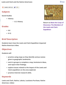
Lewis and Clark and the Native Americans
Young scholars practice using maps and identifying landmarks on the Lewis and Clark expedition. They research Lewis and Clark's relationship with the Native Americans and report their findings to the class. They identify the impact of...
Curated OER
Snow Cover By Latitude
Students create graphs comparing the amount of snow cover along selected latitudes using data sets from a NASA website. They create a spreadsheet and a bar graph on the computer, and analyze the data.
Curated OER
Introducing The Cariboo Gold Rush
Students demonstrate appreciation of contributions of Aboriginal peoples, the French, and the British to the development of Canada and explain how supply and demand are affected by population and the availability of resources. They then...
Curated OER
Mapping your watershed
Learners investigate the importance of watersheds around the world. By visiting resource links, students can locate watersheds and their sources in the USA and Russia and analyze their effects on the surrounding topography. This lesson...
Curated OER
Backwards Goes It Does
Students create a three-dimensional model of the Chicago river watershed to determine the flow of the river at its mouth. They use prepared clear gelatin and topographic maps to discover that the building of canals actually reversed the...
Curated OER
Not Just for Gods and Goddesses:
Students use dictionaries, encyclopedias, art, computers, and books to study the Gods and Goddesses of Ancient Greece. In this Ancient Greece lesson plan, students research maps, stories, Olympic games, and more about Ancient Greece.
Curated OER
Water: Where in the Watershed?
Students become connected to their watershed by exploring a local water body and mapping its features. They focus on how the local watershed fits into the larger scheme of the watershed.
Curated OER
States with Attitude, Latitude and Longitude Dude
Sixth graders identify states whose boundaries are formed by lines of latitude and longitude or natural borders such as rivers. They trace a map of the U.S., and fill in borders, rivers and lines of latitude and longitude.
Curated OER
Topography of Africa
Students study Africa's diverse landscape and investigate how these features impact the available water supply, food sources, and population distribution of the continent. They compare topographical features and
their affect on each...
Curated OER
Park Brochures
Sixth graders investigate natural environments by researching national parks. In this brochure making lesson plan, 6th graders explore a specific national park and research it's information by utilizing the web. Students create travel...
Curated OER
The Challenges Ahead
Students examine the physical obstacles that the Lewis and Clark expedition encountered on its journey. They report what challenges these physical obstacles might have posed. They review a modern-day map and explain if the obstacles...
Curated OER
Uncharted Territory
Students examine what were preconceived perceptions of the areas Lewis and Clark explored. They compare and contrast past and modern maps of North America. They accurately place route and site information on the map.
Curated OER
I Know Where You Are!
High schoolers study what a GPS is and use it to challenge themselves and find positions on a map. In this investigative lesson students find various points on a map using a GPS system and answer questions on a worksheet.
Curated OER
Explore Your World--Geography Takes You Places
Students examine how the world around them is constantly changing. In groups, they travel between centers in their classroom to role play the role of explorers in Washington D.C. They share their experiences with their classmates and...
Curated OER
Lahar Travel Time
Ninth graders analyze published geologic hazard maps of California and comprehend how to use the map's information to identify evidence of geologic events of the past and present and predict geologic changes in the future. They select...
Curated OER
Plot Your Course
High schoolers determine distance and direction on a nautical chart. In this nautical instructional activity, students identify obstacles and characteristics of common aid to navigation on a nautical chart.
Curated OER
Hidin' Out
Fourth graders draw three major Underground Railroad routes crossing Indiana on an outline map and include habitats and towns. They produce an oral history involving at least three natural habitats and one human habitat.
Curated OER
The 21st Century Lewis and Clark Trail
Students create a better route through the Rocky Mountains for the Lewis and Clark expedition after tracing the original path.
Curated OER
My Habitat
Students explore the environment they live in. In this habitats lesson, students define habitat and create a web in kidspiration. Students take a walk outside and record what they see and hear and may take pictures as well. Students...
Curated OER
Analyzing the Relationship between Snowpack and River Flow
Young scholars use the Internet to research current and past snowpack levels and river gauging station readings. They determine the relationship between snowpack and river flow. They predict future river flow.
Curated OER
The River Ran Through It
Students identify the processes that shape our rivers and form our lakes. They participate in hands-on and multimedia activities as they discover and apply the river-cutting processes of water.
Curated OER
Cherishing the Water of Life
Learners work in small groups to brainstorm a list of all creatures, plants, natural, and artificial processes that use or depend on fresh water. The class views an aquarium filled with water representing all the water in the world. The...
Curated OER
Caution: Slippery When Wet....Not!
Young scholars and manipulate data from Internet sites to design a downhill ski course that meets the International Federation of Skiing's requirements for a safe and fair competition.
Alabama Learning Exchange
Is My Water Safe?
Learners discuss what makes their drinking water safe and unsafe. They locate and visit a local tributary and test the water's pH, hardness, dissolved oxygen, and total alkalinity. They compose a summary paragraph about the tests and...


