Curated OER
Project Map: Scale Worksheet
In this map reading worksheet, students determine the distance from a plotted treasure on a topographic map. They must adjust for magnetic declination.
Curated OER
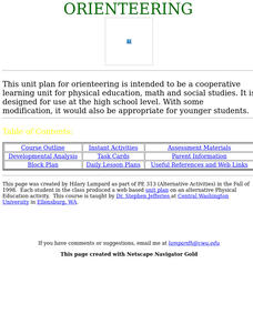
Orienteering
Everything you wanted to know about orienteering, and more! Take your class on an adventure with this creative activity. You will need to gather some supplies and materials and maps for your specific location, but the unit sounds like it...
Curated OER
You Are Here
Students map local places and learn to use scale and distance. In this mapping lesson, students map their school and a favorite place. Students recreate their maps showing distance and scale sizes. Students locate their location on a...
Mr. E. Science
Introduction to Earth Science
From the layers of Earth's spheres to latitude and longitude to looking at topographic maps, learners discover the elements of Earth's systems.
Curated OER
TOPSY TURVY MAPS
Eighth graders use the data analyzer and motion detector to collect data and measure distances. They create topographic maps drawn to scale of a given setup and relate the concepts to the creation of historical ocean maps.
Curated OER
Tracing Highs and Lows in San Francisco
On a topographic map, young scholars identify the scale bar, north arrow, and contour interval. They then locate a hill on the map and make note of the contour lines. Students then locate other places with similar contour line patterns....
Curated OER
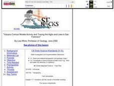
Volcano Contour Models Activity and Tracing the Highs and Lows in San Francisco
Learners investigate how to draw topographic contours and read topographic maps.They examine the topography of San Francisco and contrast the elevation of different points within San Francisco.
Curated OER
Water Monitoring Vocabulary
As the title implies, this is a list of vocabulary terms relating to water monitoring. If your ecology class is learning about how to test water quality, this will be an appropriate reference sheet for them. As a bonus, if you live in...
Curated OER
MAPPING THE TOPOGRAPHY OF UNKNOWN SURFACES
Students describe in words and graphic displays the elevation or depression profile of sections of Mars' Olympus Mons and/or Valles Marineris. They explain how orbiting spacecraft build up global maps one data slice at a time.
Curated OER
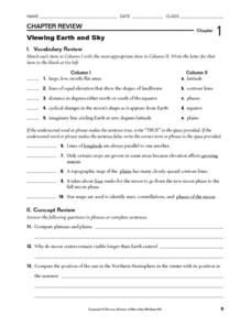
Viewing Earth and Sky
In this earth and sky learning exercise, students review terms associated with map reading. Students also review topographic maps and how contour lines represent elevation. This learning exercise has 5 matching, 5 true or false, 5 fill...
Curated OER
Topo Triangulation
Students investigate how to read a topographical map and triangulate with just a map. They convert a compass measurement to a protractor measurement, reverse a bearing direction, and using a worksheet take a bearing of certain landmarks...
Curated OER
U.S. Geography- The Northeast
Students investigate the geography of the Northeast states. For this map skills lesson, students are shown a map of the Northeast states and identify the state names and borders. Students construct individual maps of the Northeast using...
Curated OER
Mud Maps
Students discuss the location of stores, buildings, and homes in their community. Afterwards, they create a 'mud map' demonstrating the route from one point to another. In pairs, students read travel directions from a brochure, while...
Curated OER
Stranded along the Coast
Students plot stranding sites onto a map using latitude and longitude as well as compass directions with respect to coastal features. They identify several species of marine animals that might become stranded; distinguish their...
Curated OER
Science: Draining the Land - the Mississippi River
Young scholars use topographic maps to identify parts of rivers. In addition, they discover gradient and predict changes in the channels caused by variations in water flow. Other activities include sketching a river model with a new...
Curated OER
Elevation at its Peak
Young scholars pretend they are hiking up a mountain. They practice making calculations on angles and elevation. They use topographic maps to estimate distances and trigonometric ratio methods.
Curated OER
U.S. Geography: The Northeast
Young scholars investigate U.S. Geography by creating a map in class. In this natural resource lesson, students create a map of the United States and research the Northeast based on their resources and recyclable materials. Young...
Curated OER
Eagle Creek Park (A Hike)
Students plot a hiking course using aerial photos and a topographic overlay and find the latitude and longitude of absolute locations. They measure the total distance of a hiked area and figure the area of the ground walked using Heron's...
Curated OER
Topos, Compasses, and Triangles, Oh My!
Middle schoolers triangulate using a compass, topographical (topo) map and a view of outside landmarks. They take a field trip to another location away from school and mark discernible landmarks (like mountains or radio towers) and...
Curated OER
Introduction to the Planets
Students become familiar with the members of the solar system and planetary order. They identify differences and characteristics of individual planets. Finally students visualize the great size of the solar system and make the image more...
Curated OER
Cherishing the Water of Life
Students work in small groups to brainstorm a list of all creatures, plants, natural, and artificial processes that use or depend on fresh water. The class views an aquarium filled with water representing all the water in the world. The...
Curated OER
What's Its Slope
Students identify the slope of a lines.In this algebra lesson, students define the meaning of slope and write an equation given the slope. They graph linear functions using the slope and y-intercept.
Curated OER
A Model of a Scanning Tunneling Microscope
Ninth graders explain how a scanning tunneling microscope works. In this chemistry instructional activity, 9th graders construct atomic models and simulate how their images appear under the STM. They discuss the limitations of their...
Curated OER
Physical Habitat of a Stream
Students measure in metric units and use a stopwatch, calculator. They collect data with minimal instructions after the initial pre-activity briefing, then record data in the data sheets provided.


