Curated OER
Using Story Structure to Enhance Comprehension
In these story structure worksheets, learners review story structure and learn how to use story maps to help with their reading comprehension. Students review an example story map and then study three different graphic organizer versions...
Curated OER
Scale Factors
In this scale factors worksheet, 6th graders solve 10 different problems that include types of scale factors. First, they determine the missing dimensions in each problem. Then, students round their responses to the nearest tenth before...
Curated OER
Scale Drawing
In this scale drawing worksheet, 10th graders solve 10 different word problems that include various types of scale drawings in each. First, they determine the length of a highway on a map. Then, students determine the dimensions of a...
California Academy of Science
California's Climate
The United States is a large country with many different climates. Graph and analyze temperature and rainfall data for Sacramento and Washington DC as you teach your class about the characteristics of Mediterranean climates. Discuss the...
Sea World
Saving the Wild: Conservation Around the World
Enhance your unit on conservation, ecosystems, or migration with a series of lessons about ways to save the wild around the world. Kids research types of conservation, such as recycling, and use their geography skills to map the...
Concord Consortium
School Bus Routes
Plan the way to school. Given a map of a school district, class members portray a transportation consultant hired to develop a bus transportation plan that will pick up the eligible riders and get them to school. The plan must contain...
Curated OER
Weather
In this earth science worksheet, students use the clues given at the bottom of the sheet to solve the crossword puzzle related to weather. They identify various cloud types and how they are formed. Students also identify atmospheric...
It's About Time
Energy from Coal
If plastic is derived from fossil fuels and fossil fuels come from dead dinosaurs, does that mean that plastic dinosaurs are made from real dinosaurs? This lesson goes into depth about coal and other fossil fuels. First the instructor...
Curated OER
Getting Together - a Groupings Crossword Puzzle
Introduce your class to words for groups of animals and people. This is a crossword puzzle that includes 25 clues for collective nouns. The puzzle is online interactive and learners can receive immediate online feedback. Answers are not...
Curated OER
Written Document Analysis Worksheet
Investigate different types of documents with your middle schoolers. They look at newspapers, letters, maps, reports, etc. and answer a list of questions provided. Introduce them to different primary sources!
Curated OER
Frayer Model
In this Frayer model worksheet, students use the Frayer model to complete a chart about a word study. Students complete 5 steps in the model.
Curated OER
Asia Crossword
In this geography worksheet, students complete a crossword puzzle on the continent of Asia. They answer 21 questions related to the type of government systems found, capital cities, deepest lake, and lowest population density.
Curated OER
Third Grade Social Studies-Multiple Choice Activity
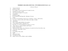
In this grade 3 social studies worksheet, 3rd graders complete a set of 25 questions about a variety of topics including geography, types of communities, map and questions about the environment.
Curated OER
Types of Sentences
In this grammar activity, students identify twenty sentences as correct as is, fragments, contains a comma splice or is a fused sentence.
Curated OER
What Type of Skeleton?
In this skeletons worksheet, learners look at 7 animals and choose which of the following skeletons they have: an internal skeleton, an external skeleton or no skeleton at all. Students draw lines from each choice to each animal.
Worksheet Web
Using Pictographs
If one ice cream cone represents three ice cream scoops, and Bob has four ice cream cones, then how many scoops does Bob have? Learners solve these kind of questions with their new understanding of pictographs.
Port Jefferson School District
Climate Patterns
Young climatologists explore the factors that contribute to a region's climate in this two-part earth science activity. To begin, learners are provided with a map of an imaginary planet and are asked to label global wind and...
Curated OER
This Week's Weather
In this weather worksheet, students record the weather for the week on individual US maps and include highs and lows, fronts and precipitation. They give all weather facts for the week and analyze the weather systems and trends of the week.
Curated OER
This Week's Weather
In this weather worksheet, students fill out a weather map each day of the week and give the lows, the highs, the warm fronts and the cold fronts. They answer six questions from their weather map work.
Curated OER
Forester
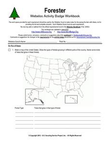
In this forester worksheet, students illustrate a map that shows the types of forests growing in various parts of the country. They also identify six forest trees common to the area where they live and explain how both wildlife and...
Curated OER
Return to Kangaroo Island
In this speaking and listening skills learning exercise, students explore, participate and experience in groups of two a treasure map with a hidden treasure as they return to Kangaroo Island.
Curated OER
Defense Against Infectious Diseases
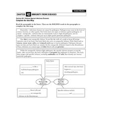
In this infectious diseases worksheet, students read about the two types of defenses the body has against pathogens: innate (nonspecific) and adaptive (specific). Students then complete a graphic organizer by filling in 11 blanks.
Curated OER
Tourism in Northern Ireland
In this tourism learning exercise, students label pictures of tourist destinations with the name of the country they are located in, write sentences about pictures showing damage caused by tourists, identify locations on a map, and fill...
Curated OER
Geometry Standardized Test Practice
In this figures and graphs review learning exercise, 10th graders solve and complete 23 various types of problems that include identifying various figures and graphs. First, they name the transformation that maps the unshaded figure or...
Other popular searches
- Different Types of Maps
- Reviewing Types of Maps
- Types of Maps Grids
- Types of Maps Worksheets
- 10 Types of Maps
- Three Types of Maps
- 2 Types of Maps
- Types of Maps Australia
- Types of Maps "Australia
- Types of Maps "Australia"
- Maps Types Key Symbols


