Science Matters
A Model of Plate Faults
The San Andreas fault is one of the longest fault zones in the world. In a series of 20 lessons, the fourth lesson has pupils use a paper model to recreate various types of plate faults. Each is held in position then drawn...
Curated OER
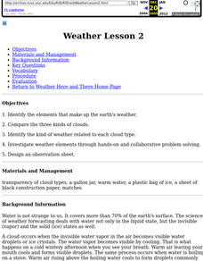
Weather Lesson 2
Students identify the elements that make up the earth's weather. Begin by having students pretend they are hiking along a mountain ridge. It's been sunny and warm all day, but you see a dark line of clouds moving from the west.
US Institute of Peace
Observing Conflict
Identifying conflict is important, but how do you handle conflict when it comes? Students use a plot mountain to graph two role-play scenarios about interpersonal conflicts.
Curated OER
Landform Tag
Third graders explore various landforms. They play landform tag while exploring the various types of landforms that are found within the United States. Students locate landforms as they are called by the teacher.
Curated OER
Cloud Viewer
Fourth graders examine different types of clouds. In this cloud lesson, 4th graders examine pictures of different types of clouds and read details about them in the captions under the images. They make a cloud viewer by cutting out the...
Curated OER
Shells on the Mountain Top?
Students work in groups to remove fossils from sediments, classifying as many organisms and parts of organisms as possible into major groups. They study the data from each formation and make conclusions about the types of organisms and...
Curated OER
Climate Types
In this weather activity, students describe the rainfall distribution found in two different areas of the world. Then they compare the various types of climates found around the world using the graphs shown on the sheet.
Curated OER
Major Types of Farming Operations in Antebellum Arkansas
Learners read a handout about the types of farms in Antebellum Arkansas and respond on the worksheet. They answer an essay question on the topic.
Curated OER
I Can Find that Where? - A Study of Landforms
First graders make landform maps of the United States. For this landform lessons, 1st graders participate in a discussion of local landforms and make a landform map of the United States. They follow the teacher's directions to add...
Curated OER
How Mountains Shape Climate
Pupils use raw data to make a climatograph; they explain the process of orographic precipitation and the concept of a rain shadow.
Curated OER
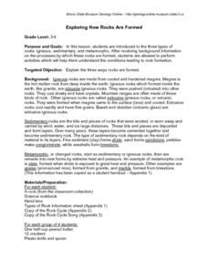
Exploring How Rocks Are Formed
These lessons produced by the Illinois State Museum are quite good. In this one, third and fourth graders are introduced to the three basic types of rocks: igneous, sedimentary, and metamorphic. They perform activities which help them...
National Geographic
Expedition Clothing Then and Now
Introduce your class to the Everest expedition to reenact a 1924 climb by George Mallory and Andrew Irvine. Discuss and show pictures of the types of clothing worn at that time and compare it to today's state-of-the-art climbing gear....
Curated OER
Neither Wind Nor Rain
Here is another in the interesting series of lessons that use the special State Quarters as a learning tool. This one uses the North Dakota State Quarter. During this lesson, your class learns about the different patterns of erosion, and...
Columbus City Schools
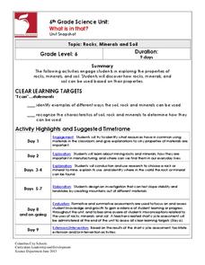
What is in that?
Invite your class to dig in to an engaging journey into the world of mining! Here you'll find the tools to equip young miners with knowledge of soil, rocks, and minerals, as well as types of mining operations. To round things out, the...
CK-12 Foundation
Topographic and Geologic Maps: Topographic Maps
Maps are great for helping you get where you're going, but what does that place actually look like? Geology scholars compare and contrast the features of topographical and geologic maps using an interactive lesson. The resource describes...
Curated OER
Create a Country
Learners work in small groups to list features and elements found on a variety of grade- appropriate maps. They develop a class list of map features and elements to draw from as they create a map of an imaginary country.
Curated OER
The Gifts of the Nile
Get your class thinking about the geography that shaped the Egyptian landscape and culture. They compare ancient climate zones and geogrpahical fetures, locate evidence of plate tectonics, take and quiz, and write a short essay. The...
Science Matters
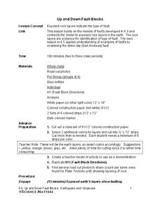
Up and Down Fault Blocks
The Sierra Mountains in Nevada and the Tetons in Wyoming originally formed as fault block mountains. In order to visualize these fault blocks, pupils use construction paper to create layers of earth. They cut the paper models and form...
Curated OER
Conejito
Third graders read the story "Conejito" and write a descriptive story about the rainforest in Panama. They answer story comprehension questions, complete worksheet questions about a map of Panama, and rewrite a paragraph changing the...
Curated OER
Black Tiger Academy Martial Arts Fitness Unit – Lesson 13
"You can never conquer the mountain. You can only conquer yourself."—Jim Whittaker. Black Tiger Academy’s martial arts lesson 13 of 20 takes the health lesson about sugars to the next level by talking about diabetes. The percent of...
NOAA
Plate Tectonics II
Mid-ocean ridges, rift valleys, island arcs, mountain ranges, earthquakes, volcanoes ... there are so many features associated with plate tectonics. The 14th installment of a 23-part NOAA Enrichment in Marine sciences and Oceanography...
Curated OER
How Volcanoes Grow
Young scholars build models of the three major types of volcanoes and see how a volcano's shape is related to the type of material it erupts. As a class, they observe a demonstration that simulates the nature of two volcanic materials:...
Curated OER
How Volcanoes Grow
Students create models of the three major types of volcanoes and determine how a volcano's shape is related to the type of material erupted. They then observe a demonstration that simulates the nature of two volcanic materials: lava and...
Curated OER
The Biggest Plates on Earth
The best part about teaching guides is all the great information you can use to inform your class. They infer what type of boundary exists between two tectonic plates. Then, using given information on earthquakes and volcanism they'll...


