US Government Publishing Office
Ben's Guide to u.s. Government: Games
Test your knowledge of U.S. geography and government with these games and printable activities. In one game, see if you can place all 50 states in their correct location. In the second game, see if you can recognize the powers of each...
Curated OER
National Park Service: Teaching With Historic Places
Lessons and activities using places on the National Park Service's National Register of Historic Places to enliven courses in U.S. history, U.S. geography, and U.S. government.
US Department of Education
Helping Your Child Learn Geography
This parent guide helps you to teach your child geography. The site features a section on each of the five themes of geography and how to specifically teach a child to learn and be able to apply each theme. Although published in 1996, it...
Other
Letter People Geography
Mr. X of the Letter People has disappeared in one of the 50 U.S. States. You must use your U.S. geography skills to help track him down.
ClassFlow
Class Flow: u.s. Cities and States
[Free Registration/Login Required] This flipchart explores U.S. Cities and States and includes Activote questions, sorting activities, and matching activities.
Education Place
Houghton Mifflin: Eduplace: Made in the u.s.a.: Economic, Geography
Site presents activities, that are fun and innovative. These tasks will assist students in their understanding of how the economics of manufacturing effects the student's daily life.
US Geological Survey
Usgs: Plate Tectonics, Hot Spots, and Ring of Fire: World Map
A world map featuring active volcanoes, plate tectonics, hot spots, and ring of fire.
Houghton Mifflin Harcourt
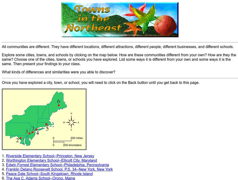
Harcourt: School Publishers: Towns in the Northeast
"All communities are different. They have different locations, different attractions, different people, different businesses, and different schools." This site is about some of the cities in the Northeast section of the United States....
Houghton Mifflin Harcourt
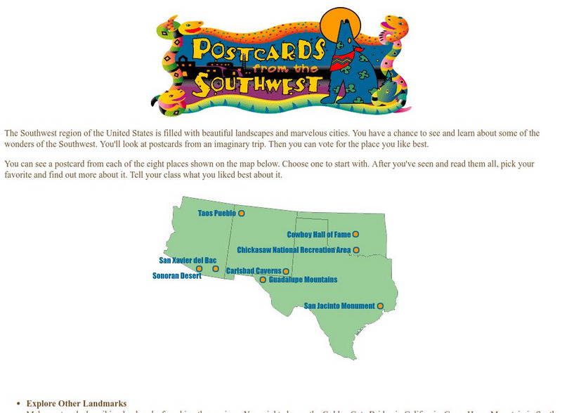
Harcourt: School Publishers: Postcards From the Southwest
The Southwest region of the United States is filled with beautiful landscapes and marvelous cities. Use this site to see and learn about some of the wonders of the Southwest. You'll look at postcards from an imaginary trip. Then you can...
National Geographic
National Geographic: Education
Excellent, comprehensive site from National Geographic that provides lesson plans, activities, maps, and National Geography Standards. Teachers can find lesson plans based on grade and standard. Covers current issues, for example, global...
PBS
Pbs Learning Media: 50 States Part 2 Lesson Plan
In this lesson, students combine psychomotor skills and geography as they travel from Montana to Wyoming. As students travel from state to state, they learn regional facts and state capitals. Students perform physical tasks highlighting...
National Endowment for the Humanities
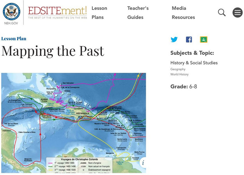
Neh: Edsit Ement: Mapping the Past
Students will examine European world maps from the Middle Ages, the Age of Discovery, and the period of New World exploration. They will then look at maps that record the early exploration of the American West and collect present-day...
PBS
Pbs Learning Media: 50 States Part 1 Lesson Plan
In this lesson, students travel virtually to 25 different states from Alabama to Missouri. While on their journey students explore geography, learn state capitals and interesting facts along the way. Movements are unique and incorporate...
Knowledge Share
Super Kids: Hangman
Use this interactive site to enhance students' spelling and vocabulary while refreshing their memories in history, geography, language, science, and entertainment. It is available to use on line or you can purchase leveled apps for the...
US Department of Labor
Bureau of Labor Statistics: Name That State!
Interactive activity in which students click on the identify the state. Choose from easy, medium, hard levels.
A&E Television
History.com: The States
Learn unique facts about each American state. You can also read a more in-depth history of each state, watch videos and play a game about all the states.
Houghton Mifflin Harcourt
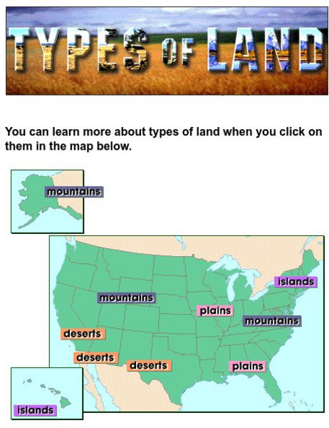
Harcourt: School Publishers: Types of Land
This clickable map of the United States defines different geographic features such as mountains, plains, islands, and deserts.
ABCya
Ab Cya: Step Right Up! States & Capitals
Step Right Up to a whole new way to learn about US states and capitals! In this activity kids match states with their capital cities (and vice versa) by playing an all-time favorite carnival game. Find 10 matches and take home a prize!
Other
Bringing History Home: Communities Long Ago
This Grade 1 unit explores U.S. communities in a historical context. By exploring their own community's buildings and services of both long ago and today, children in non-Native American communities are introduced to concepts of change,...
Library of Congress
Loc: Primary Sources by State
An interactive map to search for extensive collections of primary sources for each of the United States.
Department of Defense
Do Dea: Ap Us History: Unit 10: Understanding American History
This extensive learning module looks at how themes of American history can create a better understanding of the big picture of the nation's history.
Other
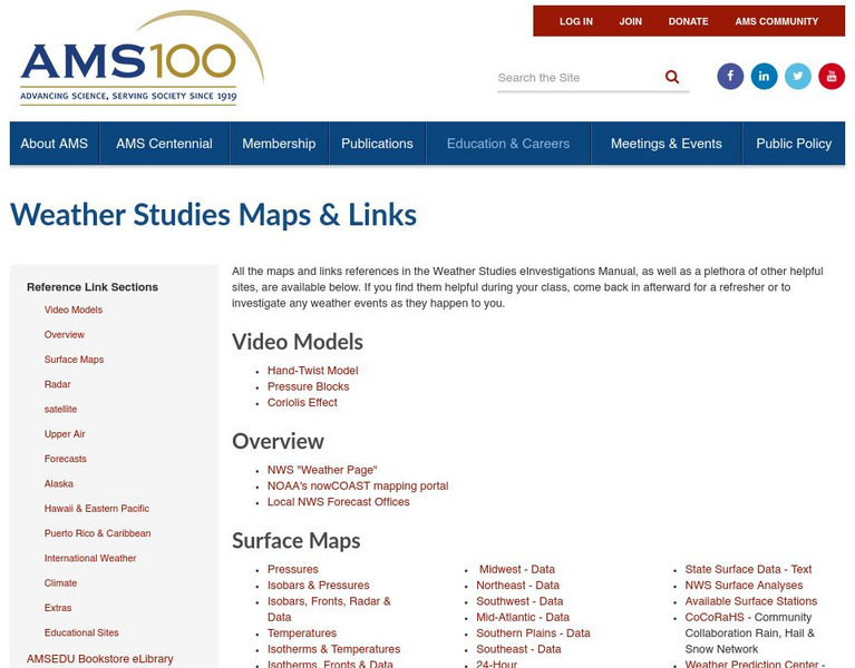
American Meteorological Society: Data Streme Atmosphere
This site provides an extensive amount of weather information. Includes current information, forecasting, and historic weather related events. Weather map symbols and terminology explained.
Library of Congress
Loc: Map Collections 1500 2002
This collection provides maps dating back to 1500 up to the present. The collection includes: cities, towns, discovery and exploration, conservation and environment, military battles, cultural landscapes, transportation, communication,...
Houghton Mifflin Harcourt
Harcourt: School Publishers: You're a Grand Old Flag
"Every country has a flag. A flag stands for a country and the people who live there. What do you know about flags? Click on one of the choices to find out more."


