Concord Consortium
Look High and Low
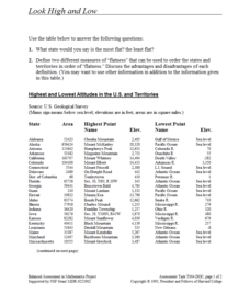
From the highest high to the lowest low here's a resource that won't fall flat. Given data on the area and the highest and lowest elevations of each of the 50 states, learners decide which states are the least flat and the most flat. Of...
Curated OER
Making A New Nation
Eighth graders read standard road maps and topographical maps, and examine the lives of pathfinders who opened the trails to the West. They develop Living History presentations, role-playing a character from the past.
Curated OER
University of California Botanical Garden Field Trip
Students explore plant species and the climates and conditions in their environment. They explore this living museum on the Garden's thirty-four acres to encounter over 13,000 plant species from around the globe.
Curated OER
Keys' Desert Queen Ranch
Students complete a variety of activities that go along with the study of and possible field trip to Keys' Desert Queen Ranch in Joshua Tree National Park, east of Los Angeles.
Curated OER
The Civil Rights Movement
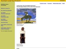
Students compare and contrast African-American, Asian-American, Chicano and Native-American movements with the civil rights movement and are exposed to the sociopolitical and economic factors involved in the rise of social movements.
Curated OER
Where Does It Come From?
Students explore where agricultural commodities used in snack foods are grown. They choose a snack food and locate the top five states that produce the food that the snack is made from.
Curated OER
Island of the Blue Dolphins Jigsaw
Fourth graders research three topics from the book, either Village Life, Sea Life, or San Nicholas Island. They research independently and meet in a jigsaw format to share what they learned. As group they create a poster for class...
Curated OER
What is Kwanzaa?
Describe the general characteristics of Kwanzaa after reading Seven Candles of Kwanzaa. For this Kwanzaa instructional activity, learners study the principles of the Kwanzaa holiday and interpret the principles through music and...
Curated OER
Drought Threatens Huge Man-Made Lake
Learners locate Lake Mead, then read a news article about Lake Mead drying up and how that would effect water and power supplies to the region. In this current events lesson, the teacher introduces the article with a map and vocabulary...
Curated OER
Gray Whales on the Move
Young scholars study whale migration and their natural history. In this migration instructional activity students plot whale migration on a map and describe their ecosystems.
Curated OER
The Constitution on Trial: The Internment of the Japanese During World War II
Eleventh graders analyze primary source documents during the Second World War. Students recall statements of Japanese-Americans who were placed into internment camps during the war.
Curated OER
Could a World of Swimmers Raise Sea Level?
Students determine the volume of water they displace. In this earth science lesson, students calculate the total water displaced by the world's population. They evaluate whether or not this value is enough to raise the sea level...
Curated OER
Child Soldiers
Students investigate the military recruitment that exists in many foreign countries. They research the occurrence of using children in the military and its social implications. For research the lesson contains a great variety of...
Curated OER
Mexican and American Views of Texas
Students study the territorial status of Texas in 1830, 1840, and 1846 and interpret an historical timeline. They develop a general statement of Mexican and American views of Texas.
Curated OER
Where is Rice Grown?
Fifth graders create a timeline of the development of rice as an important crop. In this agricultural history instructional activity, 5th graders read about the history behind why rice was grown and where it is grown. Students...
Curated OER
Planning a Railroad
Students use a topographical map to plan a route from Doknner Summit to Truckee, then compare it to the route selected by Theodore Judah.
Curated OER
What Was It Like?
Students use the Internet to gather historical facts about the county in which they live. Using the information, they discover how to check it for accuracy and present their findings to the class. They write an essay about the history of...
Curated OER
The Expansion of The United States, 1846-1848
Students interpret historical maps,identify territories acquired by the United States in the 1840s. Also they identify states later formed from these territories. The primary sources for the instructional activity are the maps found in...
Curated OER
Bureau of Land Management: Blm California
The U.S. Bureau of Land Management offers fascinating information regarding the public lands of California - conservation, use for energy, waste, wildlife, etc. Visit various locations o learn more about specific regions of the state and...
PBS
Pbs Learning Media: 50 States Part 1 Lesson Plan
In this instructional activity, learners travel virtually to 25 different states from Alabama to Missouri. While on their journey students explore geography, learn state capitals and interesting facts along the way. Movements are unique...
A&E Television
History.com: The States
Learn unique facts about each American state. You can also read a more in-depth history of each state, watch videos and play a game about all the states.
Cayuse Canyon
The Us50
This clickable map of the United States gives students access to research information from history and tourism to attractions and famous historic figures.
Curated OER
National Park Service: Alcatraz Island
Part of the Golden Gate National Recreational Area, Alcatraz Island is located in the San Francisco Bay. Originally a lighthouse and military fort, the island is best known for being a federal prison. The island is packed full of...


